Greenbush Topo Map Michigan
To zoom in, hover over the map of Greenbush
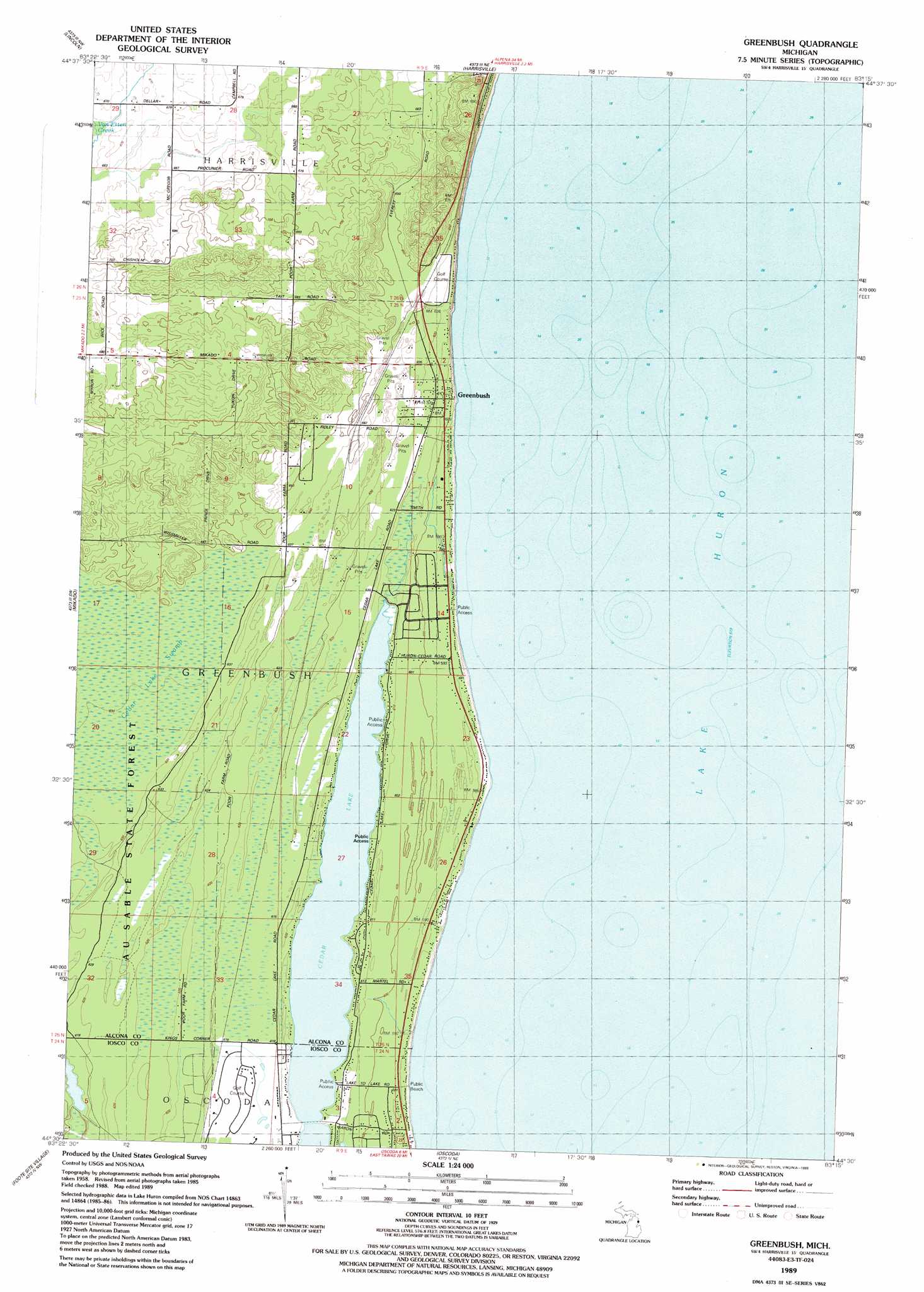
USGS Topo Quad 44083e3 - 1:24,000 scale
| Topo Map Name: | Greenbush |
| USGS Topo Quad ID: | 44083e3 |
| Print Size: | ca. 21 1/4" wide x 27" high |
| Southeast Coordinates: | 44.5° N latitude / 83.25° W longitude |
| Map Center Coordinates: | 44.5625° N latitude / 83.3125° W longitude |
| U.S. State: | MI |
| Filename: | o44083e3.jpg |
| Download Map JPG Image: | Greenbush topo map 1:24,000 scale |
| Map Type: | Topographic |
| Topo Series: | 7.5´ |
| Map Scale: | 1:24,000 |
| Source of Map Images: | United States Geological Survey (USGS) |
| Alternate Map Versions: |
Greenbush MI 1989, updated 1989 Download PDF Buy paper map Greenbush MI 2011 Download PDF Buy paper map Greenbush MI 2014 Download PDF Buy paper map Greenbush MI 2016 Download PDF Buy paper map |
1:24,000 Topo Quads surrounding Greenbush
Hubbard Lake |
Spruce |
Black River |
||
Barton City |
Lincoln |
Harrisville |
||
Sprinkler Creek |
Mikado |
Greenbush |
||
Sid Town |
Foote Site Village |
Oscoda |
||
Tawas City |
East Tawas |
Spencer Lake |
> Back to 44083e1 at 1:100,000 scale
> Back to 44082a1 at 1:250,000 scale
> Back to U.S. Topo Maps home
Greenbush topo map: Gazetteer
Greenbush: Lakes
Cedar Lake elevation 185m 606′Greenbush: Parks
Greenbush School Historical Marker elevation 190m 623′Greenbush: Populated Places
Greenbush elevation 186m 610′Greenbush: Post Offices
Greenbush Post Office elevation 187m 613′Serradella Post Office (historical) elevation 188m 616′
Greenbush: Streams
Van Etten Creek elevation 200m 656′Greenbush: Swamps
Cedar Lake Swamp elevation 191m 626′Greenbush digital topo map on disk
Buy this Greenbush topo map showing relief, roads, GPS coordinates and other geographical features, as a high-resolution digital map file on DVD:
 map DVD")