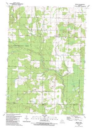
Mikado Topo Map Michigan
To zoom in, hover over the map of Mikado
USGS Topo Quad 44083e4 - 1:24,000 scale
| Topo Map Name: | Mikado |
| USGS Topo Quad ID: | 44083e4 |
| Print Size: | ca. 21 1/4" wide x 27" high |
| Southeast Coordinates: | 44.5° N latitude / 83.375° W longitude |
| Map Center Coordinates: | 44.5625° N latitude / 83.4375° W longitude |
| U.S. State: | MI |
| Filename: | o44083e4.jpg |
| Download Map JPG Image: | Mikado topo map 1:24,000 scale |
| Map Type: | Topographic |
| Topo Series: | 7.5´ |
| Map Scale: | 1:24,000 |
| Source of Map Images: | United States Geological Survey (USGS) |
| Alternate Map Versions: |
Mikado MI 1989, updated 1989 Download PDF Buy paper map Mikado MI 2012 Download PDF Buy paper map Mikado MI 2014 Download PDF Buy paper map Mikado MI 2016 Download PDF Buy paper map |
| FStopo: | US Forest Service topo Mikado is available: Download FStopo PDF Download FStopo TIF |
1:24,000 Topo Quads surrounding Mikado
> Back to 44083e1 at 1:100,000 scale
> Back to 44082a1 at 1:250,000 scale
> Back to U.S. Topo Maps home
Mikado topo map: Gazetteer
Mikado: Forests
Alpena State Forest elevation 211m 692′Mikado: Parks
Bruce Park elevation 195m 639′Mikado: Populated Places
Alvin elevation 214m 702′Mikado elevation 199m 652′
Mikado: Post Offices
Alvin Post Office (historical) elevation 214m 702′Mikado Post Office elevation 200m 656′
Roy Post Office (historical) elevation 190m 623′
Mikado: Streams
Backus Creek elevation 202m 662′Coppler Creek elevation 182m 597′
Duval Creek elevation 181m 593′
East Branch Pine River elevation 191m 626′
Gimlet Creek elevation 198m 649′
Grey Creek elevation 185m 606′
Hill Creek elevation 178m 583′
McDonald Creek elevation 191m 626′
McGillis Creek elevation 192m 629′
Roy Creek elevation 185m 606′
South Branch Pine River elevation 186m 610′
Van Etten Creek elevation 181m 593′
West Branch Pine River elevation 191m 626′
Mikado digital topo map on disk
Buy this Mikado topo map showing relief, roads, GPS coordinates and other geographical features, as a high-resolution digital map file on DVD:


