Sprinkler Creek Topo Map Michigan
To zoom in, hover over the map of Sprinkler Creek
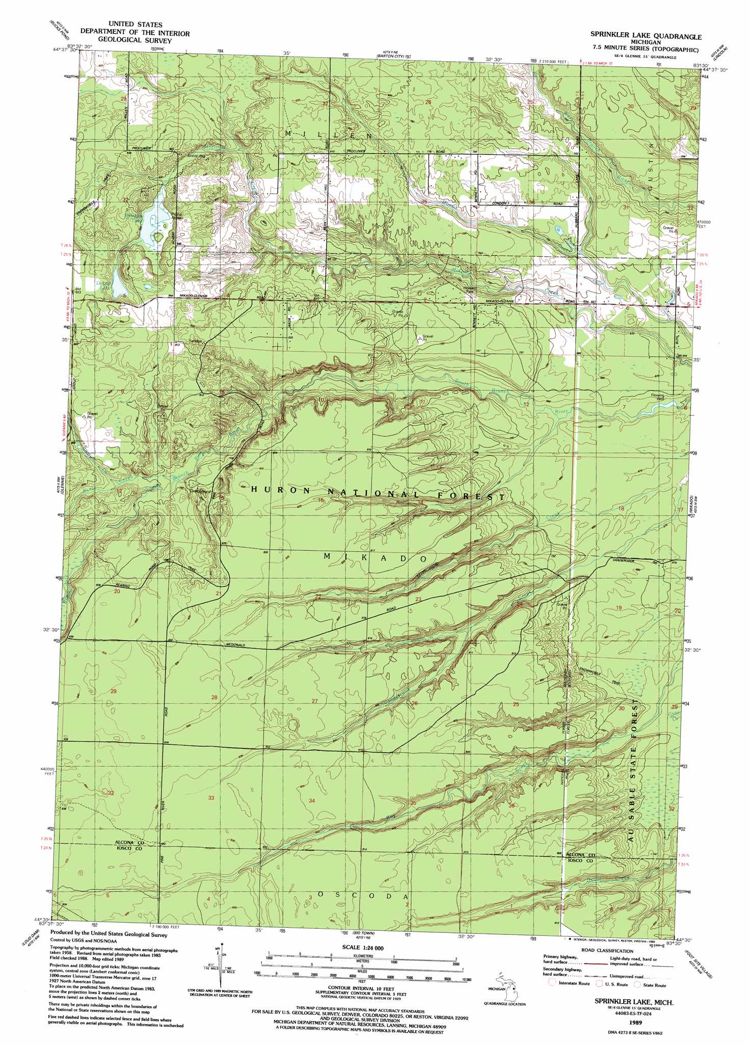
USGS Topo Quad 44083e5 - 1:24,000 scale
| Topo Map Name: | Sprinkler Creek |
| USGS Topo Quad ID: | 44083e5 |
| Print Size: | ca. 21 1/4" wide x 27" high |
| Southeast Coordinates: | 44.5° N latitude / 83.5° W longitude |
| Map Center Coordinates: | 44.5625° N latitude / 83.5625° W longitude |
| U.S. State: | MI |
| Filename: | o44083e5.jpg |
| Download Map JPG Image: | Sprinkler Creek topo map 1:24,000 scale |
| Map Type: | Topographic |
| Topo Series: | 7.5´ |
| Map Scale: | 1:24,000 |
| Source of Map Images: | United States Geological Survey (USGS) |
| Alternate Map Versions: |
Sprinkler Lake MI 1989, updated 1989 Download PDF Buy paper map Sprinkler Lake MI 2012 Download PDF Buy paper map Sprinkler Lake MI 2014 Download PDF Buy paper map Sprinkler Lake MI 2016 Download PDF Buy paper map |
| FStopo: | US Forest Service topo Sprinkler Lake is available: Download FStopo PDF Download FStopo TIF |
1:24,000 Topo Quads surrounding Sprinkler Creek
Mcginn Creek |
Hubbard Lake Sw |
Hubbard Lake |
Spruce |
Black River |
Curran |
Bucks Pond |
Barton City |
Lincoln |
Harrisville |
Alcona Dam Pond |
Glennie |
Sprinkler Creek |
Mikado |
Greenbush |
Hale |
Loud Dam |
Sid Town |
Foote Site Village |
Oscoda |
Hale Se |
Floyd Lake |
Tawas City |
East Tawas |
Spencer Lake |
> Back to 44083e1 at 1:100,000 scale
> Back to 44082a1 at 1:250,000 scale
> Back to U.S. Topo Maps home
Sprinkler Creek topo map: Gazetteer
Sprinkler Creek: Lakes
DeLap Lake elevation 245m 803′Sprinkler Lake elevation 242m 793′
Sprinkler Creek: Parks
Howard Park elevation 225m 738′Sprinkler Creek: Streams
Bryant Creek elevation 233m 764′Kurtz Creek elevation 223m 731′
Samyn Creek elevation 231m 757′
Vandercook Creek elevation 201m 659′
Wallace Creek elevation 233m 764′
Sprinkler Creek digital topo map on disk
Buy this Sprinkler Creek topo map showing relief, roads, GPS coordinates and other geographical features, as a high-resolution digital map file on DVD:
 map DVD")