Glennie Topo Map Michigan
To zoom in, hover over the map of Glennie
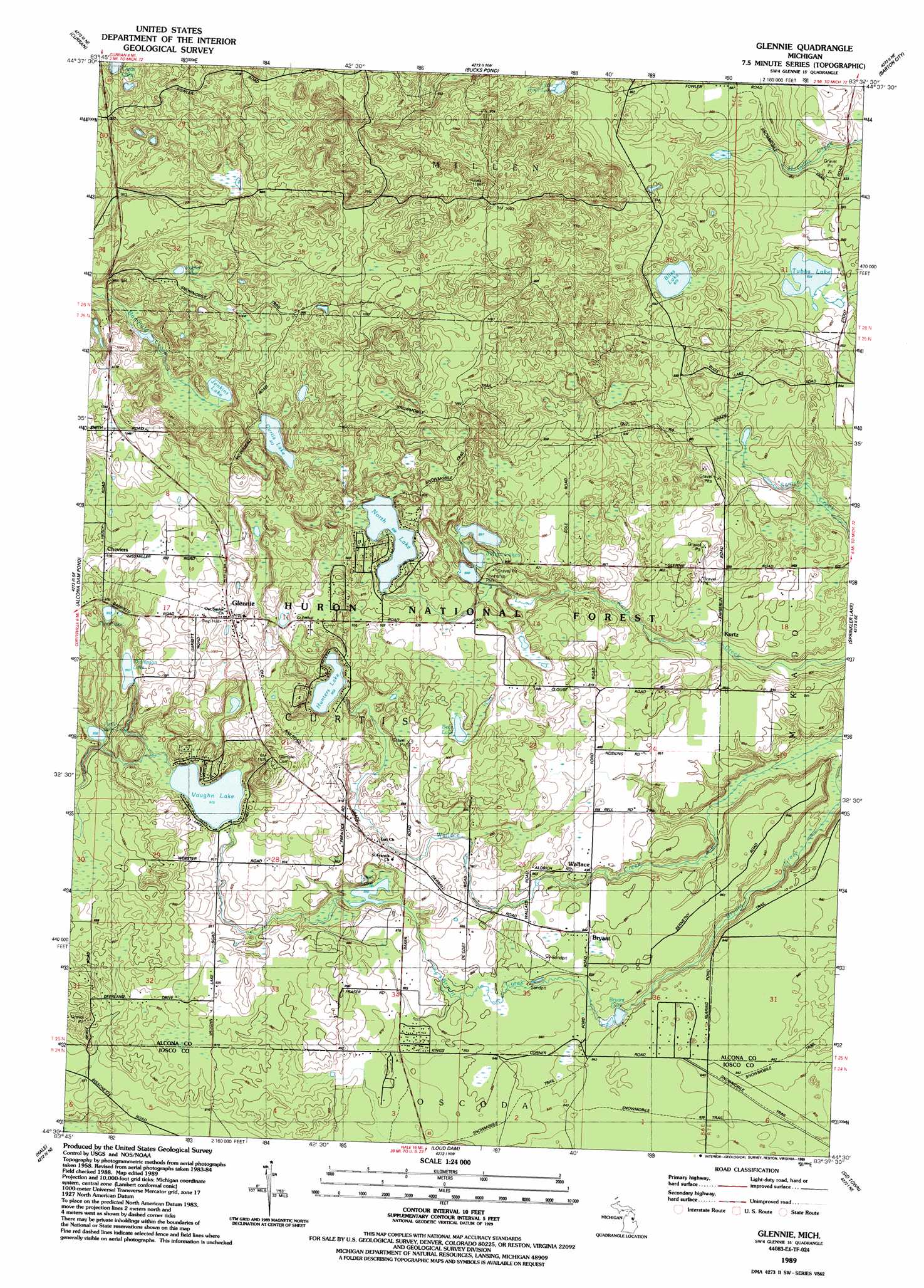
USGS Topo Quad 44083e6 - 1:24,000 scale
| Topo Map Name: | Glennie |
| USGS Topo Quad ID: | 44083e6 |
| Print Size: | ca. 21 1/4" wide x 27" high |
| Southeast Coordinates: | 44.5° N latitude / 83.625° W longitude |
| Map Center Coordinates: | 44.5625° N latitude / 83.6875° W longitude |
| U.S. State: | MI |
| Filename: | o44083e6.jpg |
| Download Map JPG Image: | Glennie topo map 1:24,000 scale |
| Map Type: | Topographic |
| Topo Series: | 7.5´ |
| Map Scale: | 1:24,000 |
| Source of Map Images: | United States Geological Survey (USGS) |
| Alternate Map Versions: |
Glennie MI 1989, updated 1989 Download PDF Buy paper map Glennie MI 2012 Download PDF Buy paper map Glennie MI 2014 Download PDF Buy paper map Glennie MI 2017 Download PDF Buy paper map |
| FStopo: | US Forest Service topo Glennie is available: Download FStopo PDF Download FStopo TIF |
1:24,000 Topo Quads surrounding Glennie
Mccollum Lake |
Mcginn Creek |
Hubbard Lake Sw |
Hubbard Lake |
Spruce |
Mckinley |
Curran |
Bucks Pond |
Barton City |
Lincoln |
Goodar |
Alcona Dam Pond |
Glennie |
Sprinkler Creek |
Mikado |
South Branch |
Hale |
Loud Dam |
Sid Town |
Foote Site Village |
Sage Lake |
Hale Se |
Floyd Lake |
Tawas City |
East Tawas |
> Back to 44083e1 at 1:100,000 scale
> Back to 44082a1 at 1:250,000 scale
> Back to U.S. Topo Maps home
Glennie topo map: Gazetteer
Glennie: Airports
Stier Airstrip elevation 261m 856′Glennie: Lakes
Bear Lake elevation 273m 895′Bliss Lake elevation 266m 872′
Bryant Lake elevation 251m 823′
Curtis Lake elevation 296m 971′
Hunters Lake elevation 275m 902′
Indian Lakes elevation 269m 882′
Jenkins Lake elevation 291m 954′
Little Bear Lake elevation 285m 935′
Little Lake elevation 260m 853′
Little Trout Lake elevation 270m 885′
North Lake elevation 286m 938′
Poplar Lake elevation 312m 1023′
Thompson Lake elevation 290m 951′
Tubbs Lake elevation 254m 833′
Twin Lake elevation 291m 954′
Vaughn Lake elevation 279m 915′
Glennie: Populated Places
Bryant elevation 258m 846′Cheviers elevation 302m 990′
Glennie elevation 310m 1017′
Kurtz elevation 256m 839′
Wallace elevation 254m 833′
Glennie: Post Offices
Glennie Post Office elevation 311m 1020′Kurtz Post Office (historical) elevation 256m 839′
Lott Post Office (historical) elevation 274m 898′
Glennie digital topo map on disk
Buy this Glennie topo map showing relief, roads, GPS coordinates and other geographical features, as a high-resolution digital map file on DVD:
 map DVD")