Mccollum Lake Topo Map Michigan
To zoom in, hover over the map of Mccollum Lake
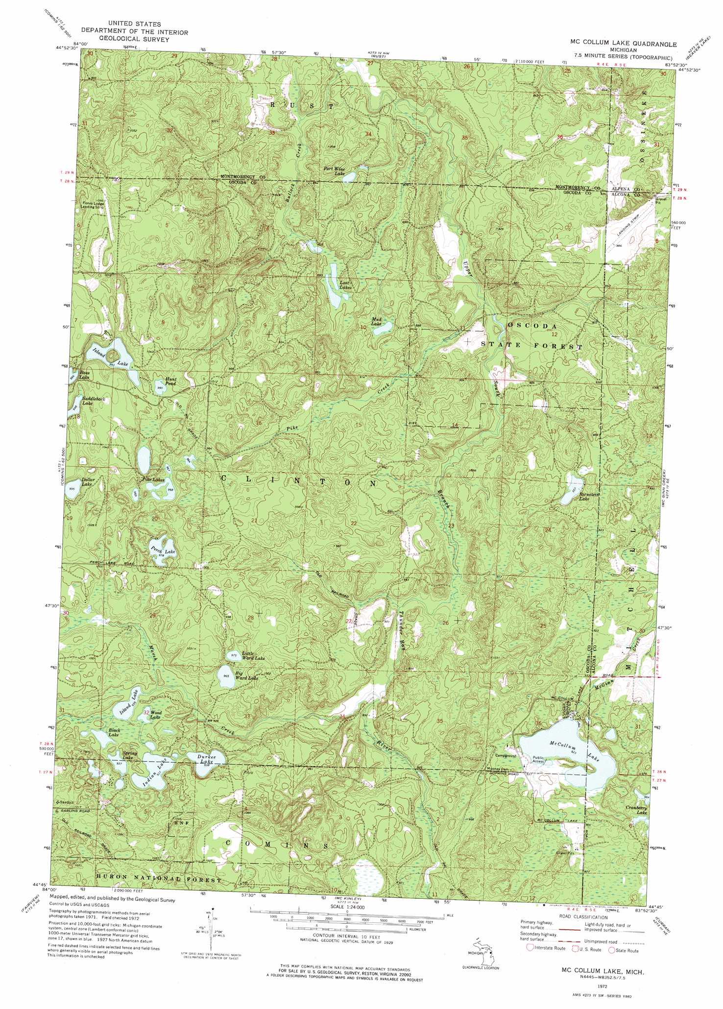
USGS Topo Quad 44083g8 - 1:24,000 scale
| Topo Map Name: | Mccollum Lake |
| USGS Topo Quad ID: | 44083g8 |
| Print Size: | ca. 21 1/4" wide x 27" high |
| Southeast Coordinates: | 44.75° N latitude / 83.875° W longitude |
| Map Center Coordinates: | 44.8125° N latitude / 83.9375° W longitude |
| U.S. State: | MI |
| Filename: | o44083g8.jpg |
| Download Map JPG Image: | Mccollum Lake topo map 1:24,000 scale |
| Map Type: | Topographic |
| Topo Series: | 7.5´ |
| Map Scale: | 1:24,000 |
| Source of Map Images: | United States Geological Survey (USGS) |
| Alternate Map Versions: |
McCollum Lake MI 1972, updated 1975 Download PDF Buy paper map McCollum Lake MI 2012 Download PDF Buy paper map McCollum Lake MI 2014 Download PDF Buy paper map McCollum Lake MI 2016 Download PDF Buy paper map |
| FStopo: | US Forest Service topo McCollum Lake is available: Download FStopo PDF Download FStopo TIF |
1:24,000 Topo Quads surrounding Mccollum Lake
Atlanta |
Atlanta Se |
Hillman |
Jewett Creek |
Lachine |
Crooked Lake |
Avery |
Rust |
Beaver Lake |
Evans Creek |
Oak Lake |
Comins |
Mccollum Lake |
Mcginn Creek |
Hubbard Lake Sw |
Mio |
Fairview |
Mckinley |
Curran |
Bucks Pond |
Island Lake |
Mack Lake |
Goodar |
Alcona Dam Pond |
Glennie |
> Back to 44083e1 at 1:100,000 scale
> Back to 44082a1 at 1:250,000 scale
> Back to U.S. Topo Maps home
Mccollum Lake topo map: Gazetteer
Mccollum Lake: Forests
Oscoda State Forest elevation 271m 889′Mccollum Lake: Lakes
Big Ward Lake elevation 294m 964′Black Lake elevation 285m 935′
Dollar Lake elevation 303m 994′
Durkee Lake elevation 286m 938′
Hunt Pond elevation 302m 990′
Indian Lake elevation 285m 935′
Island Lake elevation 303m 994′
Island Lake elevation 285m 935′
Little Ward Lake elevation 297m 974′
Lost Lakes elevation 257m 843′
McCollum Lake elevation 281m 921′
Mud Lake elevation 267m 875′
Perch Lake elevation 298m 977′
Pike Lakes elevation 295m 967′
Port Wine Lake elevation 254m 833′
Rienstein Lake elevation 285m 935′
Saddleback Lake elevation 304m 997′
Spring Lake elevation 285m 935′
Wood Lake elevation 285m 935′
Mccollum Lake: Streams
Bullock Creek elevation 239m 784′Marsh Creek elevation 268m 879′
Pike Creek elevation 250m 820′
Mccollum Lake digital topo map on disk
Buy this Mccollum Lake topo map showing relief, roads, GPS coordinates and other geographical features, as a high-resolution digital map file on DVD:
 map DVD")