Beaver Lake Topo Map Michigan
To zoom in, hover over the map of Beaver Lake
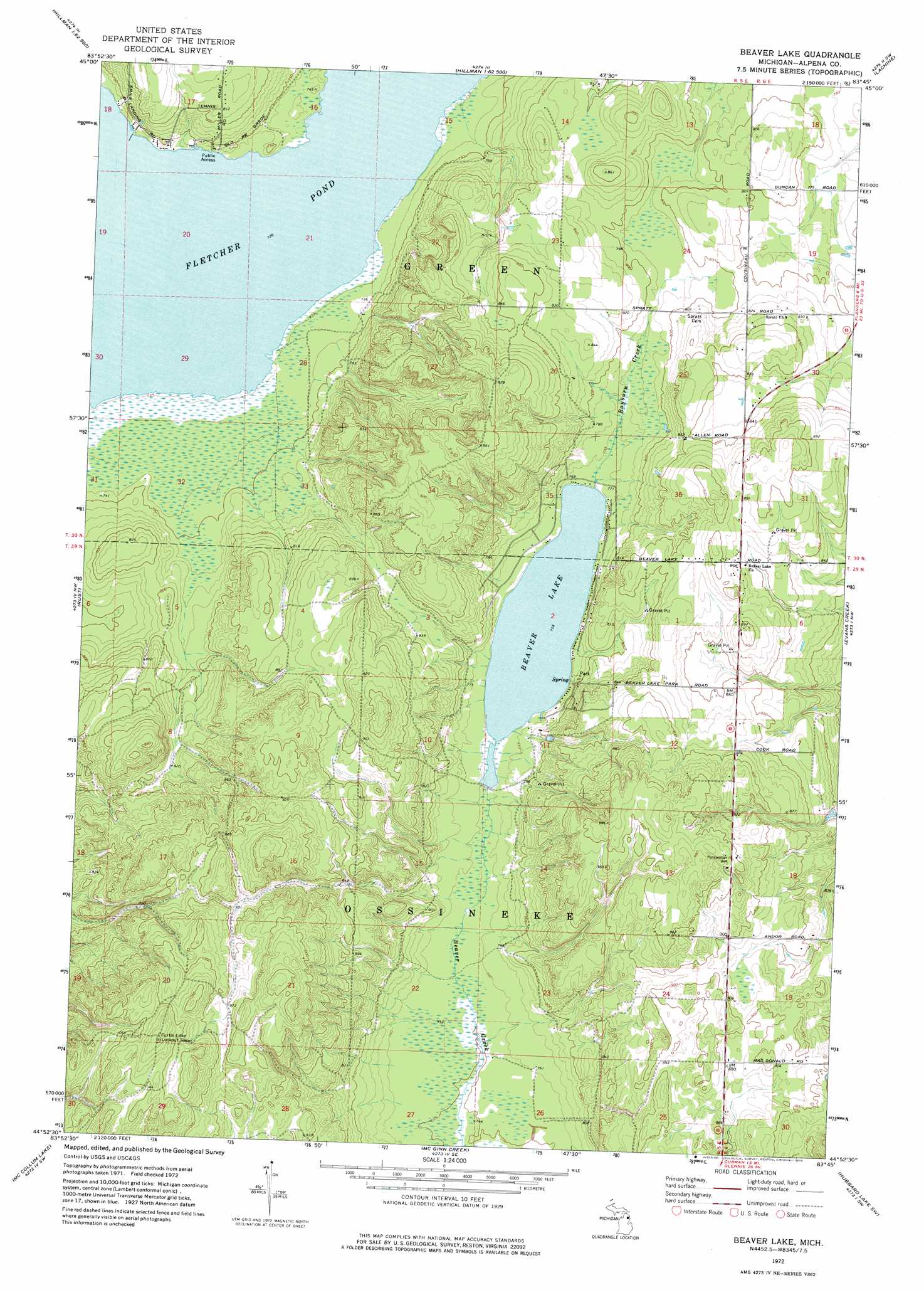
USGS Topo Quad 44083h7 - 1:24,000 scale
| Topo Map Name: | Beaver Lake |
| USGS Topo Quad ID: | 44083h7 |
| Print Size: | ca. 21 1/4" wide x 27" high |
| Southeast Coordinates: | 44.875° N latitude / 83.75° W longitude |
| Map Center Coordinates: | 44.9375° N latitude / 83.8125° W longitude |
| U.S. State: | MI |
| Filename: | o44083h7.jpg |
| Download Map JPG Image: | Beaver Lake topo map 1:24,000 scale |
| Map Type: | Topographic |
| Topo Series: | 7.5´ |
| Map Scale: | 1:24,000 |
| Source of Map Images: | United States Geological Survey (USGS) |
| Alternate Map Versions: |
Beaver Lake MI 1972, updated 1975 Download PDF Buy paper map Beaver Lake MI 2011 Download PDF Buy paper map Beaver Lake MI 2014 Download PDF Buy paper map Beaver Lake MI 2016 Download PDF Buy paper map |
1:24,000 Topo Quads surrounding Beaver Lake
Cranberry Lake |
Royston |
Hillman Ne |
Polaski |
Long Lake West |
Atlanta Se |
Hillman |
Jewett Creek |
Lachine |
Lake Winyah |
Avery |
Rust |
Beaver Lake |
Evans Creek |
Big Ravine Creek |
Comins |
Mccollum Lake |
Mcginn Creek |
Hubbard Lake Sw |
Hubbard Lake |
Fairview |
Mckinley |
Curran |
Bucks Pond |
Barton City |
> Back to 44083e1 at 1:100,000 scale
> Back to 44082a1 at 1:250,000 scale
> Back to U.S. Topo Maps home
Beaver Lake topo map: Gazetteer
Beaver Lake: Lakes
Beaver Lake elevation 231m 757′Fletcher Pond elevation 222m 728′
Beaver Lake: Parks
Beaver Lake County Park elevation 240m 787′Beaver Lake: Streams
Rayburn Creek elevation 231m 757′Beaver Lake digital topo map on disk
Buy this Beaver Lake topo map showing relief, roads, GPS coordinates and other geographical features, as a high-resolution digital map file on DVD:
 map DVD")