Rust Topo Map Michigan
To zoom in, hover over the map of Rust
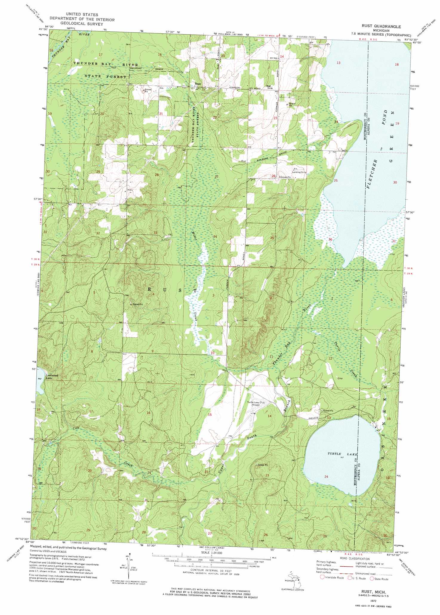
USGS Topo Quad 44083h8 - 1:24,000 scale
| Topo Map Name: | Rust |
| USGS Topo Quad ID: | 44083h8 |
| Print Size: | ca. 21 1/4" wide x 27" high |
| Southeast Coordinates: | 44.875° N latitude / 83.875° W longitude |
| Map Center Coordinates: | 44.9375° N latitude / 83.9375° W longitude |
| U.S. State: | MI |
| Filename: | o44083h8.jpg |
| Download Map JPG Image: | Rust topo map 1:24,000 scale |
| Map Type: | Topographic |
| Topo Series: | 7.5´ |
| Map Scale: | 1:24,000 |
| Source of Map Images: | United States Geological Survey (USGS) |
| Alternate Map Versions: |
Rust MI 1972, updated 1975 Download PDF Buy paper map Rust MI 2011 Download PDF Buy paper map Rust MI 2014 Download PDF Buy paper map Rust MI 2016 Download PDF Buy paper map |
1:24,000 Topo Quads surrounding Rust
Lake Geneva |
Cranberry Lake |
Royston |
Hillman Ne |
Polaski |
Atlanta |
Atlanta Se |
Hillman |
Jewett Creek |
Lachine |
Crooked Lake |
Avery |
Rust |
Beaver Lake |
Evans Creek |
Oak Lake |
Comins |
Mccollum Lake |
Mcginn Creek |
Hubbard Lake Sw |
Mio |
Fairview |
Mckinley |
Curran |
Bucks Pond |
> Back to 44083e1 at 1:100,000 scale
> Back to 44082a1 at 1:250,000 scale
> Back to U.S. Topo Maps home
Rust topo map: Gazetteer
Rust: Airports
Turtle Lake Club Airport elevation 240m 787′Rust: Lakes
Turtle Lake elevation 234m 767′Rust: Populated Places
Rust elevation 251m 823′Rust: Post Offices
Rust Post Office (historical) elevation 251m 823′Rust: Streams
Cole Creek elevation 234m 767′Turtle Creek elevation 223m 731′
Upper South Branch Thunder Bay River elevation 222m 728′
Weber Creek elevation 226m 741′
Rust digital topo map on disk
Buy this Rust topo map showing relief, roads, GPS coordinates and other geographical features, as a high-resolution digital map file on DVD:
 map DVD")