Sterling Sw Topo Map Michigan
To zoom in, hover over the map of Sterling Sw
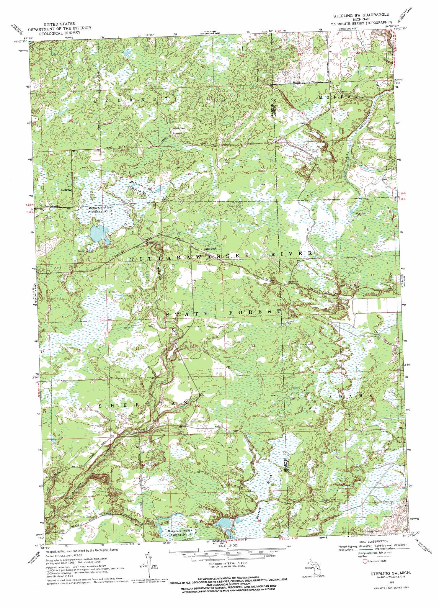
USGS Topo Quad 44084a2 - 1:24,000 scale
| Topo Map Name: | Sterling Sw |
| USGS Topo Quad ID: | 44084a2 |
| Print Size: | ca. 21 1/4" wide x 27" high |
| Southeast Coordinates: | 44° N latitude / 84.125° W longitude |
| Map Center Coordinates: | 44.0625° N latitude / 84.1875° W longitude |
| U.S. State: | MI |
| Filename: | o44084a2.jpg |
| Download Map JPG Image: | Sterling Sw topo map 1:24,000 scale |
| Map Type: | Topographic |
| Topo Series: | 7.5´ |
| Map Scale: | 1:24,000 |
| Source of Map Images: | United States Geological Survey (USGS) |
| Alternate Map Versions: |
Sterling SW MI 1968, updated 1971 Download PDF Buy paper map Sterling SW MI 2011 Download PDF Buy paper map Sterling SW MI 2014 Download PDF Buy paper map Sterling SW MI 2017 Download PDF Buy paper map |
1:24,000 Topo Quads surrounding Sterling Sw
Saint Helen |
Ogemaw Springs |
West Branch |
Selkirk |
Sage Lake |
Butman |
Edwards |
Sterling Nw |
Skidway Lake |
Prescott |
Wagarville |
Secord Lake |
Sterling Sw |
Sterling |
Omer Sw |
Gladwin |
Wooden Shoe Village |
Bentley |
Mount Forest |
Standish |
Edenville |
Hope |
Estey |
Crump |
Pinconning |
> Back to 44084a1 at 1:100,000 scale
> Back to 44084a1 at 1:250,000 scale
> Back to U.S. Topo Maps home
Sterling Sw topo map: Gazetteer
Sterling Sw: Populated Places
Bowmanville elevation 238m 780′Hard Luck elevation 233m 764′
Sterling Sw: Post Offices
Bomanville Post Office (historical) elevation 238m 780′Hardluck Post Office (historical) elevation 233m 764′
Sterling Sw: Reservoirs
Molasses River Flooding Number Five elevation 230m 754′Molasses River Flooding Number One elevation 235m 770′
Molasses River Flooding Number Two elevation 236m 774′
Sterling Sw: Swamps
Bentley Marsh elevation 233m 764′Sterling Sw: Trails
East Fireline Trail elevation 233m 764′Lame Duck Truck Trail elevation 236m 774′
Mosquito Alley Truck Trail elevation 227m 744′
Sterling Truck Trail elevation 236m 774′
Sterling Sw digital topo map on disk
Buy this Sterling Sw topo map showing relief, roads, GPS coordinates and other geographical features, as a high-resolution digital map file on DVD: