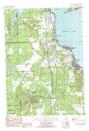
Houghton Lake Topo Map Michigan
To zoom in, hover over the map of Houghton Lake
USGS Topo Quad 44084c7 - 1:25,000 scale
| Topo Map Name: | Houghton Lake |
| USGS Topo Quad ID: | 44084c7 |
| Print Size: | ca. 21 1/4" wide x 27" high |
| Southeast Coordinates: | 44.25° N latitude / 84.75° W longitude |
| Map Center Coordinates: | 44.3125° N latitude / 84.8125° W longitude |
| U.S. State: | MI |
| Filename: | l44084c7.jpg |
| Download Map JPG Image: | Houghton Lake topo map 1:25,000 scale |
| Map Type: | Topographic |
| Topo Series: | 7.5´ |
| Map Scale: | 1:25,000 |
| Source of Map Images: | United States Geological Survey (USGS) |
| Alternate Map Versions: |
Houghton Lake MI 1983, updated 1984 Download PDF Buy paper map Houghton Lake MI 1983, updated 1984 Download PDF Buy paper map |
1:24,000 Topo Quads surrounding Houghton Lake
> Back to 44084a1 at 1:100,000 scale
> Back to 44084a1 at 1:250,000 scale
> Back to U.S. Topo Maps home
Houghton Lake topo map: Gazetteer
Houghton Lake: Airports
Houghton Lake State Airport elevation 354m 1161′Houghton Lake: Canals
Nellsville Ditch elevation 345m 1131′Houghton Lake: Capes
Long Point elevation 348m 1141′Houghton Lake: Dams
Reedsburg Dam elevation 347m 1138′Houghton Lake: Lakes
Barney Lake elevation 343m 1125′Houghton Lake: Parks
Houghton Lake Park elevation 363m 1190′Houghton Lake Wildlife Research Area elevation 345m 1131′
Houghton Lake: Populated Places
Houghton Lake elevation 349m 1145′Houghton Lake Heights elevation 358m 1174′
Houghton Point elevation 348m 1141′
Loxley elevation 342m 1122′
Nellsville elevation 350m 1148′
Houghton Lake: Post Offices
Houghton Lake Post Office elevation 377m 1236′Houghton Point Post Office (historical) elevation 348m 1141′
Loxley Post Office (historical) elevation 342m 1122′
Nellsville Post Office (historical) elevation 351m 1151′
Houghton Lake: Reservoirs
Dead Stream Flooding elevation 348m 1141′Houghton Lake Flats Flooding elevation 348m 1141′
Houghton Lake: Swamps
Curtis Pond elevation 347m 1138′Houghton Lake digital topo map on disk
Buy this Houghton Lake topo map showing relief, roads, GPS coordinates and other geographical features, as a high-resolution digital map file on DVD:


