Damon Topo Map Michigan
To zoom in, hover over the map of Damon
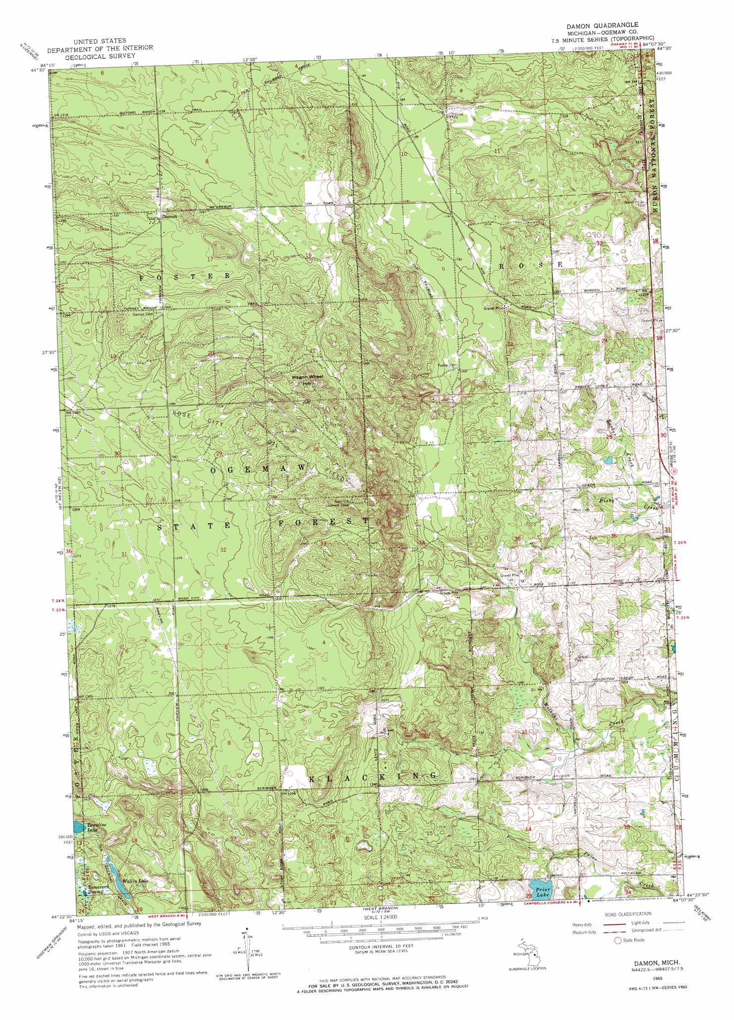
USGS Topo Quad 44084d2 - 1:24,000 scale
| Topo Map Name: | Damon |
| USGS Topo Quad ID: | 44084d2 |
| Print Size: | ca. 21 1/4" wide x 27" high |
| Southeast Coordinates: | 44.375° N latitude / 84.125° W longitude |
| Map Center Coordinates: | 44.4375° N latitude / 84.1875° W longitude |
| U.S. State: | MI |
| Filename: | o44084d2.jpg |
| Download Map JPG Image: | Damon topo map 1:24,000 scale |
| Map Type: | Topographic |
| Topo Series: | 7.5´ |
| Map Scale: | 1:24,000 |
| Source of Map Images: | United States Geological Survey (USGS) |
| Alternate Map Versions: |
Damon MI 1965, updated 1966 Download PDF Buy paper map Damon MI 2012 Download PDF Buy paper map Damon MI 2014 Download PDF Buy paper map Damon MI 2017 Download PDF Buy paper map |
| FStopo: | US Forest Service topo Damon is available: Download FStopo PDF Download FStopo TIF |
1:24,000 Topo Quads surrounding Damon
Luzerne Nw |
Red Oak |
Mio |
Fairview |
Mckinley |
Eldorado |
Luzerne |
Island Lake |
Mack Lake |
Goodar |
Saint Helen Nw |
Saint Helen Ne |
Damon |
Rose City |
South Branch |
Saint Helen |
Ogemaw Springs |
West Branch |
Selkirk |
Sage Lake |
Butman |
Edwards |
Sterling Nw |
Skidway Lake |
Prescott |
> Back to 44084a1 at 1:100,000 scale
> Back to 44084a1 at 1:250,000 scale
> Back to U.S. Topo Maps home
Damon topo map: Gazetteer
Damon: Lakes
Prior Lake elevation 309m 1013′Townline Lake elevation 386m 1266′
Wallin Lake elevation 385m 1263′
Damon: Populated Places
Damon elevation 405m 1328′Damon: Post Offices
Damon Post Office (historical) elevation 405m 1328′Damon: Streams
Barber Creek elevation 306m 1003′Damon: Summits
Wagon Wheel Hill elevation 445m 1459′Damon: Swamps
Tamarack Swamp elevation 393m 1289′Damon digital topo map on disk
Buy this Damon topo map showing relief, roads, GPS coordinates and other geographical features, as a high-resolution digital map file on DVD: