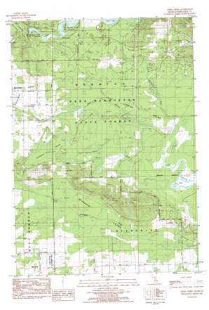
Addis Creek Topo Map Michigan
To zoom in, hover over the map of Addis Creek
USGS Topo Quad 44084d8 - 1:25,000 scale
| Topo Map Name: | Addis Creek |
| USGS Topo Quad ID: | 44084d8 |
| Print Size: | ca. 21 1/4" wide x 27" high |
| Southeast Coordinates: | 44.375° N latitude / 84.875° W longitude |
| Map Center Coordinates: | 44.4375° N latitude / 84.9375° W longitude |
| U.S. State: | MI |
| Filename: | l44084d8.jpg |
| Download Map JPG Image: | Addis Creek topo map 1:25,000 scale |
| Map Type: | Topographic |
| Topo Series: | 7.5´ |
| Map Scale: | 1:25,000 |
| Source of Map Images: | United States Geological Survey (USGS) |
| Alternate Map Versions: |
1:24,000 Topo Quads surrounding Addis Creek
> Back to 44084a1 at 1:100,000 scale
> Back to 44084a1 at 1:250,000 scale
> Back to U.S. Topo Maps home
Addis Creek topo map: Gazetteer
Addis Creek: Airports
Moorestown Airpark elevation 369m 1210′Pownell Landing Strip elevation 367m 1204′
Addis Creek: Dams
Stratford Dam elevation 357m 1171′Addis Creek: Lakes
Bear Lake elevation 345m 1131′Addis Creek: Oilfields
Enterprise Oil Field elevation 359m 1177′Norwich Oil Field elevation 366m 1200′
Addis Creek: Reservoirs
Big Cannon Creek Number One Flooding elevation 352m 1154′Big Cannon Creek Number Two Flooding elevation 357m 1171′
Addis Creek: Streams
Addis Creek elevation 347m 1138′Willow Run elevation 348m 1141′
Addis Creek: Swamps
Big Cannon Creek Swamp elevation 355m 1164′Dead Stream Swamp elevation 350m 1148′
Haymarsh Swamp elevation 356m 1167′
Remington Swamp elevation 360m 1181′
Addis Creek digital topo map on disk
Buy this Addis Creek topo map showing relief, roads, GPS coordinates and other geographical features, as a high-resolution digital map file on DVD:


