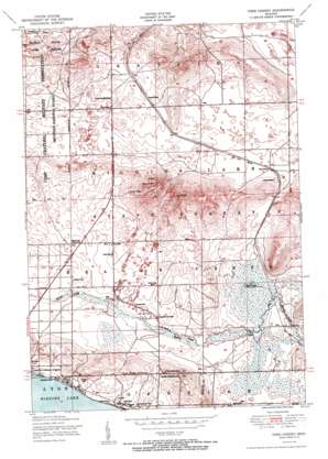
Pere Cheney Topo Map Michigan
To zoom in, hover over the map of Pere Cheney
USGS Topo Quad 44084e6 - 1:24,000 scale
| Topo Map Name: | Pere Cheney |
| USGS Topo Quad ID: | 44084e6 |
| Print Size: | ca. 21 1/4" wide x 27" high |
| Southeast Coordinates: | 44.5° N latitude / 84.625° W longitude |
| Map Center Coordinates: | 44.5625° N latitude / 84.6875° W longitude |
| U.S. State: | MI |
| Filename: | o44084e6.jpg |
| Download Map JPG Image: | Pere Cheney topo map 1:24,000 scale |
| Map Type: | Topographic |
| Topo Series: | 7.5´ |
| Map Scale: | 1:24,000 |
| Source of Map Images: | United States Geological Survey (USGS) |
| Alternate Map Versions: |
Pere Cheney MI 1951 Download PDF Buy paper map Pere Cheney MI 1951 Download PDF Buy paper map Pere Cheney MI 1951, updated 1951 Download PDF Buy paper map Pere Cheney MI 2011 Download PDF Buy paper map Pere Cheney MI 2014 Download PDF Buy paper map Pere Cheney MI 2017 Download PDF Buy paper map |
1:24,000 Topo Quads surrounding Pere Cheney
> Back to 44084e1 at 1:100,000 scale
> Back to 44084a1 at 1:250,000 scale
> Back to U.S. Topo Maps home
Pere Cheney topo map: Gazetteer
Pere Cheney: Airports
Higgins Lake Airport elevation 365m 1197′Pere Cheney: Basins
Juvigny Valley elevation 380m 1246′Pere Cheney: Crossings
Interchange 244 elevation 353m 1158′Interchange 249 elevation 377m 1236′
Interchange 251 elevation 386m 1266′
Pere Cheney: Forests
Higgins Lake State Forest elevation 417m 1368′Pere Cheney: Lakes
Mud Lake elevation 348m 1141′Pere Cheney: Populated Places
Pere Cheney elevation 366m 1200′Skyline Village elevation 400m 1312′
Pere Cheney: Post Offices
Pere Cheney Post Office (historical) elevation 366m 1200′Pere Cheney: Streams
Little Beaver Creek elevation 356m 1167′Pere Cheney: Summits
Hogarth Hill elevation 398m 1305′Sinke Hill elevation 403m 1322′
Pere Cheney digital topo map on disk
Buy this Pere Cheney topo map showing relief, roads, GPS coordinates and other geographical features, as a high-resolution digital map file on DVD:


