Grayling Topo Map Michigan
To zoom in, hover over the map of Grayling
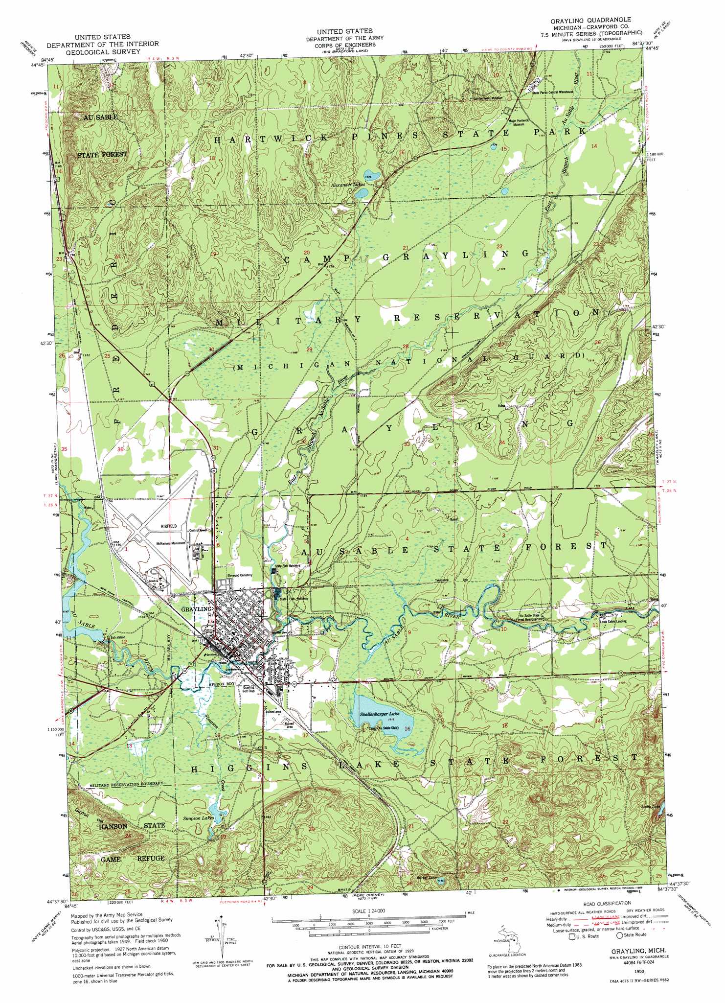
USGS Topo Quad 44084f6 - 1:24,000 scale
| Topo Map Name: | Grayling |
| USGS Topo Quad ID: | 44084f6 |
| Print Size: | ca. 21 1/4" wide x 27" high |
| Southeast Coordinates: | 44.625° N latitude / 84.625° W longitude |
| Map Center Coordinates: | 44.6875° N latitude / 84.6875° W longitude |
| U.S. State: | MI |
| Filename: | o44084f6.jpg |
| Download Map JPG Image: | Grayling topo map 1:24,000 scale |
| Map Type: | Topographic |
| Topo Series: | 7.5´ |
| Map Scale: | 1:24,000 |
| Source of Map Images: | United States Geological Survey (USGS) |
| Alternate Map Versions: |
Grayling MI 1950, updated 1973 Download PDF Buy paper map Grayling MI 1950, updated 1989 Download PDF Buy paper map Grayling MI 1951, updated 1951 Download PDF Buy paper map Grayling MI 2011 Download PDF Buy paper map Grayling MI 2014 Download PDF Buy paper map Grayling MI 2017 Download PDF Buy paper map |
1:24,000 Topo Quads surrounding Grayling
Alba |
Lake Arrowhead |
Otsego Lake |
Turtle Lake |
Johannesburg |
Starvation Lake |
Frederic |
Big Bradford Lake |
K P Lake |
Lovells |
Black Creek |
Lake Margrethe |
Grayling |
Wakeley Lake |
Luzerne Nw |
Fletcher |
Cote Dame Marie |
Pere Cheney |
Roscommon North |
Eldorado |
Addis Creek |
Meads Landing |
Lyon Manor |
Roscommon South |
Saint Helen Nw |
> Back to 44084e1 at 1:100,000 scale
> Back to 44084a1 at 1:250,000 scale
> Back to U.S. Topo Maps home
Grayling topo map: Gazetteer
Grayling: Airports
Grayling Army Air Field elevation 351m 1151′Grayling: Crossings
Interchange 254 elevation 348m 1141′Interchange 256 elevation 352m 1154′
Interchange 259 elevation 357m 1171′
Grayling: Lakes
Barker Lake elevation 353m 1158′Bright Lake elevation 358m 1174′
Hartwick Lake elevation 359m 1177′
Karen Lake elevation 359m 1177′
Shellenbarger Lake elevation 339m 1112′
Simpson Lakes elevation 348m 1141′
Staley Lake elevation 346m 1135′
Grayling: Parks
Chief Shoppenagon Historical Marker elevation 343m 1125′Hartwick Pines State Park elevation 381m 1250′
Michigan Grayling Historical Marker elevation 348m 1141′
Shoppenagon's Homesite Historical Marker elevation 343m 1125′
Grayling: Pillars
McNamara Monument elevation 351m 1151′Grayling: Populated Places
Grayling elevation 347m 1138′Louis Cabin Landing elevation 335m 1099′
Grayling: Post Offices
Grayling Post Office elevation 348m 1141′Grayling: Streams
East Branch Au Sable River elevation 343m 1125′Simpson Creek elevation 344m 1128′
Grayling: Summits
Guyton Hill elevation 387m 1269′Grayling digital topo map on disk
Buy this Grayling topo map showing relief, roads, GPS coordinates and other geographical features, as a high-resolution digital map file on DVD: