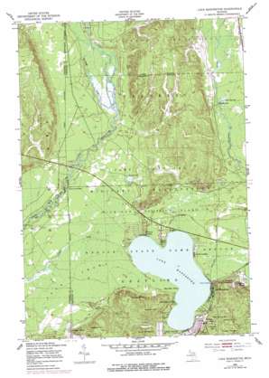
Lake Margrethe Topo Map Michigan
To zoom in, hover over the map of Lake Margrethe
USGS Topo Quad 44084f7 - 1:24,000 scale
| Topo Map Name: | Lake Margrethe |
| USGS Topo Quad ID: | 44084f7 |
| Print Size: | ca. 21 1/4" wide x 27" high |
| Southeast Coordinates: | 44.625° N latitude / 84.75° W longitude |
| Map Center Coordinates: | 44.6875° N latitude / 84.8125° W longitude |
| U.S. State: | MI |
| Filename: | o44084f7.jpg |
| Download Map JPG Image: | Lake Margrethe topo map 1:24,000 scale |
| Map Type: | Topographic |
| Topo Series: | 7.5´ |
| Map Scale: | 1:24,000 |
| Source of Map Images: | United States Geological Survey (USGS) |
| Alternate Map Versions: |
Lake Margrethe MI 1950, updated 1953 Download PDF Buy paper map Lake Margrethe MI 1950, updated 1978 Download PDF Buy paper map Lake Margrethe MI 1950, updated 1978 Download PDF Buy paper map Lake Margrethe MI 2011 Download PDF Buy paper map Lake Margrethe MI 2014 Download PDF Buy paper map Lake Margrethe MI 2017 Download PDF Buy paper map |
1:24,000 Topo Quads surrounding Lake Margrethe
> Back to 44084e1 at 1:100,000 scale
> Back to 44084a1 at 1:250,000 scale
> Back to U.S. Topo Maps home
Lake Margrethe topo map: Gazetteer
Lake Margrethe: Capes
Big Bear Point elevation 347m 1138′Eagle Point elevation 347m 1138′
Little Bear Point elevation 349m 1145′
Lake Margrethe: Lakes
Howes Lake elevation 348m 1141′Lake Margrethe elevation 346m 1135′
Sand Hill Lake elevation 353m 1158′
Lake Margrethe: Parks
Grayling Winter Recreation Area elevation 380m 1246′Hanson State Game Refuge elevation 349m 1145′
Thirty-Second Red Arrow Division Historical Marker elevation 356m 1167′
Lake Margrethe: Populated Places
Collens Landing elevation 348m 1141′Danish Landing elevation 347m 1138′
Lake Margrethe elevation 353m 1158′
McIntyre Landing elevation 347m 1138′
Rasmus elevation 364m 1194′
Lake Margrethe: Streams
Goose Creek elevation 344m 1128′Lake Margrethe: Summits
Argonne Hill elevation 389m 1276′Bald Knob elevation 384m 1259′
Croshaw Hill elevation 399m 1309′
Haan Hill elevation 392m 1286′
Mont Saint Martin elevation 391m 1282′
Mount Franklin elevation 380m 1246′
Red Arrow Hill elevation 389m 1276′
Stewart Hill elevation 409m 1341′
Thompson Hill elevation 403m 1322′
Wilson Hill elevation 387m 1269′
Lake Margrethe: Swamps
Bear Swamp elevation 345m 1131′Lake Margrethe digital topo map on disk
Buy this Lake Margrethe topo map showing relief, roads, GPS coordinates and other geographical features, as a high-resolution digital map file on DVD:


