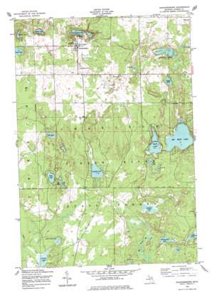
Johannesburg Topo Map Michigan
To zoom in, hover over the map of Johannesburg
USGS Topo Quad 44084h4 - 1:24,000 scale
| Topo Map Name: | Johannesburg |
| USGS Topo Quad ID: | 44084h4 |
| Print Size: | ca. 21 1/4" wide x 27" high |
| Southeast Coordinates: | 44.875° N latitude / 84.375° W longitude |
| Map Center Coordinates: | 44.9375° N latitude / 84.4375° W longitude |
| U.S. State: | MI |
| Filename: | o44084h4.jpg |
| Download Map JPG Image: | Johannesburg topo map 1:24,000 scale |
| Map Type: | Topographic |
| Topo Series: | 7.5´ |
| Map Scale: | 1:24,000 |
| Source of Map Images: | United States Geological Survey (USGS) |
| Alternate Map Versions: |
Johannesburg MI 1950, updated 1977 Download PDF Buy paper map Johannesburg MI 1951, updated 1951 Download PDF Buy paper map Johannesburg MI 2011 Download PDF Buy paper map Johannesburg MI 2014 Download PDF Buy paper map Johannesburg MI 2017 Download PDF Buy paper map |
1:24,000 Topo Quads surrounding Johannesburg
> Back to 44084e1 at 1:100,000 scale
> Back to 44084a1 at 1:250,000 scale
> Back to U.S. Topo Maps home
Johannesburg topo map: Gazetteer
Johannesburg: Lakes
Adams Lake elevation 397m 1302′Big Bear Lake elevation 378m 1240′
Caulkins Lake elevation 370m 1213′
Clear Lake elevation 375m 1230′
Crapo Lake elevation 363m 1190′
Denny Lake elevation 377m 1236′
Douglas Lake elevation 379m 1243′
Duck Lake elevation 377m 1236′
Dudd Lake elevation 391m 1282′
Ell Lake elevation 376m 1233′
Ginsel Lake elevation 378m 1240′
Johannesburg Lake elevation 378m 1240′
Kujawa or Burg Lake elevation 377m 1236′
Lewis Lake elevation 394m 1292′
Little Bear Lake elevation 378m 1240′
Little Crapo Lake elevation 366m 1200′
Long Lake elevation 376m 1233′
Mud Lake elevation 380m 1246′
Perch Lake elevation 373m 1223′
Round Lake elevation 368m 1207′
Seventh Spectacle Lake elevation 371m 1217′
Sixth Spectacle Lake elevation 373m 1223′
Swede Lake elevation 394m 1292′
Traverse Lakes elevation 397m 1302′
Johannesburg: Parks
Allen Park elevation 382m 1253′Johannesburg: Populated Places
Johannesburg elevation 412m 1351′Johannesburg: Post Offices
Johannesburg Post Office elevation 415m 1361′Johannesburg: Streams
Crapo Creek elevation 365m 1197′Johannesburg digital topo map on disk
Buy this Johannesburg topo map showing relief, roads, GPS coordinates and other geographical features, as a high-resolution digital map file on DVD:


