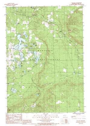
Peacock Sw Topo Map Michigan
To zoom in, hover over the map of Peacock Sw
USGS Topo Quad 44085a8 - 1:24,000 scale
| Topo Map Name: | Peacock Sw |
| USGS Topo Quad ID: | 44085a8 |
| Print Size: | ca. 21 1/4" wide x 27" high |
| Southeast Coordinates: | 44° N latitude / 85.875° W longitude |
| Map Center Coordinates: | 44.0625° N latitude / 85.9375° W longitude |
| U.S. State: | MI |
| Filename: | o44085a8.jpg |
| Download Map JPG Image: | Peacock Sw topo map 1:24,000 scale |
| Map Type: | Topographic |
| Topo Series: | 7.5´ |
| Map Scale: | 1:24,000 |
| Source of Map Images: | United States Geological Survey (USGS) |
| Alternate Map Versions: |
Peacock MI 1987, updated 1988 Download PDF Buy paper map Peacock MI 2012 Download PDF Buy paper map Peacock MI 2014 Download PDF Buy paper map Peacock MI 2016 Download PDF Buy paper map |
| FStopo: | US Forest Service topo Peacock is available: Download FStopo PDF Download FStopo TIF |
1:24,000 Topo Quads surrounding Peacock Sw
> Back to 44085a1 at 1:100,000 scale
> Back to 44084a1 at 1:250,000 scale
> Back to U.S. Topo Maps home
Peacock Sw topo map: Gazetteer
Peacock Sw: Lakes
Alice Lake elevation 228m 748′Bass Lake elevation 232m 761′
Bluegill Lake elevation 232m 761′
Brand Lake elevation 228m 748′
Brasas Lake elevation 227m 744′
Bullhead Lake elevation 233m 764′
Heart Lake elevation 228m 748′
Little Bass Lake elevation 233m 764′
Loon Lake elevation 230m 754′
McCarthy Lake elevation 267m 875′
McFall Lake elevation 228m 748′
Quick Lakes elevation 240m 787′
Sauble Lakes elevation 230m 754′
Sawmill Lake elevation 239m 784′
Seaman Lake elevation 228m 748′
Sunshine Lake elevation 233m 764′
Twin Lakes elevation 224m 734′
Wile Lake elevation 237m 777′
Zoba Lake elevation 230m 754′
Peacock Sw: Populated Places
Little Manistee elevation 253m 830′Peacock elevation 264m 866′
Sauble elevation 224m 734′
Peacock Sw: Post Offices
Peacock Post Office (historical) elevation 264m 866′Sauble Post Office (historical) elevation 224m 734′
Peacock Sw: Streams
McCarthy Creek elevation 227m 744′Peacock Sw: Swamps
Beaver Pond elevation 259m 849′Peacock Sw digital topo map on disk
Buy this Peacock Sw topo map showing relief, roads, GPS coordinates and other geographical features, as a high-resolution digital map file on DVD:


