Mcbain Topo Map Michigan
To zoom in, hover over the map of Mcbain
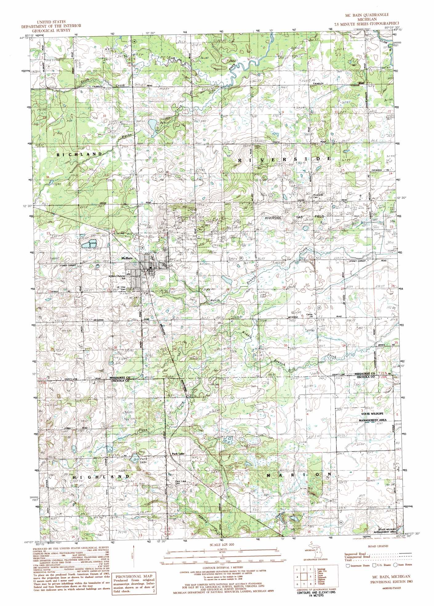
USGS Topo Quad 44085b2 - 1:25,000 scale
| Topo Map Name: | Mcbain |
| USGS Topo Quad ID: | 44085b2 |
| Print Size: | ca. 21 1/4" wide x 27" high |
| Southeast Coordinates: | 44.125° N latitude / 85.125° W longitude |
| Map Center Coordinates: | 44.1875° N latitude / 85.1875° W longitude |
| U.S. State: | MI |
| Filename: | l44085b2.jpg |
| Download Map JPG Image: | Mcbain topo map 1:25,000 scale |
| Map Type: | Topographic |
| Topo Series: | 7.5´ |
| Map Scale: | 1:25,000 |
| Source of Map Images: | United States Geological Survey (USGS) |
| Alternate Map Versions: |
McBain MI 1983, updated 1984 Download PDF Buy paper map |
1:24,000 Topo Quads surrounding Mcbain
Manton |
Arlene |
Morey |
Stittsville |
Addis Creek |
Cadillac North |
Jennings |
Lake City |
Dinca |
Merritt |
Cadillac South |
Lucas |
Mcbain |
Falmouth |
Moddersville |
Le Roy |
Dighton |
Marion |
Temple |
Prestle Creek |
Slaybaugh Corner |
Evart |
Sears |
Lake Ne |
Lake George |
> Back to 44085a1 at 1:100,000 scale
> Back to 44084a1 at 1:250,000 scale
> Back to U.S. Topo Maps home
Mcbain topo map: Gazetteer
Mcbain: Lakes
Park Lake elevation 375m 1230′Mcbain: Oilfields
Riverside Gas Field elevation 367m 1204′Mcbain: Parks
Fairdale Park elevation 384m 1259′Mcbain: Populated Places
McBain elevation 377m 1236′Park Lake elevation 375m 1230′
Pine Court Mobile Home Park elevation 372m 1220′
Mcbain: Post Offices
McBain Post Office elevation 378m 1240′Parklake Post Office (historical) elevation 375m 1230′
Mcbain: Streams
Marks Creek elevation 358m 1174′Ryan Creek elevation 356m 1167′
Stick Creek elevation 361m 1184′
Mcbain digital topo map on disk
Buy this Mcbain topo map showing relief, roads, GPS coordinates and other geographical features, as a high-resolution digital map file on DVD: