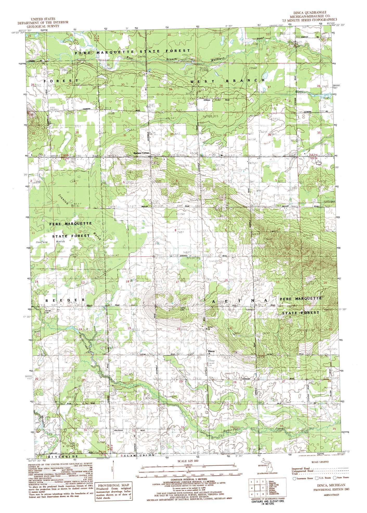
Dinca Topo Map Michigan
To zoom in, hover over the map of Dinca
USGS Topo Quad 44085c1 - 1:25,000 scale
| Topo Map Name: | Dinca |
| USGS Topo Quad ID: | 44085c1 |
| Print Size: | ca. 21 1/4" wide x 27" high |
| Southeast Coordinates: | 44.25° N latitude / 85° W longitude |
| Map Center Coordinates: | 44.3125° N latitude / 85.0625° W longitude |
| U.S. State: | MI |
| Filename: | l44085c1.jpg |
| Download Map JPG Image: | Dinca topo map 1:25,000 scale |
| Map Type: | Topographic |
| Topo Series: | 7.5´ |
| Map Scale: | 1:25,000 |
| Source of Map Images: | United States Geological Survey (USGS) |
| Alternate Map Versions: |
Dinca MI 1983, updated 1984 Download PDF Buy paper map |
1:24,000 Topo Quads surrounding Dinca
Fife Lake |
Smithville |
Sharon |
Fletcher |
Cote Dame Marie |
Arlene |
Morey |
Stittsville |
Addis Creek |
Meads Landing |
Jennings |
Lake City |
Dinca |
Merritt |
Houghton Lake |
Lucas |
Mcbain |
Falmouth |
Moddersville |
Cooperton |
Dighton |
Marion |
Temple |
Prestle Creek |
Harrison |
> Back to 44085a1 at 1:100,000 scale
> Back to 44084a1 at 1:250,000 scale
> Back to U.S. Topo Maps home
Dinca topo map: Gazetteer
Dinca: Oilfields
Butterfield Oil Field elevation 354m 1161′Dinca: Populated Places
Dinca elevation 365m 1197′Keelans Corner elevation 379m 1243′
Dinca: Post Offices
Barger Post Office (historical) elevation 359m 1177′Dinca Post Office (historical) elevation 365m 1197′
Missaukee Post Office (historical) elevation 365m 1197′
Mynnings Post Office (historical) elevation 374m 1227′
Dinca: Swamps
Seafuse Marsh elevation 366m 1200′Seanlan Marsh elevation 365m 1197′
Dinca digital topo map on disk
Buy this Dinca topo map showing relief, roads, GPS coordinates and other geographical features, as a high-resolution digital map file on DVD: