Lake City Topo Map Michigan
To zoom in, hover over the map of Lake City
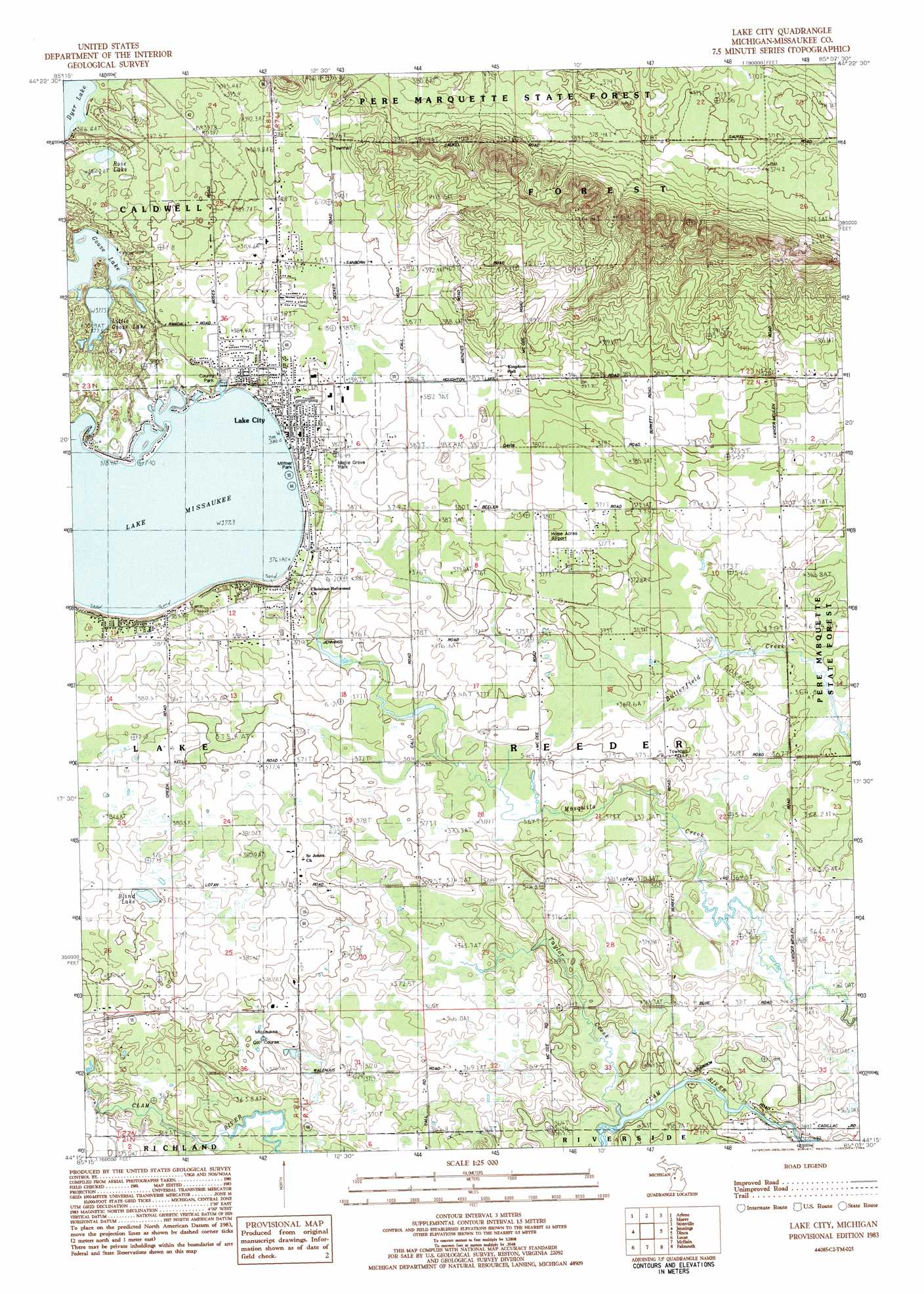
USGS Topo Quad 44085c2 - 1:25,000 scale
| Topo Map Name: | Lake City |
| USGS Topo Quad ID: | 44085c2 |
| Print Size: | ca. 21 1/4" wide x 27" high |
| Southeast Coordinates: | 44.25° N latitude / 85.125° W longitude |
| Map Center Coordinates: | 44.3125° N latitude / 85.1875° W longitude |
| U.S. State: | MI |
| Filename: | l44085c2.jpg |
| Download Map JPG Image: | Lake City topo map 1:25,000 scale |
| Map Type: | Topographic |
| Topo Series: | 7.5´ |
| Map Scale: | 1:25,000 |
| Source of Map Images: | United States Geological Survey (USGS) |
| Alternate Map Versions: |
Lake City MI 1983, updated 1984 Download PDF Buy paper map |
1:24,000 Topo Quads surrounding Lake City
Walton |
Fife Lake |
Smithville |
Sharon |
Fletcher |
Manton |
Arlene |
Morey |
Stittsville |
Addis Creek |
Cadillac North |
Jennings |
Lake City |
Dinca |
Merritt |
Cadillac South |
Lucas |
Mcbain |
Falmouth |
Moddersville |
Le Roy |
Dighton |
Marion |
Temple |
Prestle Creek |
> Back to 44085a1 at 1:100,000 scale
> Back to 44084a1 at 1:250,000 scale
> Back to U.S. Topo Maps home
Lake City topo map: Gazetteer
Lake City: Airports
Home Acres Sky Ranch elevation 378m 1240′Lake City: Lakes
Blind Lake elevation 375m 1230′Goose Lake elevation 378m 1240′
Lake Missaukee elevation 377m 1236′
Little Goose Lake elevation 378m 1240′
Rose Lake elevation 395m 1295′
Lake City: Parks
Lake City Park elevation 379m 1243′Maple Grove Park elevation 379m 1243′
Miltner Park elevation 381m 1250′
Missaukee County Park elevation 384m 1259′
Lake City: Populated Places
Lake City elevation 381m 1250′Lake City: Post Offices
Frey Post Office (historical) elevation 371m 1217′Lake City Post Office elevation 381m 1250′
Lake City: Streams
Taylor Creek elevation 357m 1171′Lake City digital topo map on disk
Buy this Lake City topo map showing relief, roads, GPS coordinates and other geographical features, as a high-resolution digital map file on DVD: