Cadillac North Topo Map Michigan
To zoom in, hover over the map of Cadillac North
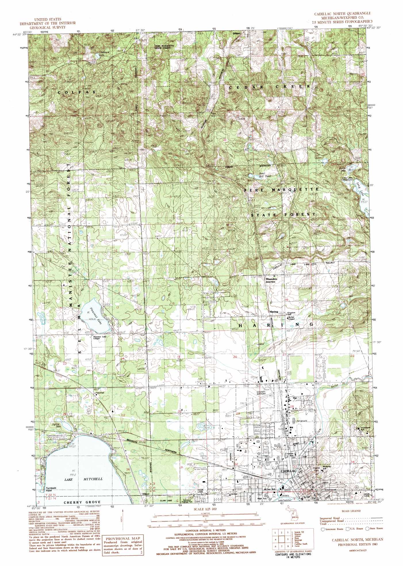
USGS Topo Quad 44085c4 - 1:25,000 scale
| Topo Map Name: | Cadillac North |
| USGS Topo Quad ID: | 44085c4 |
| Print Size: | ca. 21 1/4" wide x 27" high |
| Southeast Coordinates: | 44.25° N latitude / 85.375° W longitude |
| Map Center Coordinates: | 44.3125° N latitude / 85.4375° W longitude |
| U.S. State: | MI |
| Filename: | l44085c4.jpg |
| Download Map JPG Image: | Cadillac North topo map 1:25,000 scale |
| Map Type: | Topographic |
| Topo Series: | 7.5´ |
| Map Scale: | 1:25,000 |
| Source of Map Images: | United States Geological Survey (USGS) |
| Alternate Map Versions: | |
| FStopo: | US Forest Service topo Cadillac North is available: Download FStopo PDF Download FStopo TIF |
1:24,000 Topo Quads surrounding Cadillac North
Buckley |
Kingsley |
Walton |
Fife Lake |
Smithville |
Mesick |
Mesick Ne |
Manton |
Arlene |
Morey |
Harrieta |
Boon |
Cadillac North |
Jennings |
Lake City |
Luther Nw |
Luther Ne |
Cadillac South |
Lucas |
Mcbain |
Luther Sw |
Luther Se |
Le Roy |
Dighton |
Marion |
> Back to 44085a1 at 1:100,000 scale
> Back to 44084a1 at 1:250,000 scale
> Back to U.S. Topo Maps home
Cadillac North topo map: Gazetteer
Cadillac North: Airports
Wexford County Airport elevation 396m 1299′Cadillac North: Capes
Turnbolm Point elevation 393m 1289′Cadillac North: Lakes
Bond Mill Pond elevation 422m 1384′Gyttja Lake elevation 392m 1286′
North Lake elevation 380m 1246′
Pleasant Lake elevation 404m 1325′
Stoddard Lake elevation 363m 1190′
Cadillac North: Parks
Cadillac Carnegie Library Historical Marker elevation 403m 1322′Charles T Mitchell House Historical Marker elevation 408m 1338′
Diggins Park elevation 425m 1394′
Cadillac North: Populated Places
Cadillac elevation 398m 1305′Cadillac Leisure Mobile Home Community elevation 394m 1292′
Haring elevation 404m 1325′
Missaukee Junction elevation 408m 1338′
Cadillac North: Post Offices
Ballou Post Office (historical) elevation 421m 1381′Bond's Mills Post Office (historical) elevation 411m 1348′
Cadillac Post Office elevation 400m 1312′
Haring Post Office (historical) elevation 404m 1325′
Cadillac North digital topo map on disk
Buy this Cadillac North topo map showing relief, roads, GPS coordinates and other geographical features, as a high-resolution digital map file on DVD: