Boon Topo Map Michigan
To zoom in, hover over the map of Boon
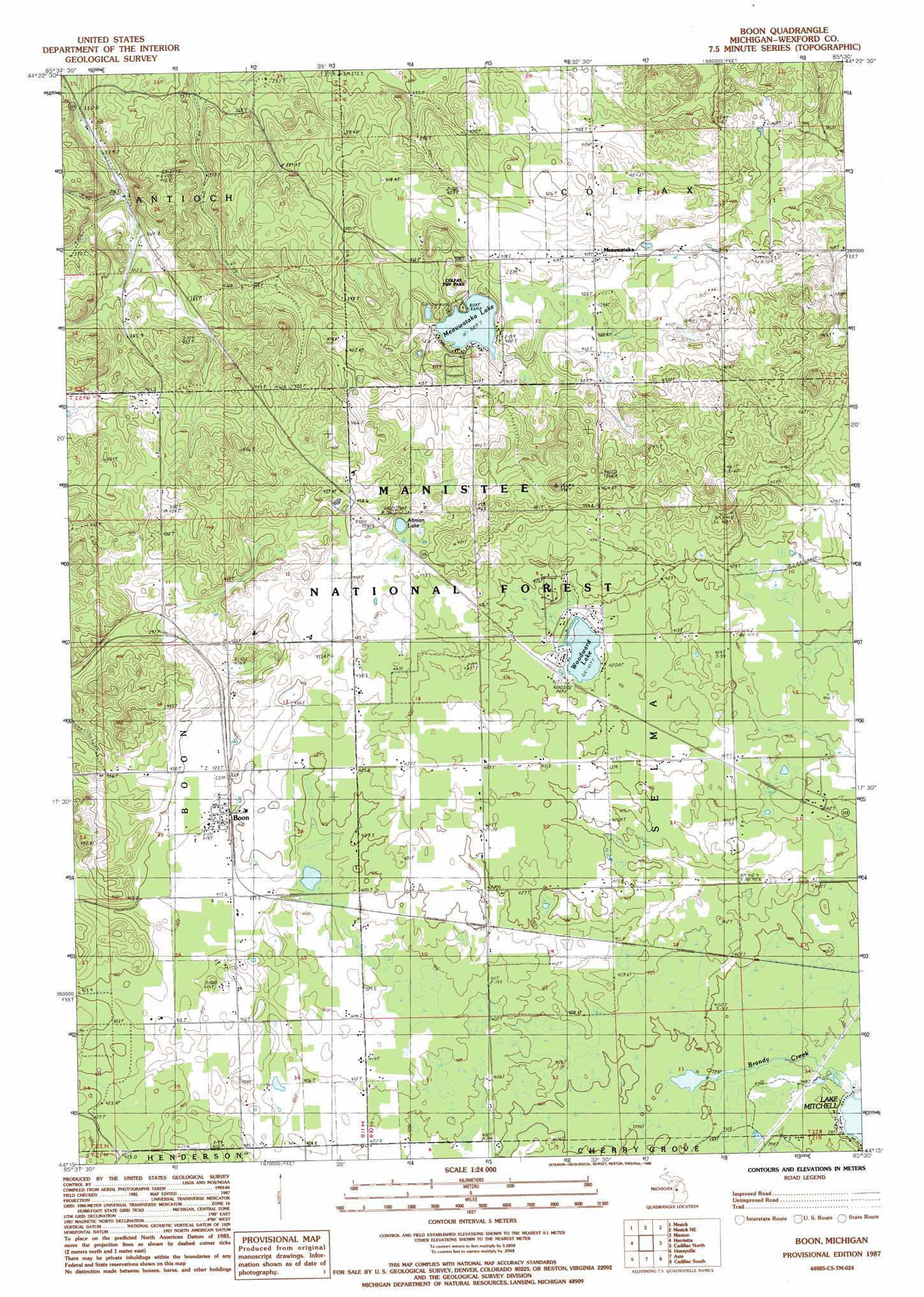
USGS Topo Quad 44085c5 - 1:24,000 scale
| Topo Map Name: | Boon |
| USGS Topo Quad ID: | 44085c5 |
| Print Size: | ca. 21 1/4" wide x 27" high |
| Southeast Coordinates: | 44.25° N latitude / 85.5° W longitude |
| Map Center Coordinates: | 44.3125° N latitude / 85.5625° W longitude |
| U.S. State: | MI |
| Filename: | o44085c5.jpg |
| Download Map JPG Image: | Boon topo map 1:24,000 scale |
| Map Type: | Topographic |
| Topo Series: | 7.5´ |
| Map Scale: | 1:24,000 |
| Source of Map Images: | United States Geological Survey (USGS) |
| Alternate Map Versions: |
Boon MI 1987, updated 1988 Download PDF Buy paper map Boon MI 2012 Download PDF Buy paper map Boon MI 2014 Download PDF Buy paper map Boon MI 2016 Download PDF Buy paper map |
| FStopo: | US Forest Service topo Boon is available: Download FStopo PDF Download FStopo TIF |
1:24,000 Topo Quads surrounding Boon
Karlin |
Buckley |
Kingsley |
Walton |
Fife Lake |
Harlan |
Mesick |
Mesick Ne |
Manton |
Arlene |
Yuma |
Harrieta |
Boon |
Cadillac North |
Jennings |
Peacock Ne |
Luther Nw |
Luther Ne |
Cadillac South |
Lucas |
Peacock Se |
Luther Sw |
Luther Se |
Le Roy |
Dighton |
> Back to 44085a1 at 1:100,000 scale
> Back to 44084a1 at 1:250,000 scale
> Back to U.S. Topo Maps home
Boon topo map: Gazetteer
Boon: Lakes
Altman Lake elevation 439m 1440′Meauwataka Lake elevation 389m 1276′
Woodward Lake elevation 417m 1368′
Boon: Parks
Brandy Brook Waterfowl Area elevation 400m 1312′Clofax Township Park elevation 389m 1276′
Boon: Populated Places
Boon elevation 420m 1377′Meauwataka elevation 416m 1364′
Millersville elevation 425m 1394′
Boon: Post Offices
Boon Post Office elevation 422m 1384′Bunyea Post Office (historical) elevation 414m 1358′
Meauwataka Post Office (historical) elevation 416m 1364′
Millersville Post Office (historical) elevation 425m 1394′
Boon: Streams
Brandy Creek elevation 396m 1299′Boon digital topo map on disk
Buy this Boon topo map showing relief, roads, GPS coordinates and other geographical features, as a high-resolution digital map file on DVD: