Morey Topo Map Michigan
To zoom in, hover over the map of Morey
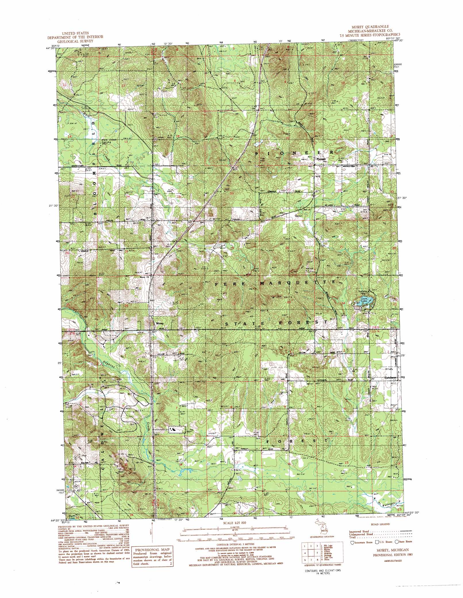
USGS Topo Quad 44085d2 - 1:25,000 scale
| Topo Map Name: | Morey |
| USGS Topo Quad ID: | 44085d2 |
| Print Size: | ca. 21 1/4" wide x 27" high |
| Southeast Coordinates: | 44.375° N latitude / 85.125° W longitude |
| Map Center Coordinates: | 44.4375° N latitude / 85.1875° W longitude |
| U.S. State: | MI |
| Filename: | l44085d2.jpg |
| Download Map JPG Image: | Morey topo map 1:25,000 scale |
| Map Type: | Topographic |
| Topo Series: | 7.5´ |
| Map Scale: | 1:25,000 |
| Source of Map Images: | United States Geological Survey (USGS) |
| Alternate Map Versions: |
Morey MI 1983, updated 1984 Download PDF Buy paper map |
1:24,000 Topo Quads surrounding Morey
Jacks Landing |
South Boardman |
Kalkaska |
Sigma |
Black Creek |
Walton |
Fife Lake |
Smithville |
Sharon |
Fletcher |
Manton |
Arlene |
Morey |
Stittsville |
Addis Creek |
Cadillac North |
Jennings |
Lake City |
Dinca |
Merritt |
Cadillac South |
Lucas |
Mcbain |
Falmouth |
Moddersville |
> Back to 44085a1 at 1:100,000 scale
> Back to 44084a1 at 1:250,000 scale
> Back to U.S. Topo Maps home
Morey topo map: Gazetteer
Morey: Lakes
Loon Lake elevation 398m 1305′Morey: Parks
Pioneer Township Park elevation 408m 1338′Morey: Populated Places
Cutcheon elevation 396m 1299′Morey elevation 370m 1213′
Pioneer elevation 405m 1328′
Morey: Post Offices
Cutcheon Post Office (historical) elevation 396m 1299′Morey Post Office (historical) elevation 371m 1217′
Pioneer Post Office (historical) elevation 405m 1328′
Morey: Springs
Ham Creek Spring elevation 324m 1062′Morey digital topo map on disk
Buy this Morey topo map showing relief, roads, GPS coordinates and other geographical features, as a high-resolution digital map file on DVD: