Copemish Topo Map Michigan
To zoom in, hover over the map of Copemish
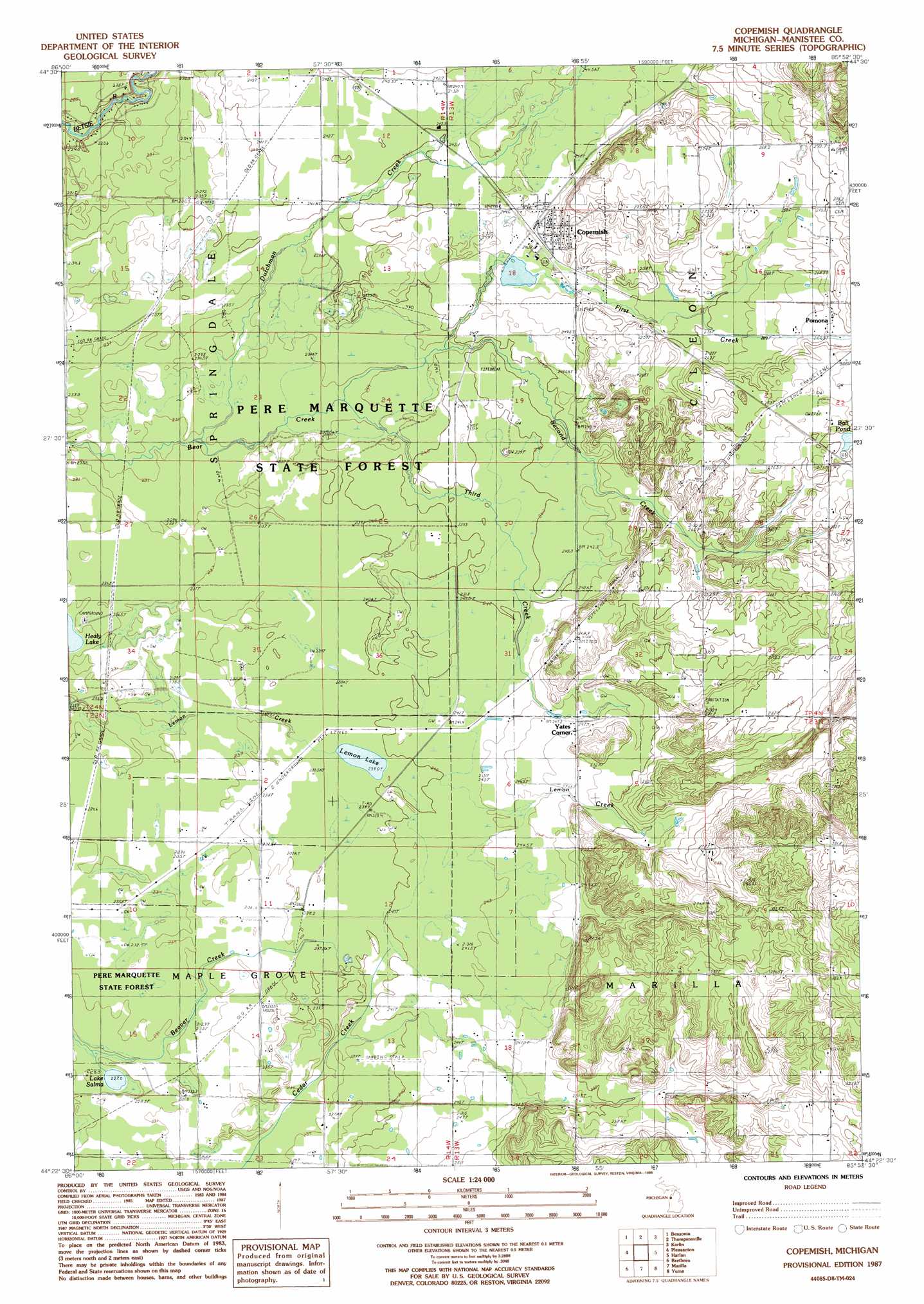
USGS Topo Quad 44085d8 - 1:24,000 scale
| Topo Map Name: | Copemish |
| USGS Topo Quad ID: | 44085d8 |
| Print Size: | ca. 21 1/4" wide x 27" high |
| Southeast Coordinates: | 44.375° N latitude / 85.875° W longitude |
| Map Center Coordinates: | 44.4375° N latitude / 85.9375° W longitude |
| U.S. State: | MI |
| Filename: | o44085d8.jpg |
| Download Map JPG Image: | Copemish topo map 1:24,000 scale |
| Map Type: | Topographic |
| Topo Series: | 7.5´ |
| Map Scale: | 1:24,000 |
| Source of Map Images: | United States Geological Survey (USGS) |
| Alternate Map Versions: |
Copemish MI 1987, updated 1988 Download PDF Buy paper map Copemish MI 2011 Download PDF Buy paper map Copemish MI 2014 Download PDF Buy paper map Copemish MI 2016 Download PDF Buy paper map |
1:24,000 Topo Quads surrounding Copemish
Frankfort |
Beulah |
Platte River |
Lake Ann |
Grawn |
Elberta |
Benzonia |
Thompsonville |
Karlin |
Buckley |
Bear Lake |
Pleasanton |
Copemish |
Harlan |
Mesick |
Onekama |
Brethern |
Marilla |
Yuma |
Harrieta |
Freesoil Nw |
Freesoil Ne |
Peacock Nw |
Peacock Ne |
Luther Nw |
> Back to 44085a1 at 1:100,000 scale
> Back to 44084a1 at 1:250,000 scale
> Back to U.S. Topo Maps home
Copemish topo map: Gazetteer
Copemish: Airports
Horaks Airport elevation 240m 787′Copemish: Lakes
Ball Pond elevation 270m 885′Lake Salma elevation 228m 748′
Lemon Lake elevation 239m 784′
Copemish: Parks
Lewis Memorial Kids Park elevation 246m 807′Pearl Park elevation 250m 820′
Copemish: Populated Places
Copemish elevation 249m 816′Pomona elevation 265m 869′
Copemish: Post Offices
Copemish Post Office elevation 247m 810′Henry Post Office (historical) elevation 238m 780′
Lemon Lake Post Office (historical) elevation 241m 790′
Pomona Post Office (historical) elevation 265m 869′
Copemish: Streams
Dutchman Creek elevation 232m 761′First Creek elevation 237m 777′
Second Creek elevation 237m 777′
Third Creek elevation 233m 764′
Copemish digital topo map on disk
Buy this Copemish topo map showing relief, roads, GPS coordinates and other geographical features, as a high-resolution digital map file on DVD: