Fife Lake Topo Map Michigan
To zoom in, hover over the map of Fife Lake
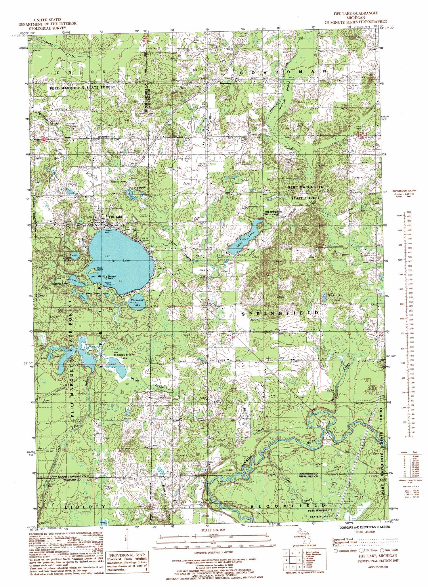
USGS Topo Quad 44085e3 - 1:24,000 scale
| Topo Map Name: | Fife Lake |
| USGS Topo Quad ID: | 44085e3 |
| Print Size: | ca. 21 1/4" wide x 27" high |
| Southeast Coordinates: | 44.5° N latitude / 85.25° W longitude |
| Map Center Coordinates: | 44.5625° N latitude / 85.3125° W longitude |
| U.S. State: | MI |
| Filename: | o44085e3.jpg |
| Download Map JPG Image: | Fife Lake topo map 1:24,000 scale |
| Map Type: | Topographic |
| Topo Series: | 7.5´ |
| Map Scale: | 1:24,000 |
| Source of Map Images: | United States Geological Survey (USGS) |
| Alternate Map Versions: |
Fife Lake MI 1985, updated 1986 Download PDF Buy paper map Fife Lake MI 2011 Download PDF Buy paper map Fife Lake MI 2014 Download PDF Buy paper map Fife Lake MI 2016 Download PDF Buy paper map |
1:24,000 Topo Quads surrounding Fife Lake
Traverse City Se |
Williamsburg |
Torch River |
Leetsville |
Westwood |
Mayfield |
Jacks Landing |
South Boardman |
Kalkaska |
Sigma |
Kingsley |
Walton |
Fife Lake |
Smithville |
Sharon |
Mesick Ne |
Manton |
Arlene |
Morey |
Stittsville |
Boon |
Cadillac North |
Jennings |
Lake City |
Dinca |
> Back to 44085e1 at 1:100,000 scale
> Back to 44084a1 at 1:250,000 scale
> Back to U.S. Topo Maps home
Fife Lake topo map: Gazetteer
Fife Lake: Islands
Florence Island elevation 312m 1023′Helen Island elevation 312m 1023′
Fife Lake: Lakes
Bloom Lake elevation 320m 1049′Fife Lake elevation 311m 1020′
Headquarters Lake elevation 307m 1007′
Holbrook Lake elevation 321m 1053′
Long Lake elevation 328m 1076′
Mirror Lake elevation 313m 1026′
Pickerel Lake elevation 312m 1023′
Spring Lake elevation 311m 1020′
Fife Lake: Parks
Fife Lake Area Park elevation 321m 1053′Fife Lake City Park elevation 312m 1023′
Fife Lake Union District Number One Schoolhouse Historical Marker elevation 308m 1010′
Fife Lake: Populated Places
Fife Lake elevation 323m 1059′Houseman elevation 333m 1092′
Fife Lake: Post Offices
Fife Lake Post Office elevation 316m 1036′Fife Lake: Streams
Bourne Creek elevation 293m 961′Gould Creek elevation 310m 1017′
Ham Creek elevation 294m 964′
Inlet Creek elevation 313m 1026′
Spring Creek elevation 295m 967′
Fife Lake: Swamps
Albright Swamp elevation 317m 1040′Fife Lake digital topo map on disk
Buy this Fife Lake topo map showing relief, roads, GPS coordinates and other geographical features, as a high-resolution digital map file on DVD: