Kalkaska Topo Map Michigan
To zoom in, hover over the map of Kalkaska
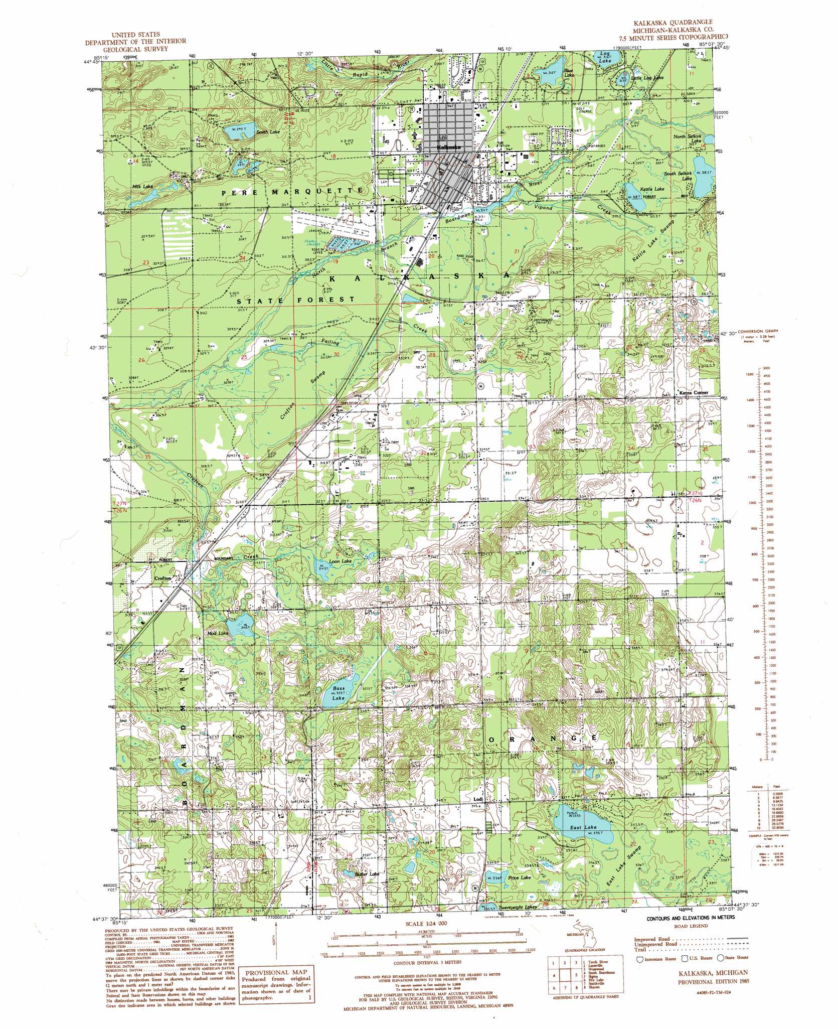
USGS Topo Quad 44085f2 - 1:24,000 scale
| Topo Map Name: | Kalkaska |
| USGS Topo Quad ID: | 44085f2 |
| Print Size: | ca. 21 1/4" wide x 27" high |
| Southeast Coordinates: | 44.625° N latitude / 85.125° W longitude |
| Map Center Coordinates: | 44.6875° N latitude / 85.1875° W longitude |
| U.S. State: | MI |
| Filename: | o44085f2.jpg |
| Download Map JPG Image: | Kalkaska topo map 1:24,000 scale |
| Map Type: | Topographic |
| Topo Series: | 7.5´ |
| Map Scale: | 1:24,000 |
| Source of Map Images: | United States Geological Survey (USGS) |
| Alternate Map Versions: |
Kalkaska MI 1985, updated 1986 Download PDF Buy paper map Kalkaska MI 1985, updated 1986 Download PDF Buy paper map Kalkaska MI 2011 Download PDF Buy paper map Kalkaska MI 2014 Download PDF Buy paper map Kalkaska MI 2016 Download PDF Buy paper map |
1:24,000 Topo Quads surrounding Kalkaska
Elk Rapids |
Alden |
Bellaire |
Mancelona |
Alba |
Williamsburg |
Torch River |
Leetsville |
Westwood |
Starvation Lake |
Jacks Landing |
South Boardman |
Kalkaska |
Sigma |
Black Creek |
Walton |
Fife Lake |
Smithville |
Sharon |
Fletcher |
Manton |
Arlene |
Morey |
Stittsville |
Addis Creek |
> Back to 44085e1 at 1:100,000 scale
> Back to 44084a1 at 1:250,000 scale
> Back to U.S. Topo Maps home
Kalkaska topo map: Gazetteer
Kalkaska: Airports
Kalkaska City Airport elevation 314m 1030′Kalkaska: Lakes
Bass Lake elevation 325m 1066′Blue Lake elevation 312m 1023′
Butler Lake elevation 332m 1089′
Camel Lake elevation 318m 1043′
East Lake elevation 335m 1099′
Kettle Lake elevation 318m 1043′
Little Log Lake elevation 318m 1043′
Log Lake elevation 316m 1036′
Loon Lake elevation 314m 1030′
Milk Lake elevation 295m 967′
Mud Lake elevation 314m 1030′
Price Lake elevation 338m 1108′
Smith Lake elevation 295m 967′
South Selkirk Lake elevation 318m 1043′
Kalkaska: Populated Places
Crofton elevation 317m 1040′Kalkaska elevation 315m 1033′
Lodi elevation 345m 1131′
Mobile Home Estates elevation 317m 1040′
Kalkaska: Post Offices
Crofton Post Office (historical) elevation 316m 1036′Kalkaska Post Office elevation 314m 1030′
Lodi Post Office (historical) elevation 345m 1131′
Kalkaska: Streams
Failing Creek elevation 306m 1003′Palmer Creek elevation 321m 1053′
Vipond Creek elevation 318m 1043′
Kalkaska: Swamps
Crofton Swamp elevation 311m 1020′East Lake Swamp elevation 336m 1102′
Kettle Lake Swamp elevation 323m 1059′
Kalkaska digital topo map on disk
Buy this Kalkaska topo map showing relief, roads, GPS coordinates and other geographical features, as a high-resolution digital map file on DVD: