Mancelona Topo Map Michigan
To zoom in, hover over the map of Mancelona
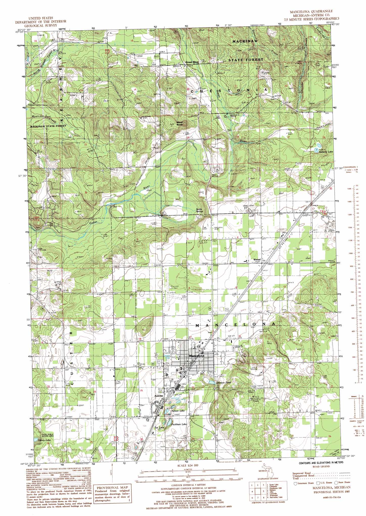
USGS Topo Quad 44085h1 - 1:24,000 scale
| Topo Map Name: | Mancelona |
| USGS Topo Quad ID: | 44085h1 |
| Print Size: | ca. 21 1/4" wide x 27" high |
| Southeast Coordinates: | 44.875° N latitude / 85° W longitude |
| Map Center Coordinates: | 44.9375° N latitude / 85.0625° W longitude |
| U.S. State: | MI |
| Filename: | o44085h1.jpg |
| Download Map JPG Image: | Mancelona topo map 1:24,000 scale |
| Map Type: | Topographic |
| Topo Series: | 7.5´ |
| Map Scale: | 1:24,000 |
| Source of Map Images: | United States Geological Survey (USGS) |
| Alternate Map Versions: |
Mancelona NE MI 1975, updated 1976 Download PDF Buy paper map Mancelona MI 1985, updated 1986 Download PDF Buy paper map Mancelona MI 1985, updated 1986 Download PDF Buy paper map Mancelona MI 2011 Download PDF Buy paper map Mancelona MI 2014 Download PDF Buy paper map Mancelona MI 2016 Download PDF Buy paper map |
1:24,000 Topo Quads surrounding Mancelona
Atwood |
Ellsworth |
Boyne City |
Boyne Falls |
Thumb Lake |
Central Lake |
Scotts Lake |
Chestonia |
Deadmans Hill |
Elmira |
Alden |
Bellaire |
Mancelona |
Alba |
Lake Arrowhead |
Torch River |
Leetsville |
Westwood |
Starvation Lake |
Frederic |
South Boardman |
Kalkaska |
Sigma |
Black Creek |
Lake Margrethe |
> Back to 44085e1 at 1:100,000 scale
> Back to 44084a1 at 1:250,000 scale
> Back to U.S. Topo Maps home
Mancelona topo map: Gazetteer
Mancelona: Airports
Mancelona Municipal Airport elevation 345m 1131′Mancelona: Lakes
Johnson Pond elevation 327m 1072′Nelson Lake elevation 321m 1053′
Peckham Lake elevation 321m 1053′
Satterly Lake elevation 323m 1059′
Tar Lake elevation 332m 1089′
Mancelona: Parks
Palmer Park elevation 342m 1122′Railroad Park elevation 343m 1125′
Triangle Park elevation 343m 1125′
Village of Wetzell Historical Marker elevation 346m 1135′
Mancelona: Populated Places
Antrim elevation 340m 1115′Green River elevation 247m 810′
Mancelona elevation 343m 1125′
Wetzel elevation 346m 1135′
Mancelona: Post Offices
Greenriver Post Office (historical) elevation 247m 810′Mancelona Post Office elevation 343m 1125′
Wetzell Post Office (historical) elevation 346m 1135′
Mancelona: Springs
Scotts Spring elevation 282m 925′Mancelona: Summits
Mount Bundy elevation 347m 1138′Mancelona digital topo map on disk
Buy this Mancelona topo map showing relief, roads, GPS coordinates and other geographical features, as a high-resolution digital map file on DVD: