Hamlin Lake Topo Map Michigan
To zoom in, hover over the map of Hamlin Lake
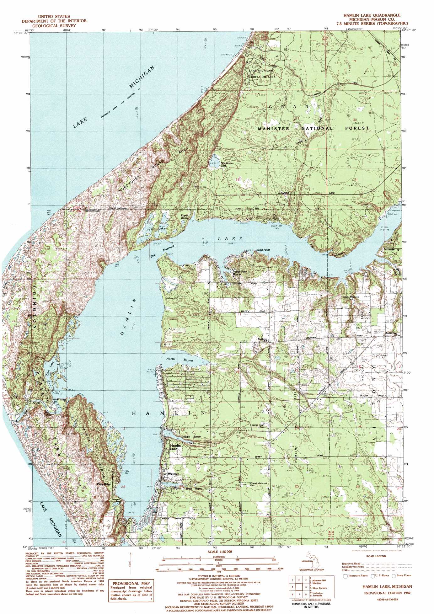
USGS Topo Quad 44086a4 - 1:25,000 scale
| Topo Map Name: | Hamlin Lake |
| USGS Topo Quad ID: | 44086a4 |
| Print Size: | ca. 21 1/4" wide x 27" high |
| Southeast Coordinates: | 44° N latitude / 86.375° W longitude |
| Map Center Coordinates: | 44.0625° N latitude / 86.4375° W longitude |
| U.S. State: | MI |
| Filename: | l44086a4.jpg |
| Download Map JPG Image: | Hamlin Lake topo map 1:25,000 scale |
| Map Type: | Topographic |
| Topo Series: | 7.5´ |
| Map Scale: | 1:25,000 |
| Source of Map Images: | United States Geological Survey (USGS) |
| Alternate Map Versions: |
Hamlin Lake MI 1982, updated 1983 Download PDF Buy paper map |
| FStopo: | US Forest Service topo Hamlin Lake is available: Download FStopo PDF Download FStopo TIF |
1:24,000 Topo Quads surrounding Hamlin Lake
Parkdale |
Onekama |
|||
Manistee Nw |
Manistee Ne |
Freesoil Nw |
||
Hamlin Lake |
Kings Corners |
Freesoil Sw |
||
Ludington Nw |
Ludington Ne |
Custer Nw |
||
Pentwater |
Wiley |
Custer Sw |
> Back to 44086a1 at 1:100,000 scale
> Back to 44086a1 at 1:250,000 scale
> Back to U.S. Topo Maps home
Hamlin Lake topo map: Gazetteer
Hamlin Lake: Bays
Indian Pete Bayou elevation 181m 593′North Bayou elevation 181m 593′
Hamlin Lake: Capes
Bugg Point elevation 184m 603′Hamlin Lake: Channels
The Narrows elevation 181m 593′Hamlin Lake: Dams
Hamlin Dam elevation 181m 593′Hamlin Lake: Lakes
Hamlin Lake elevation 181m 593′Lost Lake elevation 181m 593′
Middle Bayou elevation 185m 606′
Nordhouse Lake elevation 192m 629′
South Bayou elevation 182m 597′
Hamlin Lake: Parks
Lake Michigan Recreation Area elevation 195m 639′Ludington State Park elevation 191m 626′
Powell Memorial Park elevation 197m 646′
South Bayou Park elevation 183m 600′
Victory Memorial Park elevation 191m 626′
Wilson Township Wilson Hill Park elevation 189m 620′
Hamlin Lake: Populated Places
Hamlin Lake elevation 193m 633′Piney Ridge elevation 186m 610′
Tamarac Village Mobile Home Park elevation 187m 613′
Weimer elevation 190m 623′
Hamlin Lake: Post Offices
Weimer Post Office (historical) elevation 190m 623′Hamlin Lake: Ridges
Piney Ridge elevation 188m 616′Hamlin Lake: Streams
Dennis Creek elevation 181m 593′Porter Creek elevation 177m 580′
Hamlin Lake: Swamps
Lost Lakes elevation 184m 603′Rupert Bayou elevation 186m 610′
Hamlin Lake digital topo map on disk
Buy this Hamlin Lake topo map showing relief, roads, GPS coordinates and other geographical features, as a high-resolution digital map file on DVD: