Frankfort Topo Map Michigan
To zoom in, hover over the map of Frankfort
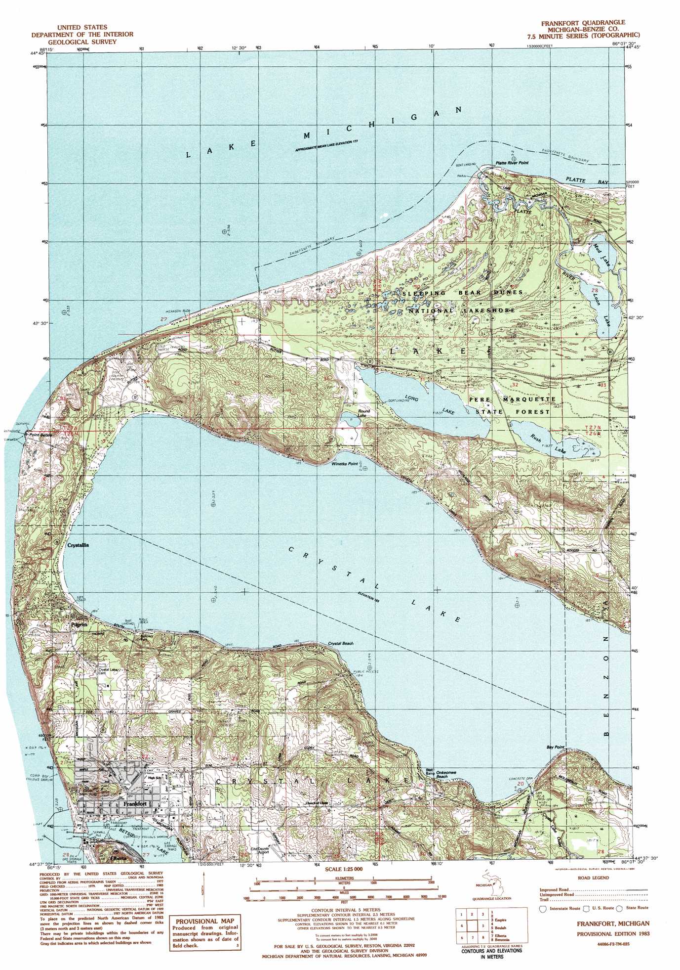
USGS Topo Quad 44086f2 - 1:25,000 scale
| Topo Map Name: | Frankfort |
| USGS Topo Quad ID: | 44086f2 |
| Print Size: | ca. 21 1/4" wide x 27" high |
| Southeast Coordinates: | 44.625° N latitude / 86.125° W longitude |
| Map Center Coordinates: | 44.6875° N latitude / 86.1875° W longitude |
| U.S. State: | MI |
| Filename: | l44086f2.jpg |
| Download Map JPG Image: | Frankfort topo map 1:25,000 scale |
| Map Type: | Topographic |
| Topo Series: | 7.5´ |
| Map Scale: | 1:25,000 |
| Source of Map Images: | United States Geological Survey (USGS) |
| Alternate Map Versions: |
1:24,000 Topo Quads surrounding Frankfort
Glen Haven |
Glen Arbor |
|||
Empire |
Burdickville |
|||
Frankfort |
Beulah |
Platte River |
||
Elberta |
Benzonia |
Thompsonville |
||
Bear Lake |
Pleasanton |
Copemish |
> Back to 44086e1 at 1:100,000 scale
> Back to 44086a1 at 1:250,000 scale
> Back to U.S. Topo Maps home
Frankfort topo map: Gazetteer
Frankfort: Airports
Frankfort City-Benzie County Airport elevation 189m 620′Frankfort: Bays
Hurdmans Bay elevation 183m 600′Outlet Bay elevation 183m 600′
Frankfort: Beaches
Crystal Beach elevation 184m 603′Elberta Beach elevation 177m 580′
Onkeonwe Beach elevation 185m 606′
Frankfort: Capes
Bay Point elevation 186m 610′Platte River Point elevation 179m 587′
Railroad Point elevation 183m 600′
Winetka Point elevation 197m 646′
Frankfort: Dams
Crystal Lake Outlet Dam elevation 184m 603′Frankfort: Harbors
Frankfort Harbor elevation 177m 580′Frankfort: Lakes
Betsie Lake elevation 177m 580′Crystal Lake elevation 183m 600′
Long Lake elevation 181m 593′
Loon Lake elevation 177m 580′
Mud Lake elevation 177m 580′
Round Lake elevation 181m 593′
Rush Lake elevation 181m 593′
Frankfort: Parks
Bellows Park elevation 192m 629′Marquette's Death Historical Marker elevation 180m 590′
Railroad Point Natural Area elevation 204m 669′
Waterfront Park elevation 177m 580′
Frankfort: Populated Places
Chimney Corners Resort elevation 183m 600′Crystallia elevation 185m 606′
Frankfort elevation 182m 597′
Frankfort Trailer Park elevation 263m 862′
Oberlin (historical) elevation 185m 606′
Pilgrim elevation 188m 616′
Frankfort: Post Offices
Frankfort Post Office elevation 182m 597′Pilgrim Post Office (historical) elevation 188m 616′
Frankfort: Streams
Betsie River elevation 177m 580′Burrows Creek elevation 185m 606′
Crystal Lake Outlet elevation 179m 587′
Platte River elevation 179m 587′
Round Lake Creek elevation 183m 600′
Thomas Road Creek elevation 185m 606′
Frankfort: Summits
Elberta Bluffs elevation 214m 702′Tank Hill elevation 237m 777′
Frankfort digital topo map on disk
Buy this Frankfort topo map showing relief, roads, GPS coordinates and other geographical features, as a high-resolution digital map file on DVD: