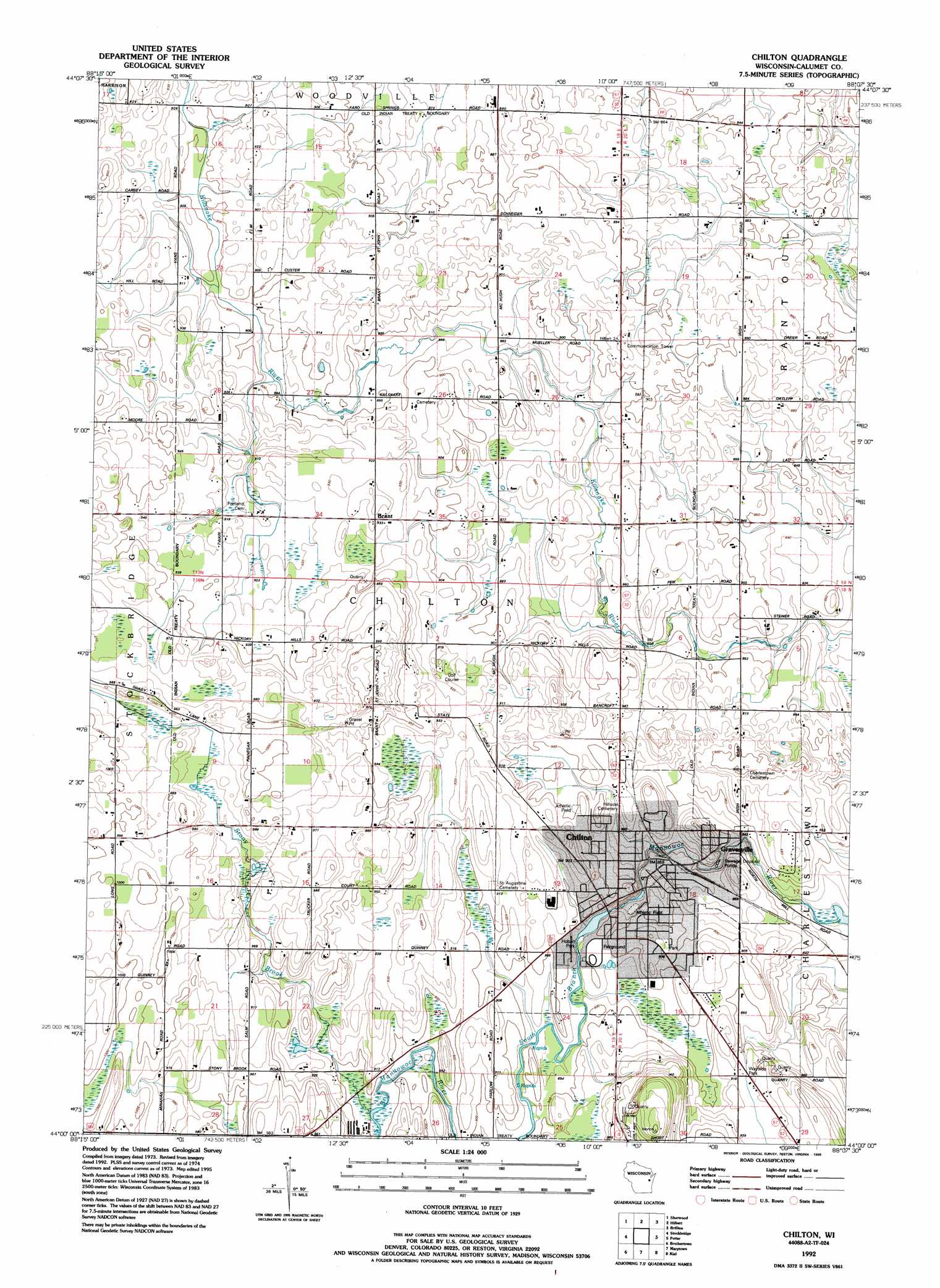
Chilton Topo Map Wisconsin
To zoom in, hover over the map of Chilton
USGS Topo Quad 44088a2 - 1:24,000 scale
| Topo Map Name: | Chilton |
| USGS Topo Quad ID: | 44088a2 |
| Print Size: | ca. 21 1/4" wide x 27" high |
| Southeast Coordinates: | 44° N latitude / 88.125° W longitude |
| Map Center Coordinates: | 44.0625° N latitude / 88.1875° W longitude |
| U.S. State: | WI |
| Filename: | o44088a2.jpg |
| Download Map JPG Image: | Chilton topo map 1:24,000 scale |
| Map Type: | Topographic |
| Topo Series: | 7.5´ |
| Map Scale: | 1:24,000 |
| Source of Map Images: | United States Geological Survey (USGS) |
| Alternate Map Versions: |
Chilton WI 1974, updated 1977 Download PDF Buy paper map Chilton WI 1992, updated 1996 Download PDF Buy paper map Chilton WI 2010 Download PDF Buy paper map Chilton WI 2013 Download PDF Buy paper map Chilton WI 2016 Download PDF Buy paper map |
1:24,000 Topo Quads surrounding Chilton
Appleton |
Kaukauna |
Wrightstown |
Greenleaf |
Morrison |
Neenah |
Sherwood |
Hilbert |
Brillion |
Reedsville |
Indian Point |
Stockbridge |
Chilton |
Potter |
Valders |
Fahrney Point |
Brothertown |
Marytown |
Kiel |
School Hill |
Fond Du Lac |
Saint Peter |
Saint Cloud |
Elkhart Lake |
Franklin |
> Back to 44088a1 at 1:100,000 scale
> Back to 44088a1 at 1:250,000 scale
> Back to U.S. Topo Maps home
Chilton topo map: Gazetteer
Chilton: Dams
Chilton WP129 Dam elevation 275m 902′Chilton: Parks
Hobart Park elevation 271m 889′Klinkner Memorial Park elevation 277m 908′
Leahy Lakeshore Park elevation 268m 879′
Riverside Park elevation 265m 869′
Chilton: Populated Places
Brant elevation 285m 935′Chilton elevation 275m 902′
Gravesville elevation 261m 856′
Chilton: Post Offices
Chilton Post Office elevation 274m 898′Chilton: Reservoirs
Chilton Millpond 75 elevation 275m 902′Chilton: Streams
Stony Brook elevation 273m 895′Chilton digital topo map on disk
Buy this Chilton topo map showing relief, roads, GPS coordinates and other geographical features, as a high-resolution digital map file on DVD: