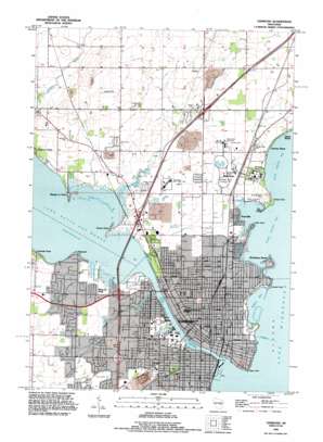
Oshkosh Topo Map Wisconsin
To zoom in, hover over the map of Oshkosh
USGS Topo Quad 44088a5 - 1:24,000 scale
| Topo Map Name: | Oshkosh |
| USGS Topo Quad ID: | 44088a5 |
| Print Size: | ca. 21 1/4" wide x 27" high |
| Southeast Coordinates: | 44° N latitude / 88.5° W longitude |
| Map Center Coordinates: | 44.0625° N latitude / 88.5625° W longitude |
| U.S. State: | WI |
| Filename: | o44088a5.jpg |
| Download Map JPG Image: | Oshkosh topo map 1:24,000 scale |
| Map Type: | Topographic |
| Topo Series: | 7.5´ |
| Map Scale: | 1:24,000 |
| Source of Map Images: | United States Geological Survey (USGS) |
| Alternate Map Versions: |
Oshkosh WI 1961, updated 1962 Download PDF Buy paper map Oshkosh WI 1961, updated 1977 Download PDF Buy paper map Oshkosh WI 1992, updated 1996 Download PDF Buy paper map Oshkosh WI 2010 Download PDF Buy paper map Oshkosh WI 2013 Download PDF Buy paper map Oshkosh WI 2016 Download PDF Buy paper map |
1:24,000 Topo Quads surrounding Oshkosh
> Back to 44088a1 at 1:100,000 scale
> Back to 44088a1 at 1:250,000 scale
> Back to U.S. Topo Maps home
Oshkosh topo map: Gazetteer
Oshkosh: Airports
Earls Air Park elevation 235m 770′Gallinger Airport elevation 237m 777′
Mercy Medical Center Heliport elevation 230m 754′
Oshkosh: Bars
Horseshoe Reef elevation 228m 748′Oshkosh Reefs elevation 228m 748′
Oshkosh: Bays
Millers Bay elevation 228m 748′North Asylum Bay elevation 228m 748′
South Asylum Bay elevation 228m 748′
Oshkosh: Capes
Asylum Point elevation 229m 751′Brays Point elevation 229m 751′
Doemel Point elevation 229m 751′
Libby Point elevation 229m 751′
Oshkosh: Crossings
Interchange 117 elevation 236m 774′Interchange 119 elevation 232m 761′
Interchange 120 elevation 232m 761′
Interchange 124 elevation 239m 784′
Knaggs Ferry (historical) elevation 228m 748′
Oshkosh: Mines
Oshkosh Quarry elevation 221m 725′Oshkosh: Parks
Abe Rochlin Park elevation 228m 748′Algoma Park elevation 234m 767′
Bauman Park elevation 228m 748′
Carl E Steiger Park elevation 228m 748′
Congress Avenue Athletic Park elevation 233m 764′
East Hall Park elevation 235m 770′
Fort Bragg Monument Park elevation 229m 751′
Franklin Park elevation 231m 757′
Garden Club Park elevation 230m 754′
Hiker Park elevation 232m 761′
Jewell Park elevation 231m 757′
Menominee Park elevation 229m 751′
Oshkosh State Normal School Historic District elevation 235m 770′
Paine Lumber Company Historic District elevation 230m 754′
Pioneer Drive Park elevation 229m 751′
Quarry Park elevation 222m 728′
Rainbow Park elevation 229m 751′
Red Arrow Park elevation 229m 751′
Riverside Park elevation 229m 751′
Shapiro Park elevation 229m 751′
South Park elevation 229m 751′
Spanbauer Field elevation 232m 761′
Stevens Park elevation 229m 751′
Washington Avenue Historic District elevation 230m 754′
William A Steiger Park elevation 228m 748′
Oshkosh: Populated Places
Fairview Beach elevation 229m 751′Island Beach elevation 230m 754′
Keenville elevation 231m 757′
Leonards Point elevation 233m 764′
Melrose Park elevation 234m 767′
Oakwood elevation 229m 751′
Oshkosh elevation 234m 767′
Rockaway Beach elevation 229m 751′
Shangri La Point elevation 229m 751′
Sunset Point elevation 228m 748′
Winnebago elevation 235m 770′
Oshkosh: Post Offices
Oshkosh Post Office elevation 231m 757′Oshkosh: Streams
Campbell Creek elevation 228m 748′Sawyer Creek elevation 228m 748′
Oshkosh digital topo map on disk
Buy this Oshkosh topo map showing relief, roads, GPS coordinates and other geographical features, as a high-resolution digital map file on DVD:


