Sherwood Topo Map Wisconsin
To zoom in, hover over the map of Sherwood
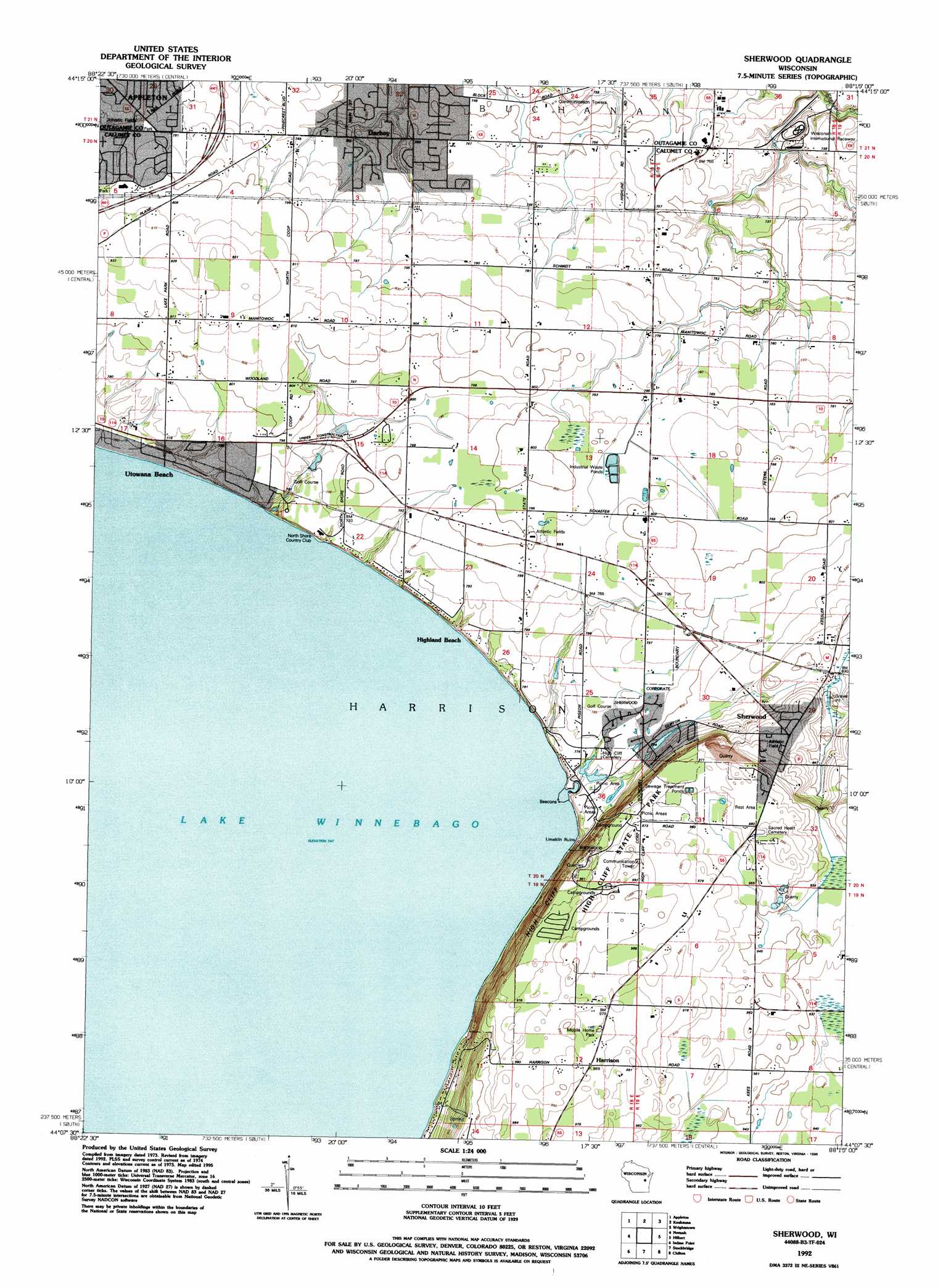
USGS Topo Quad 44088b3 - 1:24,000 scale
| Topo Map Name: | Sherwood |
| USGS Topo Quad ID: | 44088b3 |
| Print Size: | ca. 21 1/4" wide x 27" high |
| Southeast Coordinates: | 44.125° N latitude / 88.25° W longitude |
| Map Center Coordinates: | 44.1875° N latitude / 88.3125° W longitude |
| U.S. State: | WI |
| Filename: | o44088b3.jpg |
| Download Map JPG Image: | Sherwood topo map 1:24,000 scale |
| Map Type: | Topographic |
| Topo Series: | 7.5´ |
| Map Scale: | 1:24,000 |
| Source of Map Images: | United States Geological Survey (USGS) |
| Alternate Map Versions: |
Sherwood WI 1974, updated 1978 Download PDF Buy paper map Sherwood WI 1974, updated 1984 Download PDF Buy paper map Sherwood WI 1992, updated 1996 Download PDF Buy paper map Sherwood WI 2010 Download PDF Buy paper map Sherwood WI 2013 Download PDF Buy paper map Sherwood WI 2016 Download PDF Buy paper map |
1:24,000 Topo Quads surrounding Sherwood
Shiocton |
Black Creek |
Freedom |
Oneida South |
De Pere |
Greenville |
Appleton |
Kaukauna |
Wrightstown |
Greenleaf |
Oshkosh Ne |
Neenah |
Sherwood |
Hilbert |
Brillion |
Oshkosh |
Indian Point |
Stockbridge |
Chilton |
Potter |
Van Dyne |
Fahrney Point |
Brothertown |
Marytown |
Kiel |
> Back to 44088a1 at 1:100,000 scale
> Back to 44088a1 at 1:250,000 scale
> Back to U.S. Topo Maps home
Sherwood topo map: Gazetteer
Sherwood: Cliffs
High Cliff elevation 273m 895′Sherwood: Parks
High Cliff Escarpment State Natural Area elevation 266m 872′High Cliff State Park elevation 296m 971′
Sherwood: Populated Places
Darboy elevation 227m 744′Harrison elevation 301m 987′
High Cliff (historical) elevation 237m 777′
Highland Beach elevation 239m 784′
Sherwood elevation 272m 892′
Utowana Beach elevation 229m 751′
Sherwood digital topo map on disk
Buy this Sherwood topo map showing relief, roads, GPS coordinates and other geographical features, as a high-resolution digital map file on DVD: