Oshkosh Nw Topo Map Wisconsin
To zoom in, hover over the map of Oshkosh Nw
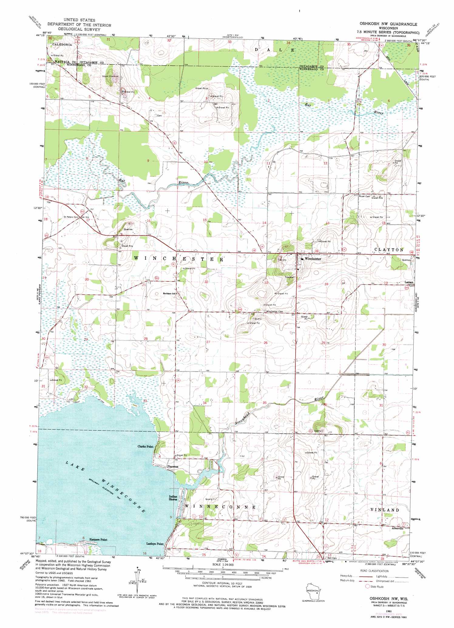
USGS Topo Quad 44088b6 - 1:24,000 scale
| Topo Map Name: | Oshkosh Nw |
| USGS Topo Quad ID: | 44088b6 |
| Print Size: | ca. 21 1/4" wide x 27" high |
| Southeast Coordinates: | 44.125° N latitude / 88.625° W longitude |
| Map Center Coordinates: | 44.1875° N latitude / 88.6875° W longitude |
| U.S. State: | WI |
| Filename: | o44088b6.jpg |
| Download Map JPG Image: | Oshkosh Nw topo map 1:24,000 scale |
| Map Type: | Topographic |
| Topo Series: | 7.5´ |
| Map Scale: | 1:24,000 |
| Source of Map Images: | United States Geological Survey (USGS) |
| Alternate Map Versions: |
Oshkosh NW WI 1961, updated 1966 Download PDF Buy paper map Oshkosh NW WI 1961, updated 1976 Download PDF Buy paper map Oshkosh NW WI 2010 Download PDF Buy paper map Oshkosh NW WI 2013 Download PDF Buy paper map Oshkosh NW WI 2016 Download PDF Buy paper map |
1:24,000 Topo Quads surrounding Oshkosh Nw
Manawa |
Northport |
New London |
Shiocton |
Black Creek |
Weyauwega |
Readfield |
Hortonville |
Greenville |
Appleton |
Poy Sippi |
Lake Poygan |
Oshkosh Nw |
Oshkosh Ne |
Neenah |
Auroraville |
Eureka |
Omro |
Oshkosh |
Indian Point |
Berlin |
Rush Lake |
Pickett |
Van Dyne |
Fahrney Point |
> Back to 44088a1 at 1:100,000 scale
> Back to 44088a1 at 1:250,000 scale
> Back to U.S. Topo Maps home
Oshkosh Nw topo map: Gazetteer
Oshkosh Nw: Airports
Larson Airport elevation 244m 800′Oshkosh Nw: Capes
Harpers Point elevation 229m 751′Oshkosh Nw: Lakes
Lake Winneconne elevation 228m 748′Oshkosh Nw: Populated Places
Clarks Point elevation 233m 764′Indian Shores elevation 228m 748′
Lasleys Point elevation 232m 761′
Piacenza elevation 231m 757′
Winchester elevation 258m 846′
Oshkosh Nw: Streams
Arrowhead River elevation 228m 748′Oshkosh Nw digital topo map on disk
Buy this Oshkosh Nw topo map showing relief, roads, GPS coordinates and other geographical features, as a high-resolution digital map file on DVD: