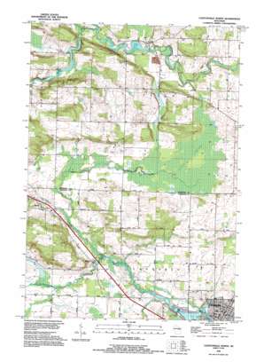
Clintonville North Topo Map Wisconsin
To zoom in, hover over the map of Clintonville North
USGS Topo Quad 44088f7 - 1:24,000 scale
| Topo Map Name: | Clintonville North |
| USGS Topo Quad ID: | 44088f7 |
| Print Size: | ca. 21 1/4" wide x 27" high |
| Southeast Coordinates: | 44.625° N latitude / 88.75° W longitude |
| Map Center Coordinates: | 44.6875° N latitude / 88.8125° W longitude |
| U.S. State: | WI |
| Filename: | o44088f7.jpg |
| Download Map JPG Image: | Clintonville North topo map 1:24,000 scale |
| Map Type: | Topographic |
| Topo Series: | 7.5´ |
| Map Scale: | 1:24,000 |
| Source of Map Images: | United States Geological Survey (USGS) |
| Alternate Map Versions: |
Clintonville North WI 1970, updated 1973 Download PDF Buy paper map Clintonville North WI 1993, updated 1995 Download PDF Buy paper map Clintonville North WI 2010 Download PDF Buy paper map Clintonville North WI 2013 Download PDF Buy paper map Clintonville North WI 2016 Download PDF Buy paper map |
1:24,000 Topo Quads surrounding Clintonville North
> Back to 44088e1 at 1:100,000 scale
> Back to 44088a1 at 1:250,000 scale
> Back to U.S. Topo Maps home
Clintonville North topo map: Gazetteer
Clintonville North: Capes
Picnic Point elevation 247m 810′Clintonville North: Dams
Hayman Falls WP 94-18 Dam elevation 270m 885′Pella 1882c38 Dam elevation 256m 839′
Clintonville North: Parks
Hayman Falls County Park elevation 263m 862′Clintonville North: Populated Places
Buckbee elevation 252m 826′Pella elevation 265m 869′
Clintonville North: Reservoirs
Hayman Falls Pond 260 elevation 270m 885′Pella Pond elevation 256m 839′
Pella Pond 334 elevation 256m 839′
Clintonville North: Streams
Brandy Creek elevation 247m 810′Hydes Creek elevation 251m 823′
North Branch Embarrass River elevation 259m 849′
North Branch Pigeon River elevation 247m 810′
South Branch Pigeon River elevation 247m 810′
Clintonville North: Swamps
Pella Swamp elevation 262m 859′Clintonville North digital topo map on disk
Buy this Clintonville North topo map showing relief, roads, GPS coordinates and other geographical features, as a high-resolution digital map file on DVD:


