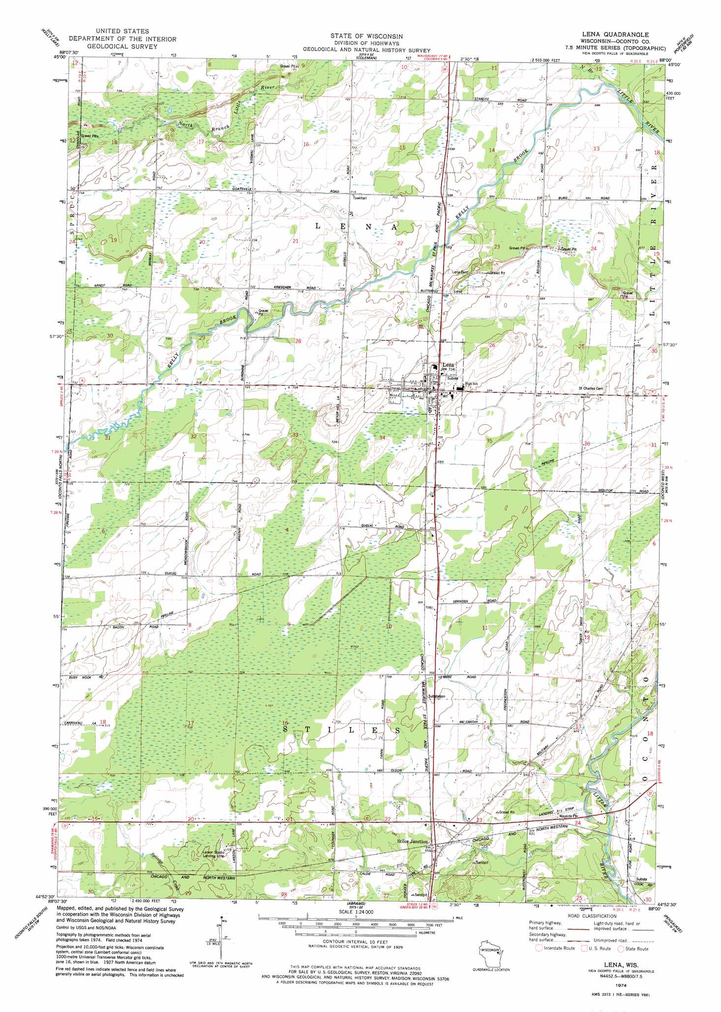
Lena Topo Map Wisconsin
To zoom in, hover over the map of Lena
USGS Topo Quad 44088h1 - 1:24,000 scale
| Topo Map Name: | Lena |
| USGS Topo Quad ID: | 44088h1 |
| Print Size: | ca. 21 1/4" wide x 27" high |
| Southeast Coordinates: | 44.875° N latitude / 88° W longitude |
| Map Center Coordinates: | 44.9375° N latitude / 88.0625° W longitude |
| U.S. State: | WI |
| Filename: | o44088h1.jpg |
| Download Map JPG Image: | Lena topo map 1:24,000 scale |
| Map Type: | Topographic |
| Topo Series: | 7.5´ |
| Map Scale: | 1:24,000 |
| Source of Map Images: | United States Geological Survey (USGS) |
| Alternate Map Versions: |
Lena WI 1974, updated 1977 Download PDF Buy paper map Lena WI 2010 Download PDF Buy paper map Lena WI 2013 Download PDF Buy paper map Lena WI 2016 Download PDF Buy paper map |
1:24,000 Topo Quads surrounding Lena
Shay Lake |
White Potato Lake |
Crivitz |
Loomis |
Porterfield |
Hickory Corners |
Kelly Lake |
Coleman |
Porterfiled Sw |
Harmony |
Gillett |
Oconto Falls North |
Lena |
Oconto West |
Oconto East |
Krakow |
Oconto Falls South |
Abrams |
Pensaukee |
Oconto Se |
Zachow |
Pulaski |
Suamico |
Little Tail Point |
Dyckesville |
> Back to 44088e1 at 1:100,000 scale
> Back to 44088a1 at 1:250,000 scale
> Back to U.S. Topo Maps home
Lena topo map: Gazetteer
Lena: Airports
Dolata Airport elevation 185m 606′Larson Studio Airport elevation 213m 698′
Matravers Landing Field (historical) elevation 221m 725′
Lena: Populated Places
Lena elevation 221m 725′Stiles Junction elevation 200m 656′
Lena: Streams
Kelly Brook elevation 204m 669′North Branch Little River elevation 205m 672′
Lena digital topo map on disk
Buy this Lena topo map showing relief, roads, GPS coordinates and other geographical features, as a high-resolution digital map file on DVD: