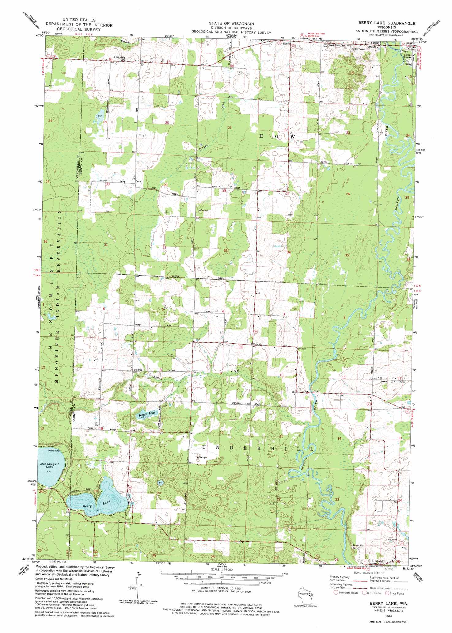
Berry Lake Topo Map Wisconsin
To zoom in, hover over the map of Berry Lake
USGS Topo Quad 44088h4 - 1:24,000 scale
| Topo Map Name: | Berry Lake |
| USGS Topo Quad ID: | 44088h4 |
| Print Size: | ca. 21 1/4" wide x 27" high |
| Southeast Coordinates: | 44.875° N latitude / 88.375° W longitude |
| Map Center Coordinates: | 44.9375° N latitude / 88.4375° W longitude |
| U.S. State: | WI |
| Filename: | o44088h4.jpg |
| Download Map JPG Image: | Berry Lake topo map 1:24,000 scale |
| Map Type: | Topographic |
| Topo Series: | 7.5´ |
| Map Scale: | 1:24,000 |
| Source of Map Images: | United States Geological Survey (USGS) |
| Alternate Map Versions: |
Berry Lake WI 1974, updated 1977 Download PDF Buy paper map Berry Lake WI 2010 Download PDF Buy paper map Berry Lake WI 2013 Download PDF Buy paper map Berry Lake WI 2016 Download PDF Buy paper map |
1:24,000 Topo Quads surrounding Berry Lake
Langlade |
Shadow Lake |
Mountain |
Shay Lake |
White Potato Lake |
Markton |
Fredenberg Lake |
Breed |
Hickory Corners |
Kelly Lake |
Keshena |
Legend Lake |
Berry Lake |
Gillett |
Oconto Falls North |
Thornton |
Shawano |
Cecil |
Krakow |
Oconto Falls South |
Embarrass |
Lunds |
Bonduel |
Zachow |
Pulaski |
> Back to 44088e1 at 1:100,000 scale
> Back to 44088a1 at 1:250,000 scale
> Back to U.S. Topo Maps home
Berry Lake topo map: Gazetteer
Berry Lake: Lakes
Berry Lake elevation 257m 843′Moshawquit Lake elevation 253m 830′
Schutt Lake elevation 245m 803′
Berry Lake: Populated Places
Hayes elevation 261m 856′Hintz elevation 244m 800′
Underhill elevation 245m 803′
Berry Lake: Streams
Linzy Creek elevation 236m 774′Berry Lake digital topo map on disk
Buy this Berry Lake topo map showing relief, roads, GPS coordinates and other geographical features, as a high-resolution digital map file on DVD: