Hatley Topo Map Wisconsin
To zoom in, hover over the map of Hatley
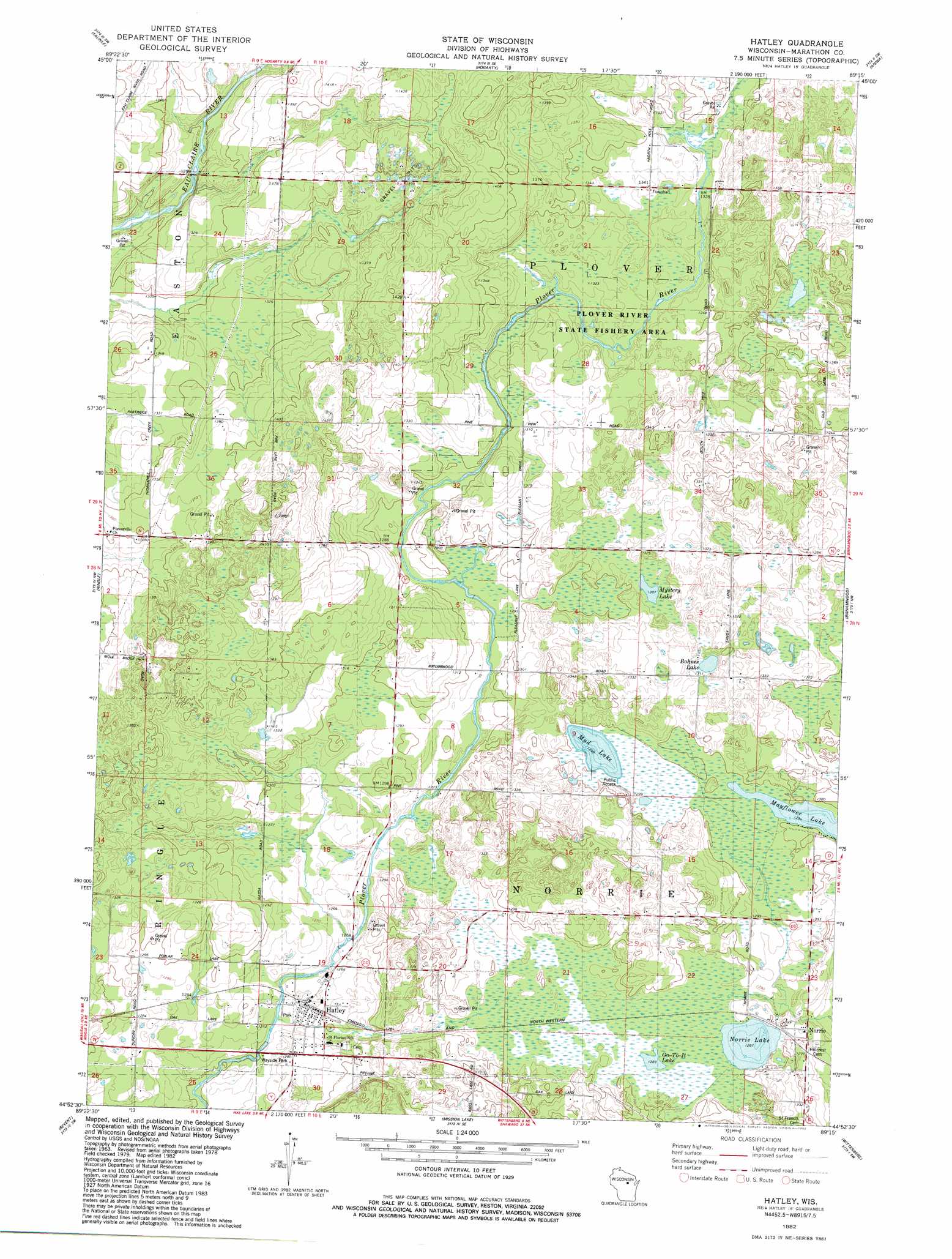
USGS Topo Quad 44089h3 - 1:24,000 scale
| Topo Map Name: | Hatley |
| USGS Topo Quad ID: | 44089h3 |
| Print Size: | ca. 21 1/4" wide x 27" high |
| Southeast Coordinates: | 44.875° N latitude / 89.25° W longitude |
| Map Center Coordinates: | 44.9375° N latitude / 89.3125° W longitude |
| U.S. State: | WI |
| Filename: | o44089h3.jpg |
| Download Map JPG Image: | Hatley topo map 1:24,000 scale |
| Map Type: | Topographic |
| Topo Series: | 7.5´ |
| Map Scale: | 1:24,000 |
| Source of Map Images: | United States Geological Survey (USGS) |
| Alternate Map Versions: |
Hatley WI 1982, updated 1982 Download PDF Buy paper map Hatley WI 2010 Download PDF Buy paper map Hatley WI 2013 Download PDF Buy paper map Hatley WI 2015 Download PDF Buy paper map |
1:24,000 Topo Quads surrounding Hatley
Pine Dells |
Doering |
Black Brook |
Antigo |
Bryant |
Nutterville |
Kalinke |
Hogarty |
Aniwa |
Mattoon |
Wausau East |
Ringle |
Hatley |
Birnamwood |
Regina |
Peplin |
Bevent |
Mission Lake |
Wittenberg |
Shepley |
Dewey Marsh |
Rosholt Nw |
Rosholt |
Tigerton Nw |
Tigerton |
> Back to 44089e1 at 1:100,000 scale
> Back to 44088a1 at 1:250,000 scale
> Back to U.S. Topo Maps home
Hatley topo map: Gazetteer
Hatley: Lakes
Bohnes Lake elevation 397m 1302′Go-To-It Lake elevation 393m 1289′
Mayflower Lake elevation 394m 1292′
Mud Lake elevation 396m 1299′
Mystery Lake elevation 398m 1305′
Norrie Lake elevation 392m 1286′
Hatley: Parks
Wayside Park elevation 380m 1246′Hatley: Populated Places
Hatley elevation 386m 1266′Norrie elevation 393m 1289′
Hatley digital topo map on disk
Buy this Hatley topo map showing relief, roads, GPS coordinates and other geographical features, as a high-resolution digital map file on DVD: