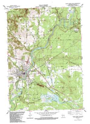
Black River Falls Topo Map Wisconsin
To zoom in, hover over the map of Black River Falls
USGS Topo Quad 44090c7 - 1:24,000 scale
| Topo Map Name: | Black River Falls |
| USGS Topo Quad ID: | 44090c7 |
| Print Size: | ca. 21 1/4" wide x 27" high |
| Southeast Coordinates: | 44.25° N latitude / 90.75° W longitude |
| Map Center Coordinates: | 44.3125° N latitude / 90.8125° W longitude |
| U.S. State: | WI |
| Filename: | o44090c7.jpg |
| Download Map JPG Image: | Black River Falls topo map 1:24,000 scale |
| Map Type: | Topographic |
| Topo Series: | 7.5´ |
| Map Scale: | 1:24,000 |
| Source of Map Images: | United States Geological Survey (USGS) |
| Alternate Map Versions: |
Black River Falls WI 1984, updated 1984 Download PDF Buy paper map Black River Falls WI 2010 Download PDF Buy paper map Black River Falls WI 2013 Download PDF Buy paper map Black River Falls WI 2015 Download PDF Buy paper map |
1:24,000 Topo Quads surrounding Black River Falls
> Back to 44090a1 at 1:100,000 scale
> Back to 44090a1 at 1:250,000 scale
> Back to U.S. Topo Maps home
Black River Falls topo map: Gazetteer
Black River Falls: Airports
Black River Falls Area Airport elevation 253m 830′Jackson County Airport (historical) elevation 262m 859′
Black River Falls: Dams
Black River Falls Dam elevation 229m 751′Perry Creek Dam elevation 264m 866′
Black River Falls: Falls
Ni-ho-kha-wa-ne-ey-ja elevation 229m 751′Black River Falls: Islands
Hawk Island elevation 226m 741′Black River Falls: Parks
Castle Mound Pine Forest State Natural Area elevation 328m 1076′Castle Mound Recreation Area elevation 262m 859′
Perry Creek Recreation Area elevation 231m 757′
Rock Springs Park elevation 238m 780′
Black River Falls: Populated Places
Black River Falls elevation 242m 793′Brockway elevation 255m 836′
Charter Oak Mills (historical) elevation 233m 764′
Sheppard elevation 266m 872′
Vaudreuil elevation 260m 853′
Winnebago Mission elevation 268m 879′
Black River Falls: Post Offices
Black River Falls Post Office elevation 233m 764′Black River Falls: Reservoirs
Black River Flowage 1610 elevation 229m 751′Cranberry Flowage elevation 262m 859′
Lake 31 3 7 elevation 264m 866′
Black River Falls: Streams
Allen Creek elevation 236m 774′Clear Creek elevation 237m 777′
Coffee Creek elevation 231m 757′
Dickey Creek elevation 238m 780′
Halls Creek elevation 237m 777′
Indian Grave Creek elevation 251m 823′
Levis Creek elevation 235m 770′
Morrison Creek elevation 238m 780′
Perry Creek elevation 226m 741′
Red Creek elevation 249m 816′
Snow Creek elevation 235m 770′
Squaw Creek elevation 223m 731′
Town Creek elevation 226m 741′
Valentine Creek elevation 238m 780′
Black River Falls: Summits
Castle Mound elevation 324m 1062′Silver Mound elevation 306m 1003′
Black River Falls digital topo map on disk
Buy this Black River Falls topo map showing relief, roads, GPS coordinates and other geographical features, as a high-resolution digital map file on DVD:


