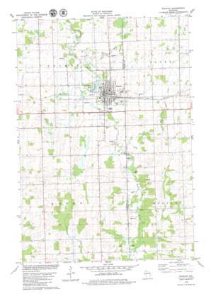
Stanley Topo Map Wisconsin
To zoom in, hover over the map of Stanley
USGS Topo Quad 44090h8 - 1:24,000 scale
| Topo Map Name: | Stanley |
| USGS Topo Quad ID: | 44090h8 |
| Print Size: | ca. 21 1/4" wide x 27" high |
| Southeast Coordinates: | 44.875° N latitude / 90.875° W longitude |
| Map Center Coordinates: | 44.9375° N latitude / 90.9375° W longitude |
| U.S. State: | WI |
| Filename: | o44090h8.jpg |
| Download Map JPG Image: | Stanley topo map 1:24,000 scale |
| Map Type: | Topographic |
| Topo Series: | 7.5´ |
| Map Scale: | 1:24,000 |
| Source of Map Images: | United States Geological Survey (USGS) |
| Alternate Map Versions: |
Stanley NW WI 1976, updated 1979 Download PDF Buy paper map Stanley WI 1979, updated 1980 Download PDF Buy paper map Stanley WI 2010 Download PDF Buy paper map Stanley WI 2013 Download PDF Buy paper map Stanley WI 2015 Download PDF Buy paper map |
1:24,000 Topo Quads surrounding Stanley
> Back to 44090e1 at 1:100,000 scale
> Back to 44090a1 at 1:250,000 scale
> Back to U.S. Topo Maps home
Stanley topo map: Gazetteer
Stanley: Airports
Victory Memorial Hospital Heliport elevation 342m 1122′Stanley: Dams
Stanley Mill Dam elevation 329m 1079′Stanley: Parks
Chapman Park elevation 332m 1089′Fandry Park elevation 333m 1092′
Schmidt Maple Woods State Natural Area elevation 328m 1076′
Stanley: Populated Places
Stanley elevation 330m 1082′Worden (historical) elevation 356m 1167′
Stanley: Post Offices
Stanley Post Office elevation 332m 1089′Stanley: Reservoirs
Chapman Lake elevation 329m 1079′Chapman Lake 31.0 elevation 329m 1079′
Stanley: Streams
Little Otter Creek elevation 332m 1089′Roger Creek elevation 320m 1049′
Stanley digital topo map on disk
Buy this Stanley topo map showing relief, roads, GPS coordinates and other geographical features, as a high-resolution digital map file on DVD:


