Altura Topo Map Minnesota
To zoom in, hover over the map of Altura
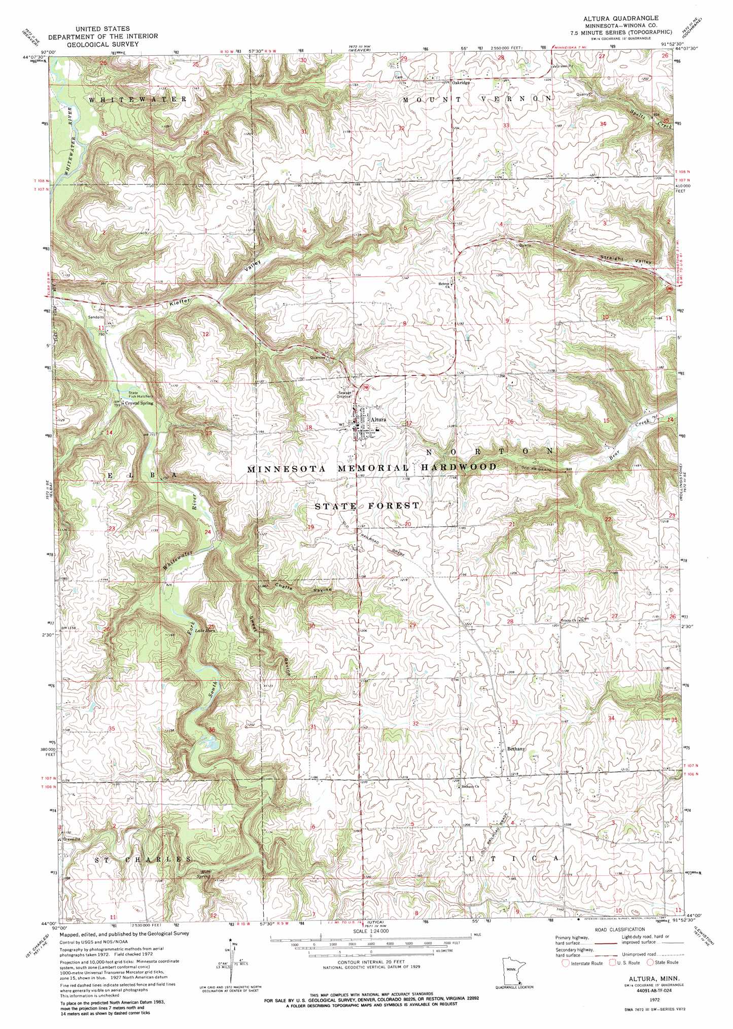
USGS Topo Quad 44091a8 - 1:24,000 scale
| Topo Map Name: | Altura |
| USGS Topo Quad ID: | 44091a8 |
| Print Size: | ca. 21 1/4" wide x 27" high |
| Southeast Coordinates: | 44° N latitude / 91.875° W longitude |
| Map Center Coordinates: | 44.0625° N latitude / 91.9375° W longitude |
| U.S. State: | MN |
| Filename: | o44091a8.jpg |
| Download Map JPG Image: | Altura topo map 1:24,000 scale |
| Map Type: | Topographic |
| Topo Series: | 7.5´ |
| Map Scale: | 1:24,000 |
| Source of Map Images: | United States Geological Survey (USGS) |
| Alternate Map Versions: |
Altura MN 1972, updated 1976 Download PDF Buy paper map Altura MN 2011 Download PDF Buy paper map Altura MN 2013 Download PDF Buy paper map Altura MN 2016 Download PDF Buy paper map |
1:24,000 Topo Quads surrounding Altura
Theilman |
Wabasha South |
Alma |
Cream |
Waumandee |
Plainview |
Beaver |
Weaver |
Cochrane |
Fountain City |
Plainview Sw |
Elba |
Altura |
Rollingstone |
Winona West |
Eyota |
Saint Charles |
Utica |
Lewiston |
Wilson |
Chatfield |
Pilot Mound |
Arendahl |
Rushford West |
Rushford East |
> Back to 44091a1 at 1:100,000 scale
> Back to 44090a1 at 1:250,000 scale
> Back to U.S. Topo Maps home
Altura topo map: Gazetteer
Altura: Dams
Lenard Greden Detention Dam elevation 355m 1164′Altura: Forests
Richard J Dorer Memorial Hardwood State Forest elevation 349m 1145′Altura: Lakes
Lake Horn elevation 255m 836′Altura: Populated Places
Altura elevation 357m 1171′Bethany elevation 371m 1217′
Crystal Spring elevation 233m 764′
Oakridge elevation 372m 1220′
Altura: Post Offices
Altura Post Office elevation 356m 1167′Bethany Post Office (historical) elevation 371m 1217′
Oakridge Post Office (historical) elevation 372m 1220′
Altura: Springs
Holt Spring elevation 292m 958′Altura: Valleys
Chaffe Ravine elevation 247m 810′Kieffer Valley elevation 226m 741′
Sweet Ravine elevation 260m 853′
Altura digital topo map on disk
Buy this Altura topo map showing relief, roads, GPS coordinates and other geographical features, as a high-resolution digital map file on DVD: