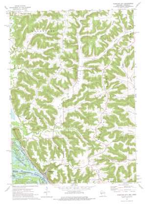
Fountain City Topo Map Wisconsin
To zoom in, hover over the map of Fountain City
USGS Topo Quad 44091b6 - 1:24,000 scale
| Topo Map Name: | Fountain City |
| USGS Topo Quad ID: | 44091b6 |
| Print Size: | ca. 21 1/4" wide x 27" high |
| Southeast Coordinates: | 44.125° N latitude / 91.625° W longitude |
| Map Center Coordinates: | 44.1875° N latitude / 91.6875° W longitude |
| U.S. States: | WI, MN |
| Filename: | o44091b6.jpg |
| Download Map JPG Image: | Fountain City topo map 1:24,000 scale |
| Map Type: | Topographic |
| Topo Series: | 7.5´ |
| Map Scale: | 1:24,000 |
| Source of Map Images: | United States Geological Survey (USGS) |
| Alternate Map Versions: |
Fountain City WI 1972, updated 1975 Download PDF Buy paper map Fountain City WI 2011 Download PDF Buy paper map Fountain City WI 2013 Download PDF Buy paper map Fountain City WI 2015 Download PDF Buy paper map |
1:24,000 Topo Quads surrounding Fountain City
> Back to 44091a1 at 1:100,000 scale
> Back to 44090a1 at 1:250,000 scale
> Back to U.S. Topo Maps home
Fountain City topo map: Gazetteer
Fountain City: Bends
Horseshoe Bend elevation 199m 652′Fountain City: Channels
Fountain City Bay elevation 199m 652′Fountain City: Cliffs
Wagners Cliff elevation 270m 885′Fountain City: Parks
Merrick State Park elevation 200m 656′Upper Mississippi Wild Life and Fish Refuge elevation 200m 656′
Fountain City: Populated Places
Fountain City elevation 203m 666′Fountain City: Ridges
Canada Ridge elevation 374m 1227′Fountain City Ridge elevation 367m 1204′
Glencoe Ridge elevation 380m 1246′
Fountain City: Streams
Waumandee Creek elevation 199m 652′Fountain City: Summits
Eagle Point elevation 342m 1122′Owl Head elevation 207m 679′
Fountain City: Valleys
Doelle Valley elevation 217m 711′Eagle Valley elevation 202m 662′
Joos Valley elevation 241m 790′
Oak Valley elevation 221m 725′
Schoepp Valley elevation 209m 685′
Speith Hole elevation 210m 688′
Fountain City digital topo map on disk
Buy this Fountain City topo map showing relief, roads, GPS coordinates and other geographical features, as a high-resolution digital map file on DVD:


