Pleasantville Topo Map Wisconsin
To zoom in, hover over the map of Pleasantville
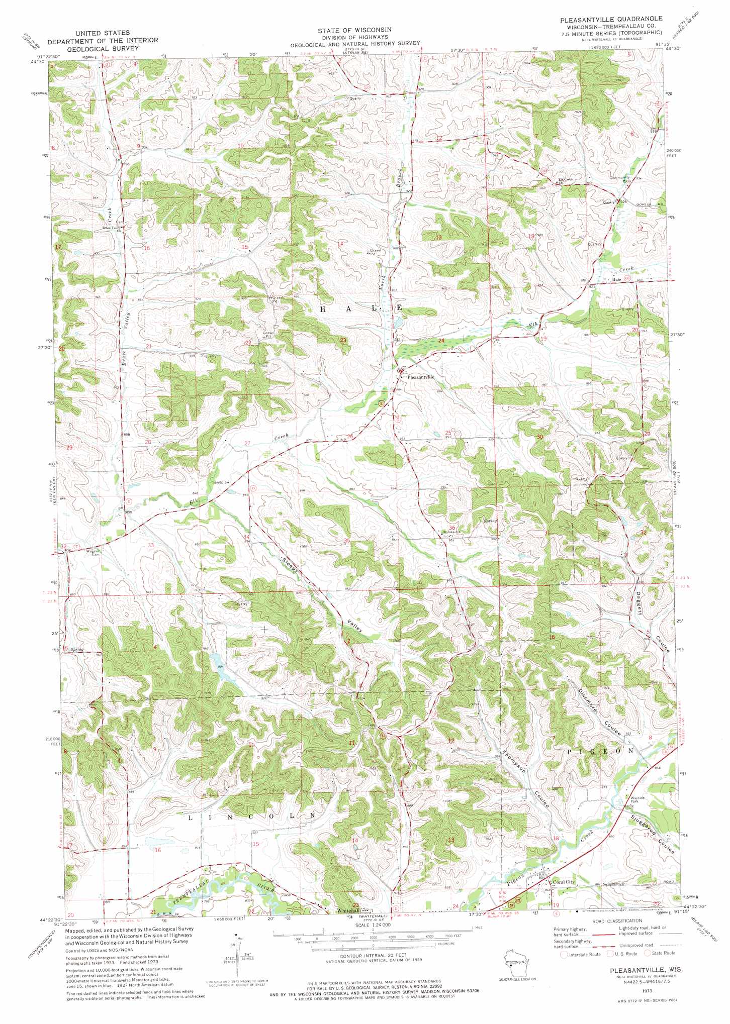
USGS Topo Quad 44091d3 - 1:24,000 scale
| Topo Map Name: | Pleasantville |
| USGS Topo Quad ID: | 44091d3 |
| Print Size: | ca. 21 1/4" wide x 27" high |
| Southeast Coordinates: | 44.375° N latitude / 91.25° W longitude |
| Map Center Coordinates: | 44.4375° N latitude / 91.3125° W longitude |
| U.S. State: | WI |
| Filename: | o44091d3.jpg |
| Download Map JPG Image: | Pleasantville topo map 1:24,000 scale |
| Map Type: | Topographic |
| Topo Series: | 7.5´ |
| Map Scale: | 1:24,000 |
| Source of Map Images: | United States Geological Survey (USGS) |
| Alternate Map Versions: |
Pleasantville WI 1973, updated 1975 Download PDF Buy paper map Pleasantville WI 2010 Download PDF Buy paper map Pleasantville WI 2013 Download PDF Buy paper map Pleasantville WI 2015 Download PDF Buy paper map |
1:24,000 Topo Quads surrounding Pleasantville
Mondovi Ne |
Cleghorn |
Brackett |
Augusta West |
Augusta East |
Rossman Creek |
Strum |
Strum Se |
Osseo |
Price |
Lookout |
Elk Creek |
Pleasantville |
Pigeon Falls |
Hixton |
Swinns Valley |
Independence |
Whitehall |
Blair |
Taylor |
Dodge |
Tamarack |
Ettrick |
Hegg |
North Bend Ne |
> Back to 44091a1 at 1:100,000 scale
> Back to 44090a1 at 1:250,000 scale
> Back to U.S. Topo Maps home
Pleasantville topo map: Gazetteer
Pleasantville: Dams
Whitehall Pigeon Rod Gun Club G7439 Dam elevation 314m 1030′Pleasantville: Populated Places
Coral City elevation 255m 836′Hale elevation 284m 931′
Pleasantville elevation 274m 898′
Pleasantville: Reservoirs
2 Reservoir elevation 314m 1030′Pleasantville: Streams
Bruce Valley Creek elevation 256m 839′North Branch Elk Creek elevation 267m 875′
Pleasantville: Valleys
Dissmore Coulee elevation 259m 849′Sjuggerud Coulee elevation 256m 839′
Sleepy Valley elevation 259m 849′
Thompson Coulee elevation 255m 836′
Pleasantville digital topo map on disk
Buy this Pleasantville topo map showing relief, roads, GPS coordinates and other geographical features, as a high-resolution digital map file on DVD: