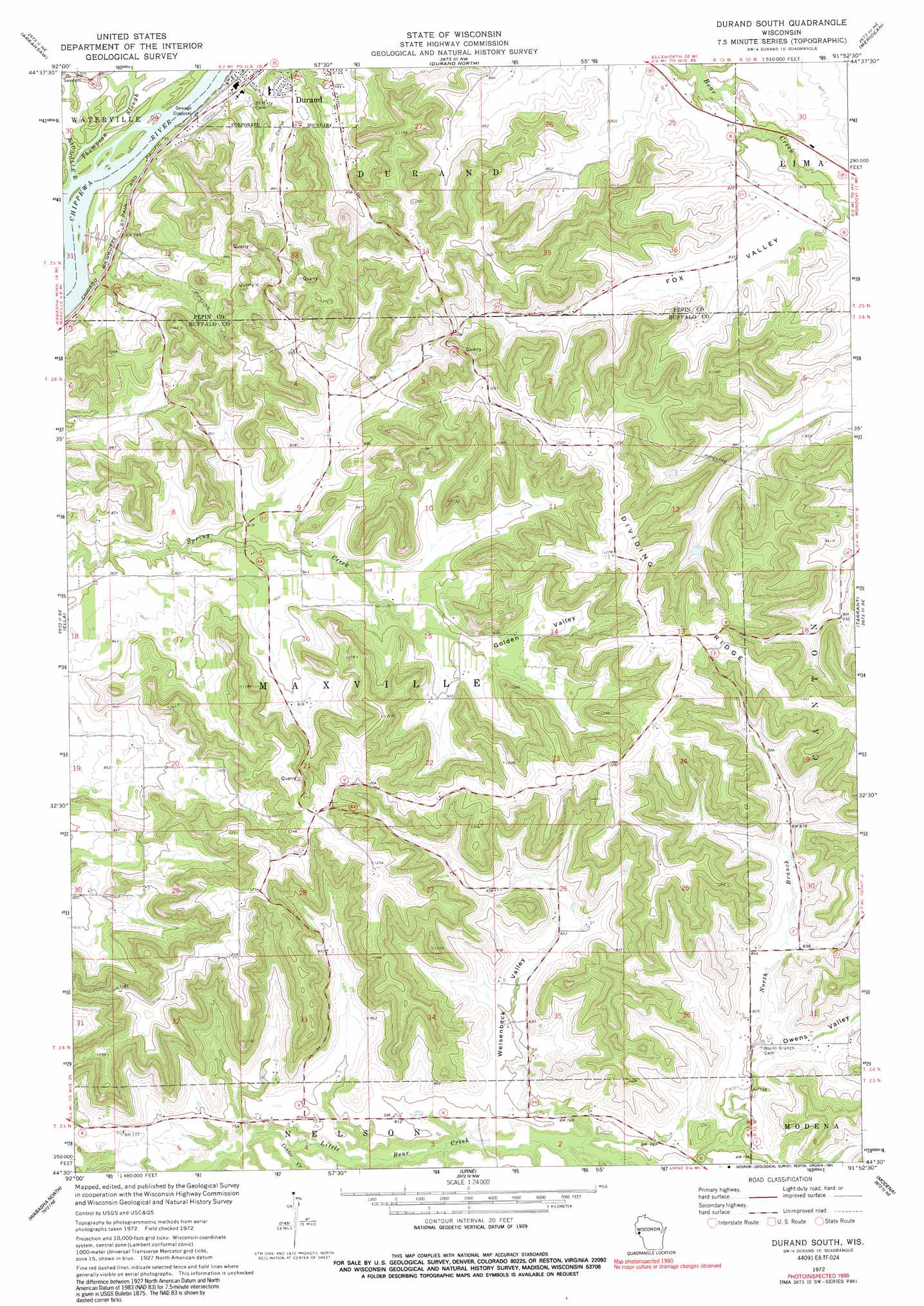
Durand South Topo Map Wisconsin
To zoom in, hover over the map of Durand South
USGS Topo Quad 44091e8 - 1:24,000 scale
| Topo Map Name: | Durand South |
| USGS Topo Quad ID: | 44091e8 |
| Print Size: | ca. 21 1/4" wide x 27" high |
| Southeast Coordinates: | 44.5° N latitude / 91.875° W longitude |
| Map Center Coordinates: | 44.5625° N latitude / 91.9375° W longitude |
| U.S. State: | WI |
| Filename: | o44091e8.jpg |
| Download Map JPG Image: | Durand South topo map 1:24,000 scale |
| Map Type: | Topographic |
| Topo Series: | 7.5´ |
| Map Scale: | 1:24,000 |
| Source of Map Images: | United States Geological Survey (USGS) |
| Alternate Map Versions: |
Durand South WI 1972, updated 1975 Download PDF Buy paper map Durand South WI 1972, updated 1991 Download PDF Buy paper map Durand South WI 2010 Download PDF Buy paper map Durand South WI 2013 Download PDF Buy paper map Durand South WI 2015 Download PDF Buy paper map |
1:24,000 Topo Quads surrounding Durand South
Spring Valley |
Weston |
Menomonie South |
Falls City |
Elk Creek Lake |
Plum City |
Arkansaw |
Durand North |
Meridean |
Rock Falls |
Nerike Hill |
Ella |
Durand South |
Tarrant |
Mondovi |
Pepin |
Wabasha North |
Urne |
Modena |
Gilmanton |
Theilman |
Wabasha South |
Alma |
Cream |
Waumandee |
> Back to 44091e1 at 1:100,000 scale
> Back to 44090a1 at 1:250,000 scale
> Back to U.S. Topo Maps home
Durand South topo map: Gazetteer
Durand South: Airports
Chippewa Valley Hospital Heliport elevation 260m 853′Durand South: Cliffs
Limekiln Bluff elevation 312m 1023′Durand South: Populated Places
Laneville elevation 254m 833′Durand South: Ridges
Dividing Ridge elevation 380m 1246′Durand South: Streams
Center Creek elevation 220m 721′Eau Galle River elevation 213m 698′
Thompson Slough elevation 214m 702′
Durand South: Valleys
Fox Valley elevation 251m 823′Golden Valley elevation 267m 875′
Owens Valley elevation 249m 816′
Stanley Valley elevation 257m 843′
Weisenbeck Valley elevation 246m 807′
Durand South digital topo map on disk
Buy this Durand South topo map showing relief, roads, GPS coordinates and other geographical features, as a high-resolution digital map file on DVD: