Augusta East Topo Map Wisconsin
To zoom in, hover over the map of Augusta East
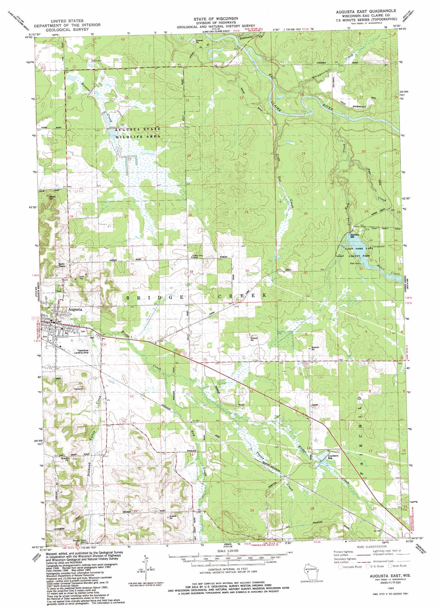
USGS Topo Quad 44091f1 - 1:24,000 scale
| Topo Map Name: | Augusta East |
| USGS Topo Quad ID: | 44091f1 |
| Print Size: | ca. 21 1/4" wide x 27" high |
| Southeast Coordinates: | 44.625° N latitude / 91° W longitude |
| Map Center Coordinates: | 44.6875° N latitude / 91.0625° W longitude |
| U.S. State: | WI |
| Filename: | o44091f1.jpg |
| Download Map JPG Image: | Augusta East topo map 1:24,000 scale |
| Map Type: | Topographic |
| Topo Series: | 7.5´ |
| Map Scale: | 1:24,000 |
| Source of Map Images: | United States Geological Survey (USGS) |
| Alternate Map Versions: |
Augusta East WI 1984, updated 1984 Download PDF Buy paper map Augusta East WI 2010 Download PDF Buy paper map Augusta East WI 2013 Download PDF Buy paper map Augusta East WI 2015 Download PDF Buy paper map |
1:24,000 Topo Quads surrounding Augusta East
Lake Wissota |
Cadott |
Boyd |
Stanley |
Thorp |
Fall Creek |
Lake Eau Claire West |
Lake Eau Claire East |
Simes Creek |
Mead Lake West |
Brackett |
Augusta West |
Augusta East |
Horse Creek |
Rock Dam Lake |
Strum Se |
Osseo |
Price |
Fairchild |
Wildcat Mound |
Pleasantville |
Pigeon Falls |
Hixton |
Alma Center |
Merrillan |
> Back to 44091e1 at 1:100,000 scale
> Back to 44090a1 at 1:250,000 scale
> Back to U.S. Topo Maps home
Augusta East topo map: Gazetteer
Augusta East: Airports
Papenfuss Landing Strip elevation 296m 971′Augusta East: Dams
Coon Creek 2WP1678 Dam elevation 295m 967′Augusta East: Parks
Augusta State Wildlife Area elevation 293m 961′Coon Fork Barrens State Natural Area elevation 297m 974′
Coon Fork Lake County Park elevation 299m 980′
Augusta East: Populated Places
Augusta elevation 293m 961′Augusta East: Post Offices
Augusta Post Office elevation 293m 961′Augusta East: Reservoirs
Coon Fork Lake elevation 295m 967′Coon Fork Lake 45 elevation 295m 967′
Augusta East: Streams
Black Creek elevation 295m 967′Coon Fork Creek elevation 280m 918′
Coon Gut Creek elevation 278m 912′
Diamond Valley Creek elevation 293m 961′
Hathaway Creek elevation 277m 908′
Hay Creek elevation 296m 971′
Pea Creek elevation 283m 928′
Travis Creek elevation 299m 980′
Whippoorwill Creek elevation 277m 908′
Augusta East digital topo map on disk
Buy this Augusta East topo map showing relief, roads, GPS coordinates and other geographical features, as a high-resolution digital map file on DVD: