Meridean Topo Map Wisconsin
To zoom in, hover over the map of Meridean
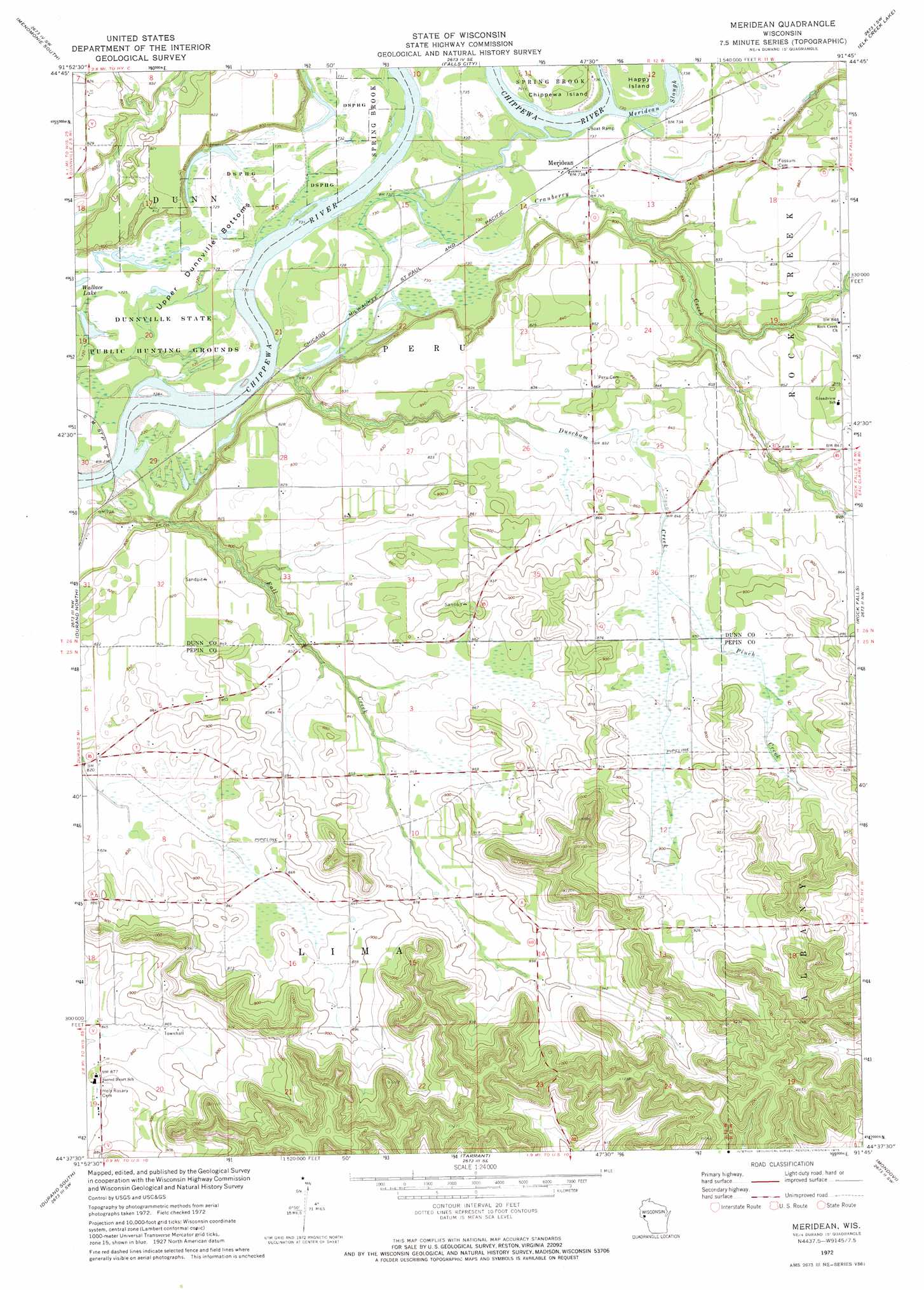
USGS Topo Quad 44091f7 - 1:24,000 scale
| Topo Map Name: | Meridean |
| USGS Topo Quad ID: | 44091f7 |
| Print Size: | ca. 21 1/4" wide x 27" high |
| Southeast Coordinates: | 44.625° N latitude / 91.75° W longitude |
| Map Center Coordinates: | 44.6875° N latitude / 91.8125° W longitude |
| U.S. State: | WI |
| Filename: | o44091f7.jpg |
| Download Map JPG Image: | Meridean topo map 1:24,000 scale |
| Map Type: | Topographic |
| Topo Series: | 7.5´ |
| Map Scale: | 1:24,000 |
| Source of Map Images: | United States Geological Survey (USGS) |
| Alternate Map Versions: |
Meridean WI 1972, updated 1975 Download PDF Buy paper map Meridean WI 2010 Download PDF Buy paper map Meridean WI 2013 Download PDF Buy paper map Meridean WI 2015 Download PDF Buy paper map |
1:24,000 Topo Quads surrounding Meridean
Knapp |
Menomonie North |
Rusk |
Colfax South |
Albertville |
Weston |
Menomonie South |
Falls City |
Elk Creek Lake |
Eau Claire West |
Arkansaw |
Durand North |
Meridean |
Rock Falls |
Mondovi Ne |
Ella |
Durand South |
Tarrant |
Mondovi |
Rossman Creek |
Wabasha North |
Urne |
Modena |
Gilmanton |
Lookout |
> Back to 44091e1 at 1:100,000 scale
> Back to 44090a1 at 1:250,000 scale
> Back to U.S. Topo Maps home
Meridean topo map: Gazetteer
Meridean: Bends
Upper Dunnville Bottoms elevation 224m 734′Meridean: Crossings
Meridean Ferry (historical) elevation 219m 718′Meridean: Parks
Dunnville State Public Hunting Grounds elevation 220m 721′Meridean: Populated Places
Lima elevation 264m 866′Meridean elevation 225m 738′
Old Tyrone (historical) elevation 231m 757′
Meridean: Streams
Cranberry Creek elevation 220m 721′Duscham Creek elevation 224m 734′
Fall Creek elevation 220m 721′
Meridean Slu elevation 219m 718′
Pinch Creek elevation 259m 849′
Meridean digital topo map on disk
Buy this Meridean topo map showing relief, roads, GPS coordinates and other geographical features, as a high-resolution digital map file on DVD: