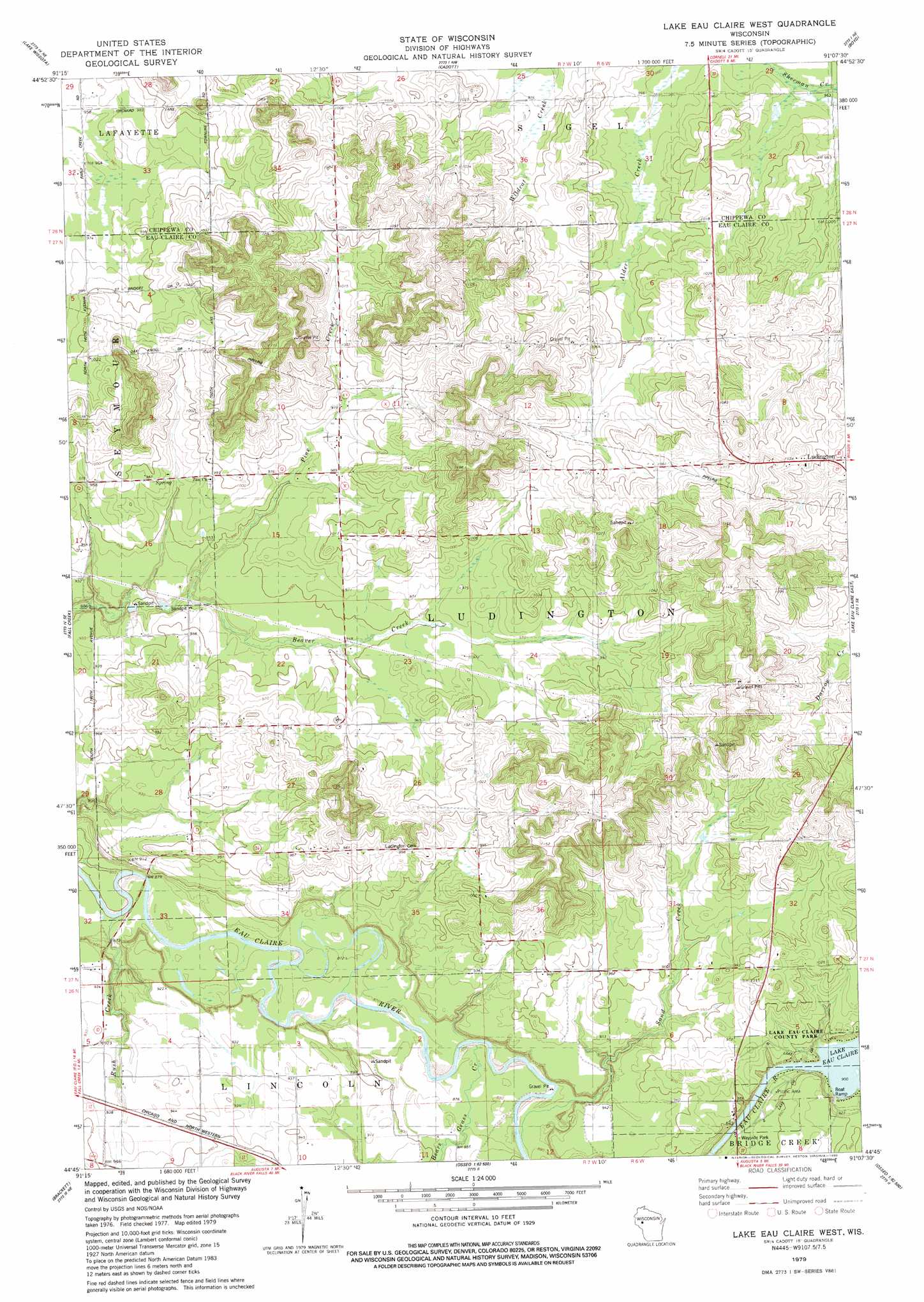
Lake Eau Claire West Topo Map Wisconsin
To zoom in, hover over the map of Lake Eau Claire West
USGS Topo Quad 44091g2 - 1:24,000 scale
| Topo Map Name: | Lake Eau Claire West |
| USGS Topo Quad ID: | 44091g2 |
| Print Size: | ca. 21 1/4" wide x 27" high |
| Southeast Coordinates: | 44.75° N latitude / 91.125° W longitude |
| Map Center Coordinates: | 44.8125° N latitude / 91.1875° W longitude |
| U.S. State: | WI |
| Filename: | o44091g2.jpg |
| Download Map JPG Image: | Lake Eau Claire West topo map 1:24,000 scale |
| Map Type: | Topographic |
| Topo Series: | 7.5´ |
| Map Scale: | 1:24,000 |
| Source of Map Images: | United States Geological Survey (USGS) |
| Alternate Map Versions: |
Lake Eau Claire West WI 1979, updated 1980 Download PDF Buy paper map Lake Eau Claire West WI 2010 Download PDF Buy paper map Lake Eau Claire West WI 2013 Download PDF Buy paper map Lake Eau Claire West WI 2015 Download PDF Buy paper map |
1:24,000 Topo Quads surrounding Lake Eau Claire West
Bloomer |
Jim Falls |
Crescent |
Colburn |
Huron |
Chippewa Falls |
Lake Wissota |
Cadott |
Boyd |
Stanley |
Eau Claire East |
Fall Creek |
Lake Eau Claire West |
Lake Eau Claire East |
Simes Creek |
Cleghorn |
Brackett |
Augusta West |
Augusta East |
Horse Creek |
Strum |
Strum Se |
Osseo |
Price |
Fairchild |
> Back to 44091e1 at 1:100,000 scale
> Back to 44090a1 at 1:250,000 scale
> Back to U.S. Topo Maps home
Lake Eau Claire West topo map: Gazetteer
Lake Eau Claire West: Dams
Eau Claire River 2WP224 Dam elevation 274m 898′Lake Eau Claire West: Populated Places
Ludington elevation 332m 1089′Lake Eau Claire West: Reservoirs
Lake Eau Claire elevation 275m 902′Lake Eau Claire 605 elevation 274m 898′
Lake Eau Claire West: Streams
Bears Grass Creek elevation 265m 869′Pine Creek elevation 276m 905′
Rush Creek elevation 259m 849′
Sand Creek elevation 265m 869′
Lake Eau Claire West digital topo map on disk
Buy this Lake Eau Claire West topo map showing relief, roads, GPS coordinates and other geographical features, as a high-resolution digital map file on DVD: