Claremont Topo Map Minnesota
To zoom in, hover over the map of Claremont
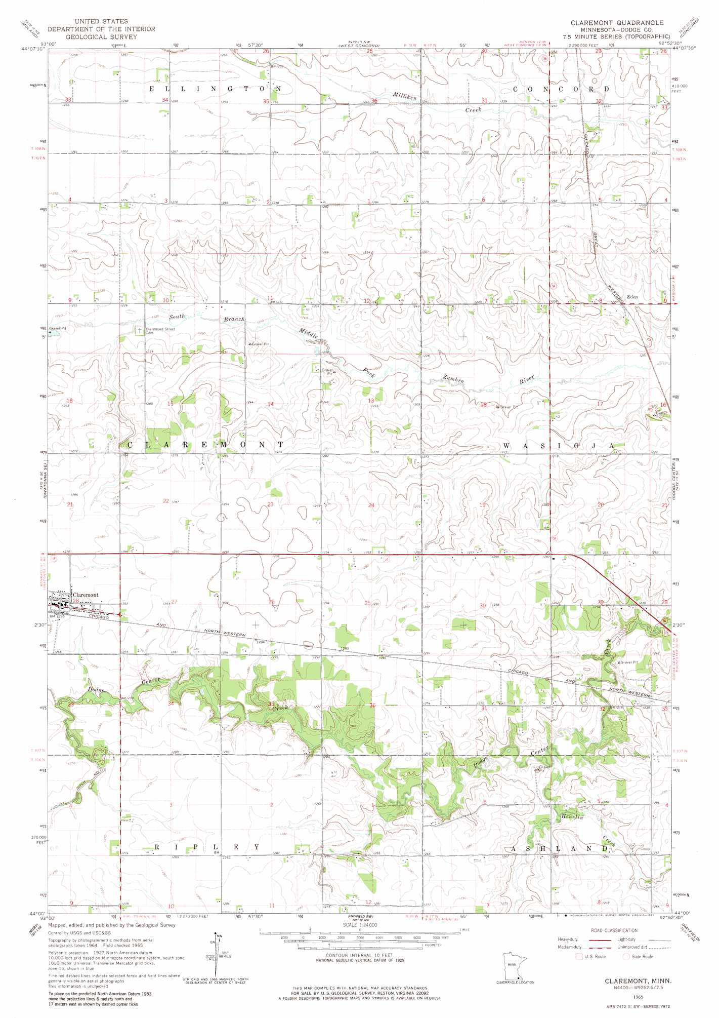
USGS Topo Quad 44092a8 - 1:24,000 scale
| Topo Map Name: | Claremont |
| USGS Topo Quad ID: | 44092a8 |
| Print Size: | ca. 21 1/4" wide x 27" high |
| Southeast Coordinates: | 44° N latitude / 92.875° W longitude |
| Map Center Coordinates: | 44.0625° N latitude / 92.9375° W longitude |
| U.S. State: | MN |
| Filename: | o44092a8.jpg |
| Download Map JPG Image: | Claremont topo map 1:24,000 scale |
| Map Type: | Topographic |
| Topo Series: | 7.5´ |
| Map Scale: | 1:24,000 |
| Source of Map Images: | United States Geological Survey (USGS) |
| Alternate Map Versions: |
Claremont MN 1965, updated 1966 Download PDF Buy paper map Claremont MN 1965, updated 1981 Download PDF Buy paper map Claremont MN 2010 Download PDF Buy paper map Claremont MN 2013 Download PDF Buy paper map Claremont MN 2016 Download PDF Buy paper map |
1:24,000 Topo Quads surrounding Claremont
Cannon City |
Nerstrand |
Kenyon |
Wanamingo |
Zumbrota |
Medford East |
Moland |
West Concord |
Concord |
Pine Island |
Owatonna |
Owatonna Se |
Claremont |
Dodge Center |
Byron |
Steele Center |
Bixby |
Hayfield Nw |
Hayfield |
Rock Dell |
Hollandale |
Blooming Prairie |
Waltham |
Sargeant |
High Forest Sw |
> Back to 44092a1 at 1:100,000 scale
> Back to 44092a1 at 1:250,000 scale
> Back to U.S. Topo Maps home
Claremont topo map: Gazetteer
Claremont: Dams
Jim Donaldson Pond Dam elevation 386m 1266′Claremont: Populated Places
Claremont elevation 392m 1286′Claremont Mobile Homes elevation 390m 1279′
Eden elevation 372m 1220′
Claremont: Post Offices
Claremont Post Office elevation 392m 1286′Claremont: Streams
Henslin Creek elevation 369m 1210′Claremont digital topo map on disk
Buy this Claremont topo map showing relief, roads, GPS coordinates and other geographical features, as a high-resolution digital map file on DVD: