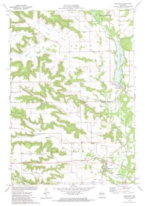
Arkansaw Topo Map Wisconsin
To zoom in, hover over the map of Arkansaw
USGS Topo Quad 44092f1 - 1:24,000 scale
| Topo Map Name: | Arkansaw |
| USGS Topo Quad ID: | 44092f1 |
| Print Size: | ca. 21 1/4" wide x 27" high |
| Southeast Coordinates: | 44.625° N latitude / 92° W longitude |
| Map Center Coordinates: | 44.6875° N latitude / 92.0625° W longitude |
| U.S. State: | WI |
| Filename: | o44092f1.jpg |
| Download Map JPG Image: | Arkansaw topo map 1:24,000 scale |
| Map Type: | Topographic |
| Topo Series: | 7.5´ |
| Map Scale: | 1:24,000 |
| Source of Map Images: | United States Geological Survey (USGS) |
| Alternate Map Versions: |
Arkansaw WI 1972, updated 1975 Download PDF Buy paper map Arkansaw WI 2010 Download PDF Buy paper map Arkansaw WI 2013 Download PDF Buy paper map Arkansaw WI 2015 Download PDF Buy paper map |
1:24,000 Topo Quads surrounding Arkansaw
> Back to 44092e1 at 1:100,000 scale
> Back to 44092a1 at 1:250,000 scale
> Back to U.S. Topo Maps home
Arkansaw topo map: Gazetteer
Arkansaw: Dams
Eau Galle WP 193 Dam elevation 229m 751′Arkansaw: Lakes
Lake Eau Galle elevation 229m 751′Arkansaw: Parks
Pine View Park elevation 234m 767′Arkansaw: Populated Places
Arkansaw elevation 228m 748′Eau Galle elevation 232m 761′
Welch Point (historical) elevation 238m 780′
Arkansaw: Reservoirs
Lake Eau Galle 173 elevation 222m 728′Arkansaw: Ridges
Coburn Ridge elevation 366m 1200′Maple Ridge elevation 366m 1200′
The Hogback elevation 345m 1131′
Arkansaw: Streams
Arkansaw Creek elevation 215m 705′Barnes Branch elevation 226m 741′
Hay Creek elevation 231m 757′
Little Arkansaw Creek elevation 230m 754′
Little Missouri Creek elevation 237m 777′
Missouri Creek elevation 219m 718′
Arkansaw: Summits
Gap Hill elevation 294m 964′Stringer Hill elevation 321m 1053′
Weisinger Hill elevation 354m 1161′
Arkansaw: Valleys
Devils Gate elevation 267m 875′Joe Gray Coulee elevation 258m 846′
Twin Valley elevation 250m 820′
Weber Valley elevation 247m 810′
Arkansaw digital topo map on disk
Buy this Arkansaw topo map showing relief, roads, GPS coordinates and other geographical features, as a high-resolution digital map file on DVD:


