Roberts Topo Map Wisconsin
To zoom in, hover over the map of Roberts
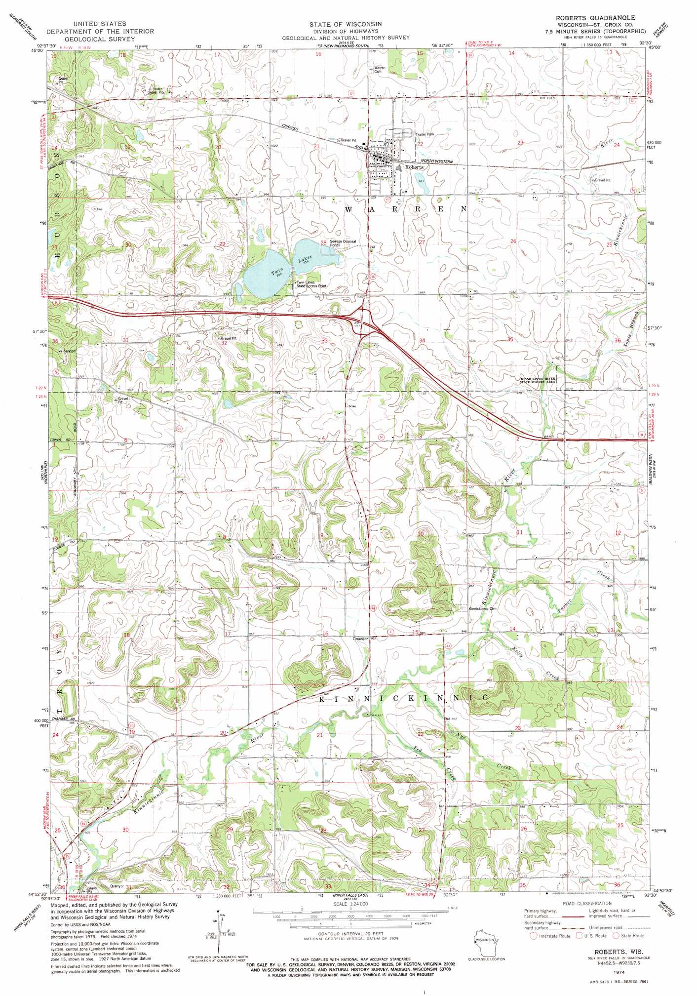
USGS Topo Quad 44092h5 - 1:24,000 scale
| Topo Map Name: | Roberts |
| USGS Topo Quad ID: | 44092h5 |
| Print Size: | ca. 21 1/4" wide x 27" high |
| Southeast Coordinates: | 44.875° N latitude / 92.5° W longitude |
| Map Center Coordinates: | 44.9375° N latitude / 92.5625° W longitude |
| U.S. State: | WI |
| Filename: | o44092h5.jpg |
| Download Map JPG Image: | Roberts topo map 1:24,000 scale |
| Map Type: | Topographic |
| Topo Series: | 7.5´ |
| Map Scale: | 1:24,000 |
| Source of Map Images: | United States Geological Survey (USGS) |
| Alternate Map Versions: |
Roberts WI 1974, updated 1977 Download PDF Buy paper map Roberts WI 2010 Download PDF Buy paper map Roberts WI 2013 Download PDF Buy paper map Roberts WI 2015 Download PDF Buy paper map |
1:24,000 Topo Quads surrounding Roberts
Marine On Saint Croix |
Somerset North |
New Richmond North |
Deer Park |
Forest |
Stillwater |
Somerset South |
New Richmond South |
Jewett |
Emerald |
Hudson |
Northline |
Roberts |
Baldwin West |
Baldwin East |
Prescott |
River Falls West |
River Falls East |
Martell |
El Paso |
Hastings |
Diamond Bluff West |
Diamond Bluff East |
Ellsworth |
Waverly |
> Back to 44092e1 at 1:100,000 scale
> Back to 44092a1 at 1:250,000 scale
> Back to U.S. Topo Maps home
Roberts topo map: Gazetteer
Roberts: Lakes
Twin Lakes elevation 290m 951′Roberts: Parks
Kinnickinnic River State Fishery Area elevation 301m 987′Roberts: Populated Places
Roberts elevation 315m 1033′Roberts: Streams
Kelly Creek elevation 284m 931′Nye Creek elevation 281m 921′
Parker Creek elevation 285m 935′
South Branch Kinnickinnic River elevation 296m 971′
Ted Creek elevation 280m 918′
Roberts digital topo map on disk
Buy this Roberts topo map showing relief, roads, GPS coordinates and other geographical features, as a high-resolution digital map file on DVD: