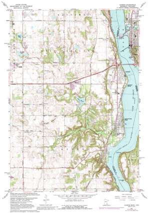
Hudson Topo Map Minnesota
To zoom in, hover over the map of Hudson
USGS Topo Quad 44092h7 - 1:24,000 scale
| Topo Map Name: | Hudson |
| USGS Topo Quad ID: | 44092h7 |
| Print Size: | ca. 21 1/4" wide x 27" high |
| Southeast Coordinates: | 44.875° N latitude / 92.75° W longitude |
| Map Center Coordinates: | 44.9375° N latitude / 92.8125° W longitude |
| U.S. States: | MN, WI |
| Filename: | o44092h7.jpg |
| Download Map JPG Image: | Hudson topo map 1:24,000 scale |
| Map Type: | Topographic |
| Topo Series: | 7.5´ |
| Map Scale: | 1:24,000 |
| Source of Map Images: | United States Geological Survey (USGS) |
| Alternate Map Versions: |
Hudson WI 1949, updated 1958 Download PDF Buy paper map Hudson WI 1949, updated 1964 Download PDF Buy paper map Hudson WI 1950 Download PDF Buy paper map Hudson WI 1967, updated 1969 Download PDF Buy paper map Hudson WI 1967, updated 1973 Download PDF Buy paper map Hudson WI 1967, updated 1988 Download PDF Buy paper map Hudson WI 1967, updated 1993 Download PDF Buy paper map Hudson WI 2010 Download PDF Buy paper map Hudson WI 2013 Download PDF Buy paper map Hudson WI 2015 Download PDF Buy paper map |
1:24,000 Topo Quads surrounding Hudson
> Back to 44092e1 at 1:100,000 scale
> Back to 44092a1 at 1:250,000 scale
> Back to U.S. Topo Maps home
Hudson topo map: Gazetteer
Hudson: Airports
Farm Airport elevation 241m 790′Lake Elmo Airport elevation 281m 921′
Hudson: Bars
Black Bass Bar elevation 207m 679′Catfish Bar elevation 207m 679′
Hudson: Beaches
Browns Beach elevation 207m 679′Hudson: Crossings
Interchance 253 elevation 271m 889′Interchange 253 elevation 272m 892′
Interchange 258 elevation 229m 751′
Hudson: Dams
Willow River Saint Croix Dam elevation 204m 669′Hudson: Lakes
Downs Lake elevation 269m 882′Horseshoe Lake elevation 265m 869′
Lake Edith elevation 241m 790′
Lake Saint Croix elevation 204m 669′
Sunfish Lake elevation 265m 869′
Hudson: Parks
Afton - Bolles Flourmill Wayside elevation 210m 688′Birkmose Park elevation 239m 784′
Cully Park elevation 219m 718′
Fourth Street Park elevation 223m 731′
Lakefront Park elevation 207m 679′
Lakeland City Park elevation 220m 721′
Pepper Fest Park elevation 228m 748′
Prospect Park elevation 275m 902′
Sixth Street Historic District elevation 232m 761′
Steamboat Park elevation 209m 685′
Hudson: Populated Places
Afton elevation 217m 711′Hudson elevation 216m 708′
Lake Saint Croix Beach elevation 211m 692′
Lakeland elevation 222m 728′
Lakeland Shores elevation 224m 734′
North Hudson elevation 226m 741′
Saint Marys Point elevation 211m 692′
Hudson: Post Offices
Afton Post Office elevation 208m 682′Lakeland Post Office elevation 223m 731′
Hudson: Reservoirs
Lake Mallalieu elevation 209m 685′Lake Mallalieu 175 elevation 204m 669′
Hudson: Streams
Valley Branch elevation 205m 672′Willow River elevation 204m 669′
Hudson: Summits
Bissels Mounds elevation 307m 1007′Hudson digital topo map on disk
Buy this Hudson topo map showing relief, roads, GPS coordinates and other geographical features, as a high-resolution digital map file on DVD:


