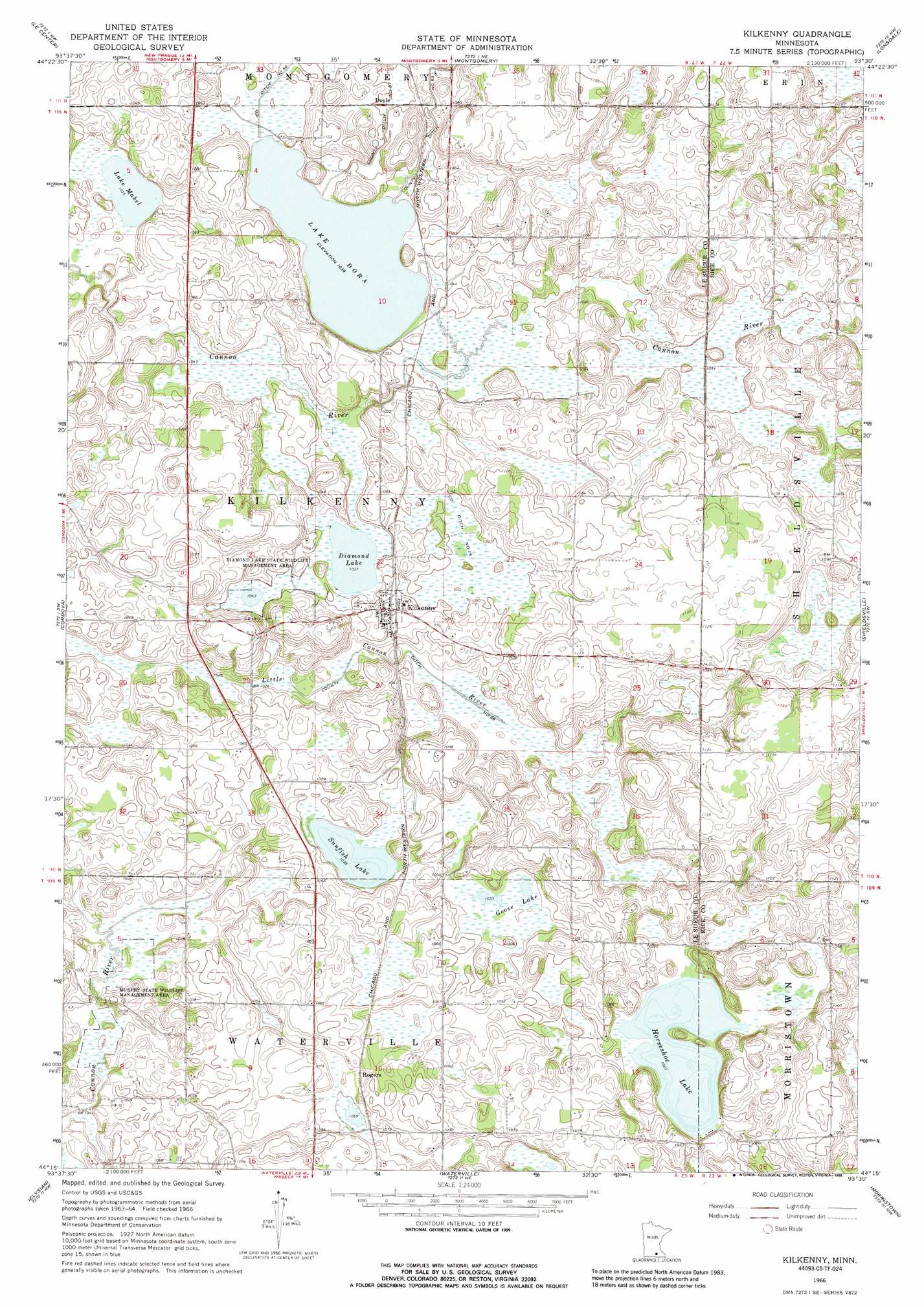
Kilkenny Topo Map Minnesota
To zoom in, hover over the map of Kilkenny
USGS Topo Quad 44093c5 - 1:24,000 scale
| Topo Map Name: | Kilkenny |
| USGS Topo Quad ID: | 44093c5 |
| Print Size: | ca. 21 1/4" wide x 27" high |
| Southeast Coordinates: | 44.25° N latitude / 93.5° W longitude |
| Map Center Coordinates: | 44.3125° N latitude / 93.5625° W longitude |
| U.S. State: | MN |
| Filename: | o44093c5.jpg |
| Download Map JPG Image: | Kilkenny topo map 1:24,000 scale |
| Map Type: | Topographic |
| Topo Series: | 7.5´ |
| Map Scale: | 1:24,000 |
| Source of Map Images: | United States Geological Survey (USGS) |
| Alternate Map Versions: |
Kilkenny MN 1966, updated 1968 Download PDF Buy paper map Kilkenny MN 1966, updated 1988 Download PDF Buy paper map Kilkenny MN 2010 Download PDF Buy paper map Kilkenny MN 2013 Download PDF Buy paper map Kilkenny MN 2016 Download PDF Buy paper map |
1:24,000 Topo Quads surrounding Kilkenny
Belle Plaine South |
Union Hill |
New Prague |
Veseli |
New Market |
Saint Thomas |
Le Center |
Montgomery |
Lonsdale |
Little Chicago |
Cleveland |
Cordova |
Kilkenny |
Shieldsville |
Faribault |
Madison Lake |
Elysian |
Waterville |
Morristown |
Medford West |
Saint Clair |
Janesville |
Waseca |
Meriden |
Saco |
> Back to 44093a1 at 1:100,000 scale
> Back to 44092a1 at 1:250,000 scale
> Back to U.S. Topo Maps home
Kilkenny topo map: Gazetteer
Kilkenny: Canals
County Ditch Number Fifteen elevation 320m 1049′County Ditch Number Fiftyseven elevation 320m 1049′
County Ditch Number Forty elevation 317m 1040′
County Ditch Number Sixtysix elevation 311m 1020′
Kilkenny: Lakes
Diamond Lake elevation 316m 1036′Goose Lake elevation 316m 1036′
Horseshoe Lake elevation 312m 1023′
Lake Dora elevation 317m 1040′
Lake Mabel elevation 316m 1036′
Sunfish Lake elevation 316m 1036′
Kilkenny: Parks
Diamond Lake State Wildlife Management Ar elevation 319m 1046′Murphy State Wildlife Management Area elevation 309m 1013′
Kilkenny: Populated Places
Doyle elevation 319m 1046′Gishville (historical) elevation 326m 1069′
Kilkenny elevation 323m 1059′
Rogers elevation 326m 1069′
Kilkenny: Post Offices
Doyle Post Office (historical) elevation 319m 1046′Kilkenny Post Office elevation 323m 1059′
Kilkenny digital topo map on disk
Buy this Kilkenny topo map showing relief, roads, GPS coordinates and other geographical features, as a high-resolution digital map file on DVD: